Information
Landmark: Equator MonumentCity: Pontianak
Country: Indonesia
Continent: Asia
Equator Monument: A Landmark of Geographical Significance
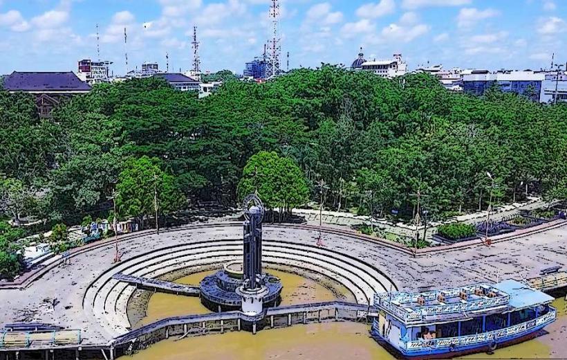
The Equator Monument (known as Tugu Garis Lintang in Indonesian) is a prominent geographical and cultural landmark located in Pontianak, the capital of West Kalimantan province, Indonesia. The monument marks the line of the equator, the imaginary line that divides the Earth into the Northern Hemisphere and the Southern Hemisphere.
1. Overview
- Name: Equator Monument (Tugu Garis Lintang)
- Location: Pontianak, West Kalimantan, Indonesia
- Coordinates: Approximately 0°0'0" Latitude (on the equator line)
- Established: 1928
- Purpose: To mark the exact location of the equator and celebrate its geographical significance.
The Equator Monument stands as a significant symbol of the Earth's geography and a popular tourist destination, attracting visitors who wish to experience standing at the exact spot where the Northern and Southern Hemispheres meet.
2. Historical Background
The monument was built in 1928 by the Dutch East Indies government, and its construction was aimed at marking the location of the equator in what was then the Dutch colonial territory. The monument itself serves as a reminder of the scientific and historical efforts that led to the identification and measurement of the equator.
Initially, the Equator Monument was a simple stone pillar marking the equatorial line, but over time, it has been upgraded into the current landmark with more prominent features and additional installations.
3. The Monument's Features
The Equator Monument is designed to provide both a geographical reference and a tourist attraction. Some of its key features include:
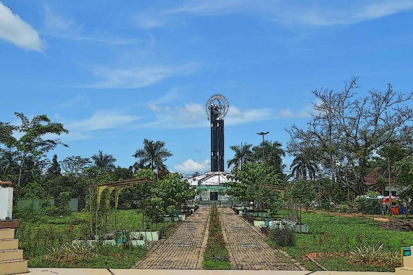
a. The Central Pillar
- The central structure of the monument is a pillar with an inscription that marks the exact location of the equator. The pillar is engraved with the date of construction and serves as a focal point for visitors to photograph and take in the significance of the site.
b. Equator Line Marker
- The most notable feature of the monument is the equator line marker that stretches across the monument area. This line is painted on the ground to show visitors the exact location of the equator, and it is often marked with signs and markers that highlight the unique geographical position.
c. Visitor Experience
- Visitors can stand with one foot in the Northern Hemisphere and one foot in the Southern Hemisphere, experiencing the rare geographical phenomenon of being at the center of the Earth.
- The monument is surrounded by lush greenery and offers a peaceful atmosphere, making it a great spot for visitors to take photos, relax, and reflect on the significance of this location.
4. Surrounding Area and Amenities
The Equator Monument is part of a small park area where tourists can explore and take in the surrounding scenery. Some amenities and attractions include:
a. Interactive Exhibits
- The monument area features informative displays and exhibits about the equator and its geographical importance. Visitors can learn more about the line of the equator, its impact on the Earth's climate, and its cultural significance to the region.
b. Local Markets and Souvenir Shops
- Around the monument, there are small markets and souvenir shops where visitors can purchase local handicrafts, snacks, and memorabilia related to the equator and the region.
c. Viewing Platforms
- There are areas where visitors can take in panoramic views of the surrounding landscape, including views of the nearby river and the city of Pontianak.
d. Cafes and Rest Areas
- The park around the monument features some cafes and rest areas, where visitors can relax and enjoy light refreshments after exploring the site.
5. Significance of the Equator Monument
The Equator Monument in Pontianak holds both geographical and cultural significance. It highlights Indonesia’s unique position as one of the few countries that straddle the equator, and it draws attention to the Earth's physical characteristics that affect weather patterns, seasons, and climates.
a. Geographical Importance
- The Equator is an important line of reference for global navigation and geography. It divides the Earth into two equal halves, and places located along the equator experience relatively constant temperatures and equal day and night lengths throughout the year.
b. Cultural Importance
- The monument represents the pride of Pontianak and West Kalimantan, with the city often promoting itself as the "Equator City" due to its geographical location. The monument is a symbol of the region’s identity and its connection to both the natural world and global positioning.
6. Accessibility
The Equator Monument is easily accessible for both local residents and international tourists. Located just a short distance from the city center of Pontianak, the monument is well-connected by road. Visitors can reach the site by taxi, private car, or public transportation.
The monument is open to the public year-round, and there is no admission fee, making it an affordable and accessible destination for tourists and locals alike.
7. Best Time to Visit
The best time to visit the Equator Monument is during the dry season, which typically runs from April to October. During this period, the weather is sunny and pleasant, making it ideal for outdoor activities and sightseeing.
However, the site is open year-round, and visitors can enjoy the landmark at any time, experiencing the unique feeling of standing on the equator.
8. Conclusion
The Equator Monument in Pontianak is a must-visit landmark for anyone interested in geography, science, and Indonesian culture. As one of the few places in the world where you can stand directly on the equator, it provides a unique and memorable experience. Whether you're taking photos at the marker, exploring the surrounding area, or learning more about the importance of the equator, the monument offers a fascinating and fun way to connect with the world’s natural wonders.