Information
City: BadullaCountry: Sri Lanka
Continent: Asia
Badulla, Sri Lanka, Asia
Badulla is the capital of the Uva Province and one of Sri Lanka’s oldest towns. It is situated in a valley at an elevation of approximately $670$ meters, almost entirely encircled by the Badulu Oya river and the surrounding mountain ranges.
Historical Timeline
Badulla was a significant regional capital in the pre-colonial era and later served as a vital administrative hub for the British. In the 19th century, it was developed as a center for the tea and coffee plantation industries. It marks the final terminus of the Main Line railway, constructed by the British to transport tea from the highlands to the Colombo port.
Demographics & Population
The city has a population of approximately 42,000. It is a multi-ethnic and multi-religious center, with a majority Sinhalese population and significant Sri Lankan Tamil, Indian Tamil, and Muslim minorities. The economy is driven by provincial administration, retail trade, and the surrounding tea and vegetable plantations.
Urban Layout & Key Districts
The city is built on a flat basin surrounded by hills.
City Center: Focused around the King’s Street and the central bus terminal, characterized by colonial-era clock towers and administrative buildings.
The Railway Zone: The northern edge of the city where the Main Line terminates.
Kandegedara: A residential area known for its scenic views of the valley.
Top Landmarks
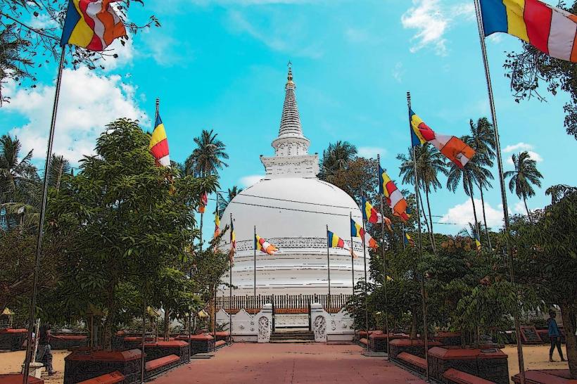
Muthiyangana Raja Maha Vihara: An ancient Buddhist temple visited by the Buddha, making it one of the Solosmasthana (16 sacred sites) in Sri Lanka.
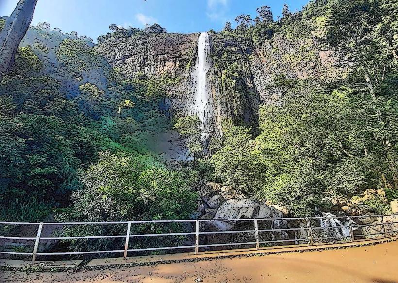
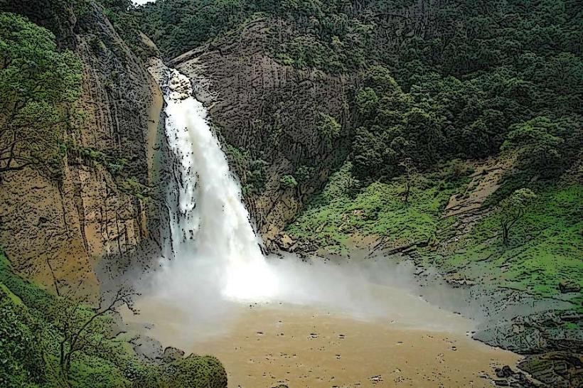
Dunhinda Falls: A 64-meter waterfall located 5 km from the city, renowned for the smoky mist it creates (Dun means smoke).
Badulla Clock Tower: A prominent colonial-errected monument in the center of the town.
St. Mark’s Church: Built in memory of Major Thomas Rogers, it was the first church consecrated in Badulla (1857).
Bogoda Wooden Bridge: Located nearby, it is the oldest surviving wooden bridge in Sri Lanka, dating back to the 16th-century Dambadeniya era.
Transportation Network
Rail: Badulla Railway Station is the final stop of the scenic Main Line. The journey from Colombo takes 9–11 hours, passing through the highest points of the rail network.
Road: Accessible via the A16 (from Ella) and A4 highways. The "18-Hairpin Bends" (Mahiyangana Road) is a famous engineering route nearby.
Public Transit: A major bus hub for the Uva Province, providing links to Kandy, Nuwara Eliya, and the East Coast.
Local Transit: Tuk-tuks are the primary mode of internal transport.
Safety & "Red Zones"
Terrain: The roads leading in and out of the valley are steep and prone to landslides during the monsoon season.
Wildlife: The path to Dunhinda Falls is populated by macaques; they are habituated to humans and will aggressively snatch food and loose items.
Night Transit: Due to the mountainous terrain, night driving on the outskirts is hazardous due to mist and heavy vehicle traffic on narrow bends.
Digital & Financial Infrastructure
4G/LTE coverage is robust within the city basin. The currency is the Sri Lankan Rupee (LKR). ATMs from all major banks (Commercial Bank, Sampath, Bank of Ceylon) are clustered in the city center. Credit cards are accepted in major supermarkets and hotels but rarely elsewhere.
Climate & Air Quality
Humid Subtropical climate. It is warmer than Nuwara Eliya but cooler than the coastal plains. Morning mist is a permanent feature of the geography. Air quality is high, though localized dust occurs in the commercial center.
Culture & Social Norms
Badulla remains a traditional provincial town.
Religious Etiquette: Standard temple rules (covering shoulders/knees and removing shoes) are strictly enforced at Muthiyangana Vihara.
Poya Days: As a religious center, the city is very quiet on full-moon days; businesses are closed and alcohol is prohibited.
Local Cost Index (LKR)
1 Espresso: 500–800 LKR (Limited availability)
1 Standard Lunch (Rice & Curry): 400–900 LKR
1 Tuk-Tuk Ride (within city): 250–450 LKR
Nearby Day Trips
Ella: 45 minutes south; the tourism hub famous for the Nine Arches Bridge.
Narangala: 1 hour north; a popular mountain peak for hiking and camping.
Meedumpitiya: Known for its sweeping views of the Uva Basin.
Facts & Legends
Legend says the Muthiyangana Vihara was established by a local king who met the Buddha and received a lock of hair and drops of sweat that turned into pearls (Mutu). A geographic fact: Badulla is located at the end of the "Up-country" rail line, meaning trains must use a "tablet" signaling system and specialized engines to manage the final descent into the valley. Historically, the city was a critical stronghold for the Uva Rebellion against British rule in 1818.