Information
City: LautokaCountry: Fiji
Continent: Australia
Lautoka, Fiji, Australia
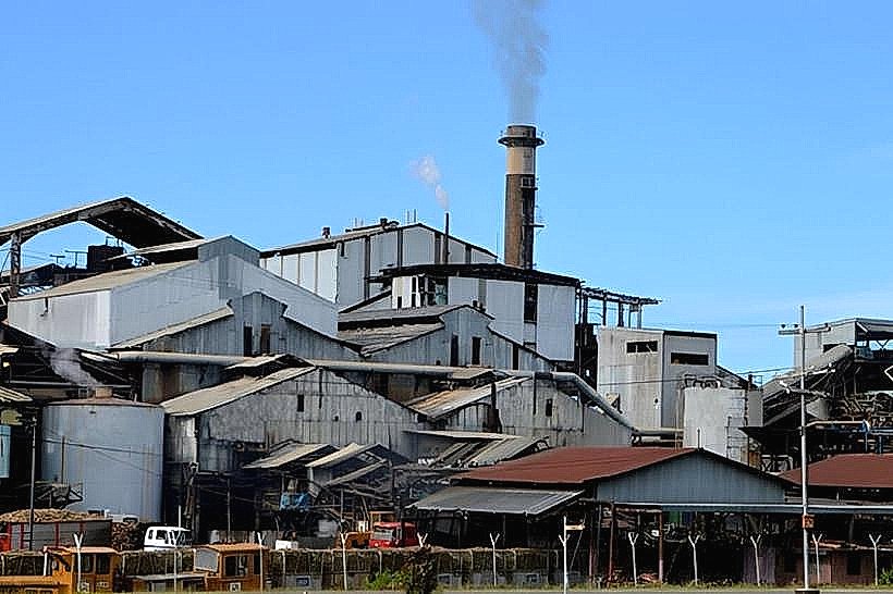
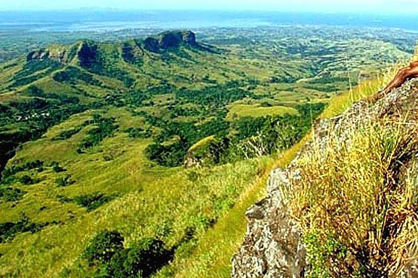
Lautoka serves as the second-largest port of entry in Fiji and is the primary center for the nation’s sugar industry. It is located on the northwest coast of Viti Levu, 24 km north of Nadi, positioned between the Blue Mountains and the Pacific Ocean.
Historical Timeline
Lautoka was formally established as a town in 1929, though its development began in 1903 with the commissioning of the Lautoka Sugar Mill by the Colonial Sugar Refining (CSR) Company. The city was officially proclaimed a city on February 25, 1977. The primary event that shaped the current urban form was the colonial industrial planning of the early 20th century, which integrated the deep-water wharf facilities with a narrow-gauge railway system designed specifically for sugar cane transport to the central mill.
Demographics & Population
The total population within the city limits is approximately 53,000, with a metropolitan area reaching approximately 71,500. The demographic breakdown consists of 54% Indo-Fijian, 42% iTaukei (Indigenous Fijian), and 4% other ethnicities, including Chinese and European. The median age is 28.4 years.
Urban Layout & Key Districts
The city is organized on a grid system focused around the waterfront. The Central Business District is bounded by Vitogo Parade and Naviti Street. The Industrial Zone, dominated by the sugar mill and timber yards, is located to the north in the Walu Bay sector. The residential districts of Simla and Upper Jazzland are located on the elevated hills to the east, providing a geographic separation from the industrial core.
Top City Landmarks
Lautoka Sugar Mill: One of the largest sugar mills in the Southern Hemisphere, operational since 1903.
Hare Krishna Temple: A significant multi-story religious structure located on Tavewa Avenue.
Punjas Children’s Park: A central recreational zone on the waterfront reclaimed from the sea.
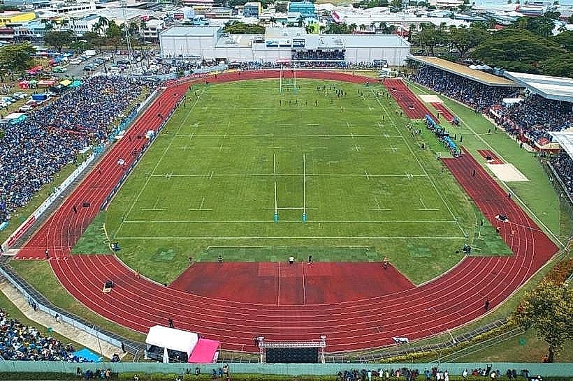
Churchill Park: The city's primary multi-purpose stadium and civic gathering point.
Lautoka Market: A major regional logistical hub for produce from the Sigatoka Valley and the Yasawa Islands.
Transportation Network
Internal transit is facilitated by a high-frequency bus network centered at the Lautoka Bus Station. Official taxis are white and metered, with major stands located at the market and the hospital. There is no metro; however, a functional narrow-gauge sugarcane railway bisects many city streets during the harvest season. Traffic density is moderate but peaks at the Vitogo Parade intersections and near the mill entrance during the crushing season (June–December).
Safety & "Red Zones"
The general safety level is high during the day but declines significantly after 20:00. Avoid walking in the vicinity of the Lautoka Wharf and the bus station area late at night. The informal settlements on the city periphery, such as parts of Vitogo, are high-risk zones for petty theft. Common scams involve "prophets" or street herbalists offering unsolicited medical advice in exchange for cash.
Digital & Financial Infrastructure
Internet speeds average 20–30 Mbps. Primary carriers are Vodafone Fiji and Digicel. Credit card acceptance is high in supermarkets (RB Patel, NewWorld) and pharmacies but low in the municipal market and small retail stalls. Banks with 24-hour ATMs (ANZ, Westpac, BSP) are concentrated along Vitogo Parade.
Climate & Air Quality
Lautoka has a tropical savanna climate with a distinct dry season. Temperatures range from 19°C–27°C in July to 23°C–31°C in January. Air quality is generally good, though the "soot" or "black snow" (burnt sugarcane ash) is a frequent seasonal pollutant during the harvest months. Flash flooding occurs during the monsoon season (January–March).
Culture & Social Norms
Tipping is not standard. Lautoka is colloquially known as the "Sugar City," and social life often revolves around the sugar harvest calendar. Modest dress (shoulders and knees covered) is expected when visiting local villages or religious sites. Public consumption of kava is common, but strict adherence to village protocol is required if invited to a private session.
Accommodation Zones
Simla: Recommended for long-term stays or quiet environments; located on the hills with views of the ocean.
Tavewa Avenue/CBD: Recommended for short-term logistical access to the port and bus terminal.
Local Cost Index
1 Espresso: 6.00 FJD ($2.68 USD)
1 Standard Lunch: 10.00–18.00 FJD ($4.46–$8.04 USD)
1 Bus Ticket (Local): 1.15 FJD ($0.51 USD)
Nearby Day Trips
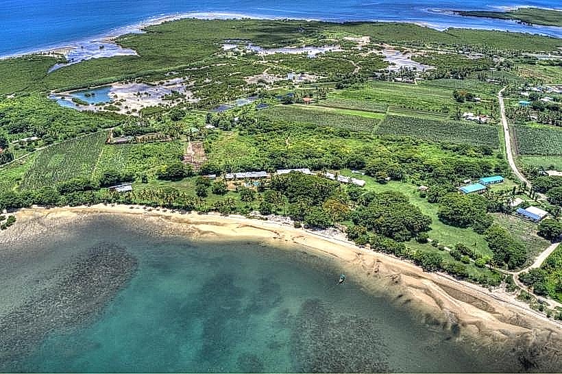
Vuda Marina: 12 km (15-minute drive).
Sabeto Valley: 18 km (25-minute drive).
Koroyanitu National Heritage Park: 15 km (requires 4WD, 45-minute drive).
Yasawa Islands: Accessible via ferry from Lautoka Wharf (2–4 hours depending on island).
Facts & Legends
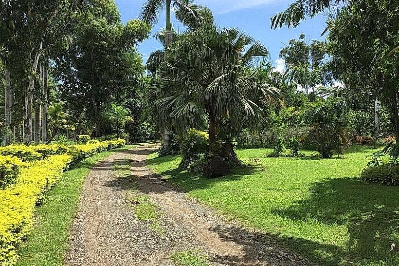
The name "Lautoka" is derived from the iTaukei words Lau-Toka, which literally translate to "spear hit" or "bull's eye." According to local oral history, the name originated from a duel between two chiefs; one struck the other with a spear, shouting "Lau-Toka!" as the weapon hit its mark. This event reportedly took place in the vicinity of what is now the city's main street. Additionally, Lautoka is unique in Fiji for its wide, tree-lined streets, a result of early CSR Company planning which sought to mimic European industrial town layouts.