Information
City: Mekong DeltaCountry: Vietnam
Continent: Asia
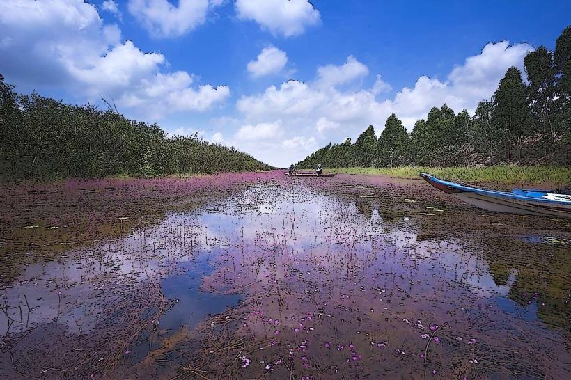
Mekong Delta, Vietnam, Asia
The Mekong Delta is a vast biological treasure and agricultural heartland in southwestern Vietnam, where the Mekong River empties into the sea through a network of distributaries. It is defined by its water-based economy, floating markets, and extensive canal systems.
Historical Timeline
The region was historically part of the Khmer Empire (known as Khmer Krom) before a steady southward expansion by the Vietnamese (Nam Tien) began in the 17th century. Governance transitioned from the Nguyen Dynasty to French colonial rule (as part of Cochinchina) and later to the Socialist Republic of Vietnam. The primary event shaping the current urban and rural form was the 1986 "Doi Moi" reforms, which transitioned the delta into one of the world's most productive rice and aquaculture exporters.
Demographics & Population
The total regional population is approximately 17.5 million. The demographics are predominantly Kinh (Vietnamese), with significant Khmer Krom and Hoa (ethnic Chinese) minorities, and a smaller Cham community in An Giang. The median age is approximately 31.2 years.
Urban Layout & Key Districts
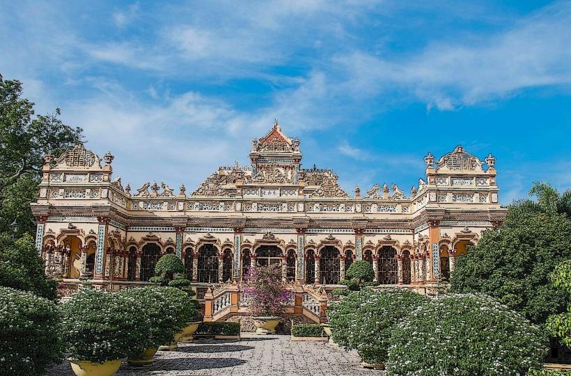
The region is polycentric, consisting of 12 provinces and one central municipality. The 2 most important hubs are Can Tho (the political and economic "capital" of the delta, located Central) and My Tho (the primary gateway for tourism from Ho Chi Minh City, located East).
Top Regional Landmarks
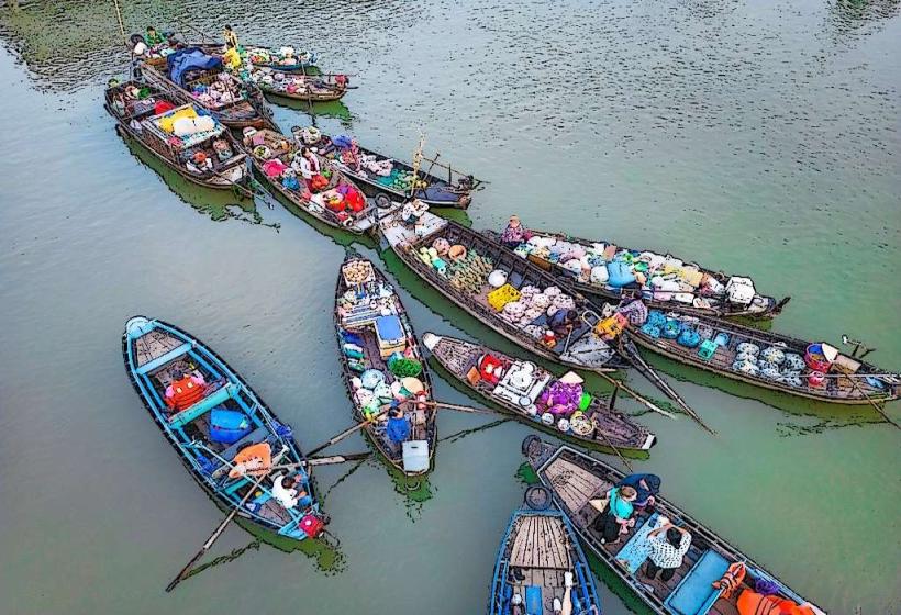
Cai Rang Floating Market (Can Tho)
Tram Chim National Park (Dong Thap)
Sam Mountain (Chau Doc)
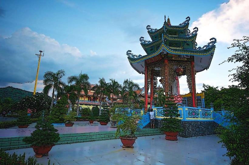
Vinh Trang Pagoda (My Tho)
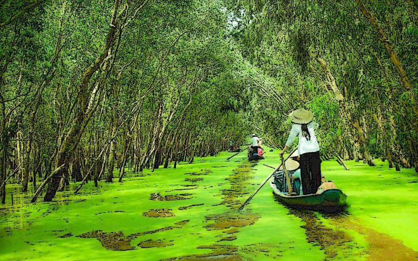
Tra Su Cajuput Forest (An Giang)
Transportation Network
Movement is dual-modal, utilizing both land and water. A developing network of expressways (Trung Luong–My Thuan) connects the delta to Ho Chi Minh City. Intra-delta transport relies on provincial buses, motorcycle taxis (Xe Om), and ferries. There is no rail system. Water transport via "ghe" or "panga" boats remains essential for rural logistics and tourism. Traffic density is high at river crossings and bridge bottle-necks.
Safety & "Red Zones"
The general safety level is very high. There are no designated "red zones." Risks are primarily limited to boat safety (ensure life jackets are provided) and standard petty theft in crowded market areas. The most significant hazard is the unpredictable nature of river currents during the monsoon.
Digital & Financial Infrastructure
Internet speeds average 30–60 Mbps in urban centers like Can Tho. Main carriers are Viettel and Vinaphone. Card acceptance is limited to major hotels and supermarkets in cities; cash (VND) is absolute for floating markets, rural transport, and local eateries. ATMs are available in all provincial capitals but sparse in remote districts.
Climate & Air Quality
The climate is tropical monsoonal with two distinct seasons: Dry (December–April) and Rainy (May–November). Temperatures average 27°C–30°C. Air quality is generally high due to the lack of heavy industry. The primary environmental risk is the "Annual Flood" (Mùa nước nổi) and increasing saltwater intrusion due to rising sea levels and upstream damming.
Culture & Social Norms
Tipping is not expected but appreciated in tourist services. The "Westerner" (Mien Tay) culture is characterized by extreme hospitality and a relaxed social pace. Dress code is casual, but modest clothing is required for temples and pagodas. Social life often revolves around the river, with early morning commerce (starting at 05:00) being the norm.
Accommodation Zones
Can Tho (Ninh Kieu Wharf): Stay here for access to the largest floating markets and urban amenities.
Chau Doc: Stay here for cultural immersion near the Cambodian border and Sam Mountain.
Ben Tre: Stay here for eco-lodges and a focus on coconut-based agriculture.
Local Cost Index
1 Vietnamese Coffee: 20,000 VND ($0.80 USD)
1 Standard Lunch (Hủ tiếu Mỹ Tho): 45,000 VND ($1.80 USD)
1 Private Boat Hire (3 hours): 400,000 VND ($16.00 USD)
Nearby Day Trips
Phu Quoc Island: Accessible via ferry from Rach Gia or Ha Tien.
Phnom Penh, Cambodia: Accessible via speedboat from Chau Doc (5 hours).
Dong Tam Snake Farm: Located near My Tho.
Facts & Legends
The Mekong Delta is known as "Cửu Long" (Nine Dragons), representing the nine branches of the river that originally flowed into the sea. A local legend tells of the "Thanh Xà, Bạch Xà" (Green and White Snakes), protector spirits of the waterways. A verified historical oddity is that the delta produces enough rice to feed the entire population of Vietnam plus a significant portion of the global export market, despite accounting for only 12% of the country's land area.