Information
City: Quang NinhCountry: Vietnam
Continent: Asia
Quang Ninh, Vietnam, Asia
Quang Ninh Province serves as a strategic industrial hub and the primary center for coal production in Vietnam, contributing significantly to the national GDP. It is located in the northeastern coastal region, bordering China to the north and the Gulf of Tonkin to the south and east.
Historical Timeline
The region has been inhabited since the prehistoric Soi Nhu and Ha Long cultures. Governance shifted through various Vietnamese dynasties until the French colonial period (1883–1954), which initiated large-scale coal mining. The most significant political and architectural reconstruction occurred post-1994, following the UNESCO designation of Ha Long Bay. The 2018 completion of the Van Don International Airport and the Hanoi-Hai Phong-Quang Ninh expressway triangle shaped the current urban and logistical form.
Demographics & Population
The provincial population is approximately 1.35 million. The largest city, Ha Long, contains roughly 330,000 residents. The top three ethnic demographics are Kinh (87.7%), Dao (5.4%), and Tay (4.5%). The median age of the population is 31.2 years.
Urban Layout & Key Districts
The province is linear, following the coastline. Ha Long City is the administrative center, divided by the Cua Luc Strait into two main sections: Hon Gai (East), the industrial and political core, and Bai Chay (West), the primary tourism and commerce hub. Cam Pha, located east of Ha Long, serves as the secondary industrial center.
Top City Landmarks
Ha Long Bay (UNESCO World Heritage Site)
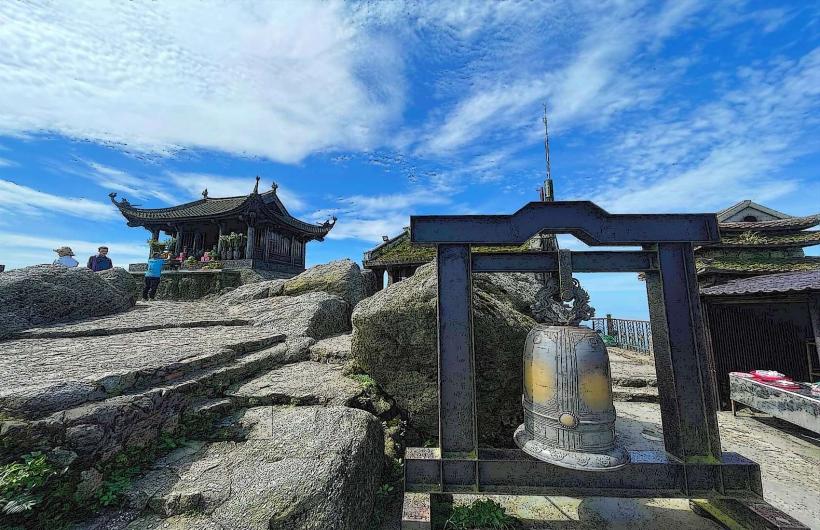
Yen Tu Pagoda Complex
Quang Ninh Museum (Dolphin-shaped architecture)
Bai Chay Bridge
Sun World Ha Long Complex
Transportation Network
Movement within urban centers relies on private motorbikes and local bus routes. The VinBus electric network is expanding in Ha Long. Grab is the primary ride-sharing app for cars and motorbikes. Official taxis, such as Mai Linh (green) and Thanh Cong (white/blue), are abundant. Traffic density is moderate but increases significantly near the border gates and industrial ports.
Safety & "Red Zones"
The province is generally safe for professionals and travelers. Caution is advised in the border city of Mong Cai due to grey-market trading activities. Common scams include "hidden fees" on low-cost cruise boat tours and inflated prices for seafood at unlicensed street stalls in tourist zones.
Digital & Financial Infrastructure
Average internet speed is 80 Mbps. Main mobile carriers are Viettel, Vinaphone, and Mobifone. Card acceptance is high in hotels and shopping malls but remains cash-dominant for local markets and small vendors. ATMs are concentrated in Ha Long, Cam Pha, and Uong Bi.
Climate & Air Quality
Temperatures range from 13°C to 20°C in winter and 27°C to 35°C in summer. Air quality can be compromised in Cam Pha and Uong Bi due to coal dust. Monsoon season occurs from June to August, bringing high humidity and periodic typhoon risks.
Culture & Social Norms
Tipping is not mandatory but 5-10% is appreciated in high-end service sectors. Handshakes are the standard greeting. Dress code is conservative when visiting religious sites like Yen Tu (shoulders and knees covered). Public smoking is common among men but prohibited in air-conditioned public spaces.
Accommodation Zones
Bai Chay: Recommended for logistics and proximity to the harbor and expressway.
Tuan Chau Island: Recommended for a secluded environment and direct access to luxury cruise departures.
Local Cost Index
1 Espresso: 45,000 VND ($1.85)
1 Standard Lunch: 75,000 VND ($3.10)
1 Bus Ticket: 15,000 VND ($0.60)
Nearby Day Trips
Cat Ba Island: 25 km (1.5 hours via ferry)
Mong Cai Border City: 150 km (2 hours via expressway)
Binh Lieu (The "Sa Pa" of Quang Ninh): 100 km (2 hours)
Facts & Legends
Local lore attributes the formation of the Ha Long archipelago to a descending family of dragons sent by the Jade Emperor. According to the legend, the dragons spat jewels and jade into the sea, which transformed into the thousands of limestone islands currently present, creating a natural fortress to defend the kingdom against invaders.