Information
City: Quatre BornesCountry: Mauritius
Continent: Africa
Quatre Bornes, Mauritius, Africa
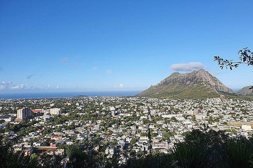
Quatre Bornes functions as a major residential and commercial center in the Plaines Wilhems District, situated at an altitude of 312 meters. It is known as the "City of Flowers" and serves as a vital transit link between the western coastal regions and the central plateau.
Historical Timeline
The town was founded in the late 18th century and experienced rapid growth following the completion of the North-South railway line in 1864. It was officially declared a town in 1896. The primary event that shaped the current urban form was the post-1960s commercial boom, which transformed the residential Saint Jean Road into the island's most dense retail corridor, later reinforced by the 2021 integration of the Metro Express.
Demographics & Population
The population within the municipal limits is approximately 77,500. The demographic profile is 66% Indo-Mauritian, 26% Creole, and 8% Sino-Mauritian and European. The median age is 37 years.
Urban Layout & Key Districts
The city is organized linearly along the Saint Jean Road (A1). Key districts include the City Center, dominated by the traditional market and retail banks; Sodnac (South), an upscale residential area near the hillside; and Vieux Quatre Bornes (West), the historic residential core.
Top City Landmarks
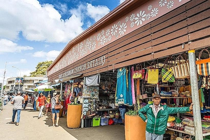
Quatre Bornes Central Market (Fair)
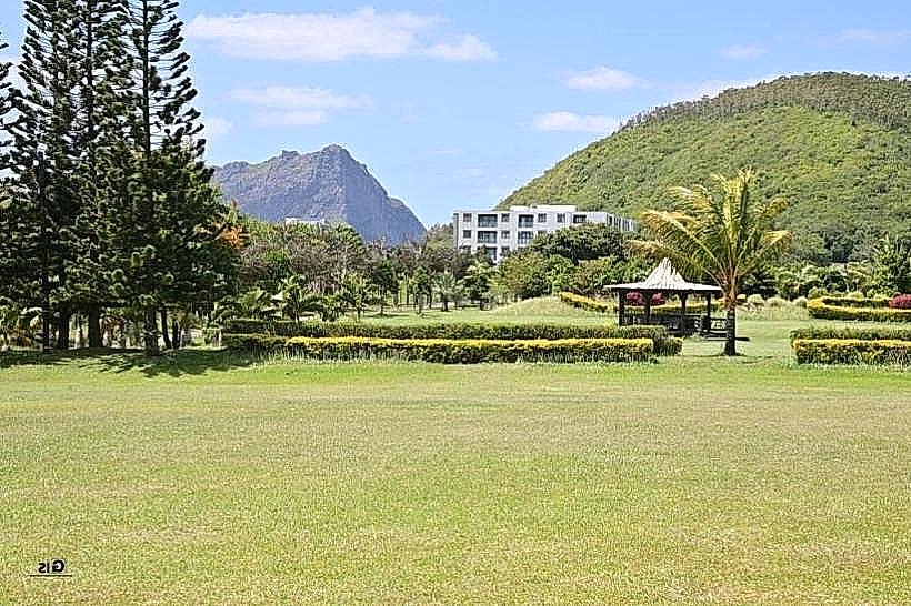
Candos Hill (Mount Corps de Garde)
Newton Tower
Saint Jean Church
Transportation Network
Movement is facilitated by the Metro Express, with a major station at Saint Jean. The town serves as a hub for bus routes heading to the West Coast (Flic-en-Flac) and Port Louis. Ride-sharing is available via Yugo. Official taxis are white with yellow markings. Traffic density is extreme on Saint Jean Road, particularly on Thursdays and Sundays during market days.
Safety & "Red Zones"
The safety level is high. Avoid the central market area and the bus terminal after 20:00 when foot traffic diminishes. Pickpocketing is a specific risk within the crowded textile market.
Digital & Financial Infrastructure
Average internet speed is 50 Mbps. Primary mobile carriers are my.t and Emtel. Card acceptance is high in the Orchard Centre and modern shops, but the central market operates strictly on a cash-only basis. ATMs are densely clustered along the main road.
Climate & Air Quality
Temperatures range from 15°C to 23°C in winter and 21°C to 29°C in summer. It experiences a transitional climate between the humid highlands and the dry west. Air quality is generally good, though vehicle emissions concentrate along the A1 corridor during peak hours.
Culture & Social Norms
Tipping of 10% is customary in cafes. Handshakes are the standard greeting. The dress code is smart-casual. Smoking is prohibited in public squares and near the metro station. The town has a conservative social fabric; modest dress is expected in residential neighborhoods.
Accommodation Zones
Stay in Sodnac for modern apartment rentals and proximity to green spaces.
Stay near Saint Jean Road for immediate access to the Metro Express and retail centers.
Local Cost Index
1 Espresso: 110 MUR ($2.40 USD)
1 Standard Lunch: 275 MUR ($6.00 USD)
1 Metro Ticket: 35-55 MUR ($0.75 - $1.20 USD)
Nearby Day Trips
Casela Nature Parks: 10 km (20 minutes)
Flic-en-Flac Beach: 12 km (25 minutes)
Corps de Garde Mountain: 2 km (10 minutes to trailhead)
Bagatelle Mall: 7 km (15 minutes)
Facts & Legends
The name "Quatre Bornes" (Four Boundary Stones) originates from a 1761 land survey marking the intersection of four large estates: Palma, Bassin, Beau Séjour, and La Solitude. Local urban legend suggests that the Candos Hill (Corps de Garde) resembles a sleeping sentry guarding the central plateau, a myth reinforced by the silhouettes formed by the mountain’s ridges at sunset.