Information
City: Stara ZagoraCountry: Bulgaria
Continent: Europe
Stara Zagora, Bulgaria, Europe
Stara Zagora functions as a major industrial, energy, and educational hub in central Bulgaria, serving as the administrative seat of the Stara Zagora Province. It is positioned in the Upper Thracian Plain at the southern foothills of the Sredna Gora mountains, approximately 230 km east of Sofia and 100 km northeast of Plovdiv.
Historical Timeline
The city site contains evidence of human habitation dating to the 7th millennium BC, making it one of the oldest continuously inhabited areas in Europe. It was formally established as the Thracian settlement Beroe in the 4th century BC before becoming the Roman city Augusta Trajana in 107 AD under Emperor Trajan. Major governance eras include Byzantine, the First and Second Bulgarian Empires, and Ottoman rule (1370–1878). The defining event for the modern urban form was the Russo-Turkish War (1877–1878), during which the city was burned to the ground. Reconstruction began on October 5, 1879, based on a rigorous orthogonal grid plan designed by Czech engineer Lubor Bayer.
Demographics & Population
As of 2026, the population within city limits is approximately 120,000, while the metropolitan (municipality) area hosts roughly 154,000 residents. The top three ethnic demographics are Bulgarian (93%), Turkish (2.5%), and Romani (1.5%). The median age of the population is 43.1 years.
Urban Layout & Key Districts
Stara Zagora is noted for its strict grid layout, featuring straight, parallel streets that are rare in Bulgarian urban planning.
City Center: The administrative and commercial core, centered around the pedestrianized Tsar Simeon Veliki Boulevard.
Lozenets: A residential district located to the north, offering higher elevation and proximity to forest zones.
Zheleznik: A large residential district on the western periphery, characterized by high-density socialist-era apartment blocks.
Industrial Zone: Concentrated in the southern and southeastern sectors, housing the city’s manufacturing and logistical facilities.
Top City Landmarks
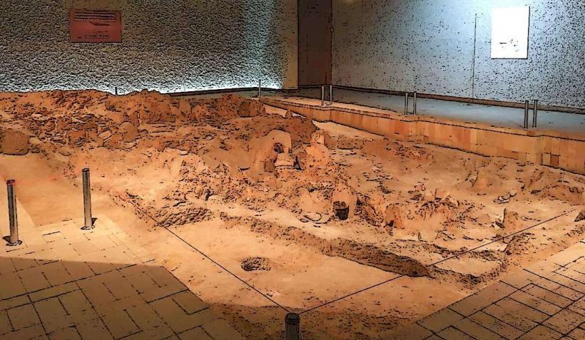
Neolithic Dwellings Museum: Encloses two of the best-preserved 6th-millennium BC houses in Europe, found in situ with their original hearths and pottery.
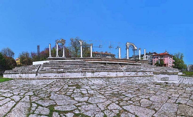
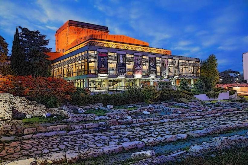
Ancient Forum of Augusta Trajana: An excavated Roman archaeological site in the city center featuring a theater-like auditorium and a triumphal arch.
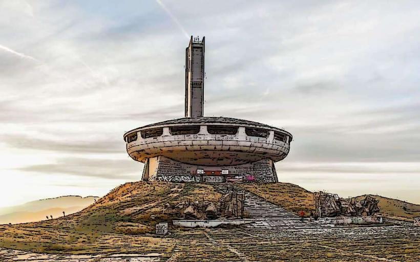
Samara Flag Monument (Defenders of Stara Zagora): A 50-meter-high concrete monument on a hill to the east, commemorating the 1877 battle of the Russo-Turkish War.
Ayazmo Park: An expansive 3,500-acre forest park on the northern hills, established in 1895, containing a zoo and a botanical garden.
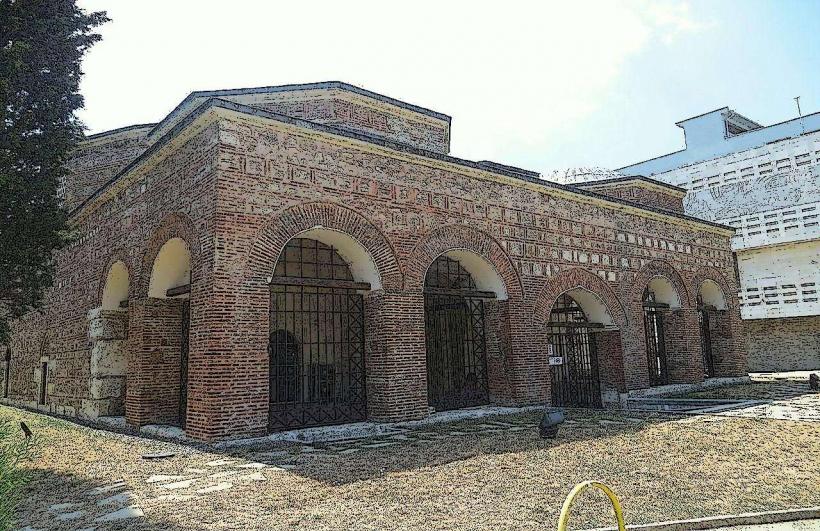
Museum of Religions: Housed in the 15th-century Eski Mosque, the only public building to survive the 1877 fire, which sits atop Thracian, Roman, and medieval Christian shrines.
Transportation Network
Public transport is managed by the municipality and consists of a network of buses and trolleybuses. Service is highly reliable, operating until 22:30. Ride-sharing is provided via TaxiMe; Uber and Bolt are unavailable. Official taxis are yellow; 6000 and City Taxi are the primary companies. Traffic density is moderate, with peak congestion on Patriarch Evtimiy Boulevard and around the Central Railway Station during rush hours (08:00–09:00 and 17:30–18:30).
Safety & "Red Zones"
Stara Zagora is considered one of the safest cities in Bulgaria. There are no formal "red zones," though caution is advised in the northern periphery of the Lozenets district at night due to higher rates of petty theft. Scams are infrequent, but visitors should ensure taxis use a meter and be wary of "private" tour offers at the bus station.
Digital & Financial Infrastructure
Average fixed broadband speed is 170 Mbps, with full 5G coverage provided by A1, Vivacom, and Yettel. Following Bulgaria’s entry into the Eurozone on January 1, 2026, the official currency is the Euro (€). Card acceptance is high in the center and malls (Galleria Mall), but cash is still required for small kiosks and public market stalls. ATMs are densely located along the central pedestrian thoroughfare.
Climate & Air Quality
The climate is transitional continental with Mediterranean influences. Summer temperatures range from 18°C to 32°C, while winters are mild, ranging from -2°C to 7°C. Air quality is generally good, but the city can experience localized pollution (SO2) from the Maritsa Iztok power complex to the southeast, particularly during specific wind conditions.
Culture & Social Norms
Tipping: 10% in restaurants; rounding up in taxis.
Greetings: A handshake and direct eye contact are standard; formal address (Mr./Mrs.) is common in business.
Dress Code: Casual is the norm, but modest dress (shoulders and knees covered) is required for religious sites.
Regulations: Smoking is prohibited indoors; alcohol consumption in public parks is permitted but frowned upon near playgrounds.
Accommodation Zones
City Center: Recommended for walking access to museums, the Roman Forum, and shopping.
Tri Chuchura: Recommended for families seeking a quiet environment near Ayazmo Park and the zoo.
Local Cost Index
1 Espresso: €1.50
1 Standard Lunch: €9.00
1 Bus Ticket: €0.80
Nearby Day Trips
Stara Zagora Spa (15 km): Mineral baths and wellness centers.
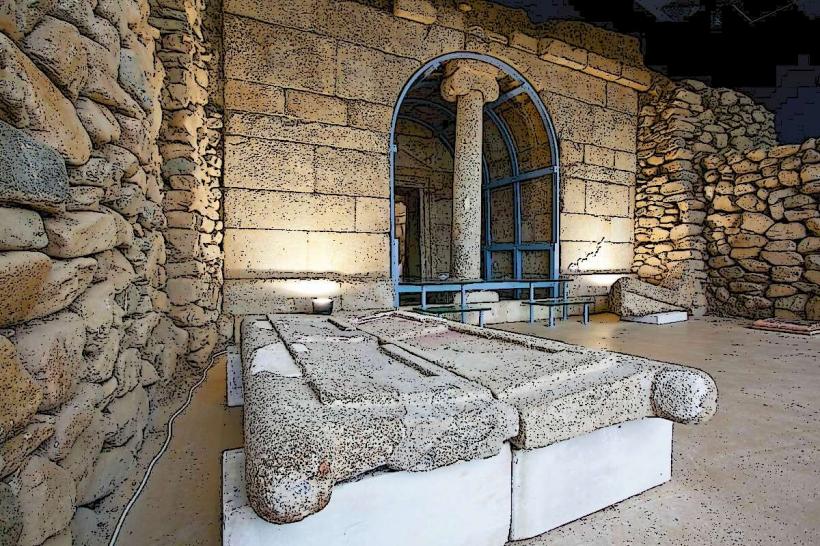
Kazanlak (35 km): Center of the Valley of the Roses and home to the Thracian Tomb of Kazanlak (UNESCO).
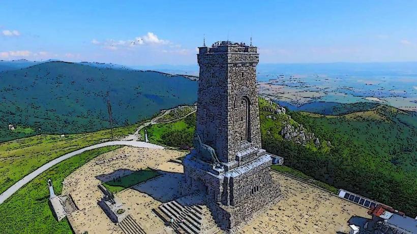
Shipka Pass (50 km): Location of the Monument to Liberty and the ornate Shipka Memorial Church.
Chirpan (40 km): Home to the P.K. Yavorov House-Museum and local wineries.
Facts & Legends
The "Breastfeeding Lioness" is a unique medieval stone relief found in Stara Zagora, dating to the 11th century. It is the only known depiction of its kind in medieval Bulgarian art and has become the primary symbol on the city's coat of arms. Local legend claims that the water of the "Ayazmo" spring has miraculous healing properties and that the forest was planted by a saintly metropolitan who transformed a barren hill into a lush garden through prayer and manual labor.