Information
City: Tay NinhCountry: Vietnam
Continent: Asia
Tay Ninh, Vietnam, Asia
Tay Ninh serves as a strategic economic gateway connecting the Southern Key Economic Region to Cambodia and the ASEAN market. It is situated on the transition zone between the Central Highlands and the Mekong Delta, approximately 90 km northwest of Ho Chi Minh City.
Historical Timeline
The region was historically part of the Chenla Empire before becoming an administrative unit of the Nguyen Dynasty in 1836. It served as a major revolutionary base (Boi Loi/Chang Riec) during the anti-colonial and Vietnam wars. A transformative political shift occurred on July 1, 2025, when Long An Province was officially merged into Tay Ninh Province. This administrative consolidation unified the industrial and logistical capacity of the Mekong Delta corridor with the border-economic strengths of Tay Ninh, relocating the provincial administrative center to Long An Ward (formerly Tan An City).
Demographics & Population
Following the 2025 merger, the provincial population is approximately 3.3 million. The demographic profile is predominantly Kinh, with a culturally significant minority of Khmer (approx. 2%) and Cham. The province has a young workforce with over 67% in the working-age bracket. The median age is approximately 31.8 years.
Urban Layout & Key Districts
The expanded province is organized into three primary socio-economic zones:
Tan An City (South): The official administrative and political headquarters.
Tan Ninh Ward (Central): Formerly Tay Ninh City, it remains the "second base" for administrative agencies and the core for spiritual tourism.
Moc Bai (West): A specialized international border-gate economic zone.
Go Dau/Trang Bang (East): The primary heavy industrial and manufacturing corridor.
Top City Landmarks
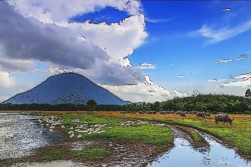
Ba Den Mountain (Black Virgin Mountain): The highest peak in Southern Vietnam ($986m$).
Cao Dai Holy See: The Great Temple of Caodaism, featuring unique architectural syncretism.
Dau Tieng Lake: One of Southeast Asia's largest man-made reservoirs.
Lo Go-Xa Mat National Park: A UNESCO Biosphere Reserve.
Statue of Buddha Konagamana: A 24K gold-plated landmark on the summit of Ba Den.
Transportation Network
Movement relies on National Route 22 (Trans-Asia Highway) and Route 22B.
Logistics: The province serves as a gateway linking the Mekong Delta to Cambodia via the Moc Bai and Xa Mat border gates.
Public Transit: Grab (Car/Bike) is operational in Tan An and Tan Ninh. Official taxis include Mai Linh (green) and Sao Do (red).
Future Links: Development is underway for the Ho Chi Minh City–Moc Bai Expressway to reduce transit time to the metropolitan hub to under 60 minutes.
Safety & "Red Zones"
Tay Ninh is highly safe for residents and travelers. There are no designated "red zones." Caution is advised regarding the "Border Gate Economy" scams, specifically involving unregulated currency exchange and high-pressure sales tactics near Moc Bai. Environmental safety focuses on lightning risks during the monsoon season (May–November) at Ba Den Mountain.
Digital & Financial Infrastructure
Average internet speed is 72 Mbps. Following the 2025 merger, the province launched an integrated Smart City platform to unify administrative data between the former Long An and Tay Ninh districts. Card acceptance is high in Tan An City and the Ba Den Mountain cable car facilities, but cash is mandatory for border-gate markets. ATMs are densely clustered in Tan An and Tan Ninh wards.
Climate & Air Quality
Temperatures range from 24°C to 28°C in the cool season (December–January) and 28°C to 36°C in the dry season (March–May). Air quality is generally high, though localized dust is prevalent near the Trang Bang industrial zones. The rainy season occurs from May to November.
Culture & Social Norms
Tipping is not standard. Handshakes are the professional norm. Dress code is strictly conservative at the Cao Dai Holy See and Ba Den Mountain temples (shoulders and knees must be covered). A specific social norm is the Vegetarian Culture; Tay Ninh is the center of unique vegetarian cuisine linked to Caodaism, and the 2nd Tay Ninh Vegetarian Cuisine Festival is a major scheduled event for 2026.
Accommodation Zones
Tan An (South): Recommended for business logistics and government-related travel.
Tan Ninh (Central): Recommended for tourism, mountain access, and spiritual visits.
Local Cost Index
1 Espresso: 25,000 VND ($1.05)
1 Standard Lunch (Trang Bang Dew-wetted Rice Paper): 60,000 VND ($2.50)
1 Taxi trip (3km): 55,000 VND ($2.30)
Nearby Day Trips
Ho Chi Minh City: 90 km (2.5 hours via current roads)
Cu Chi Tunnels: 40 km (1 hour)
Moc Bai Border Gate: 35 km (50 minutes)
Dau Tieng Lake: 25 km (40 minutes)
Facts & Legends
A prominent legend regarding Ba Den Mountain tells of Linh Son Thanh Mau, a woman who jumped from the mountain to protect her virtue and later appeared in the dreams of monks to guide them in building the temple. A verified historical oddity is the Cao Dai Holy See, which was constructed without blue-prints, guided by "divine inspiration" and using bamboo-reinforced concrete, surviving multiple wars completely intact. Another 2026 development is the official switch to biofuels for all provincial transport as of June 1, 2026.