Information
Landmark: El Tarf Coastal PathCity: El Tarf
Country: Algeria
Continent: Africa
El Tarf Coastal Path, El Tarf, Algeria, Africa
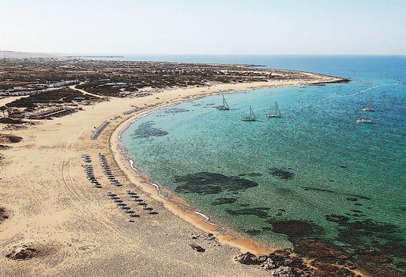
The El Tarf Coastal Path is a designated walking route along the Mediterranean coastline in the El Tarf province of northeastern Algeria.
This path traverses a varied coastal landscape, featuring sandy beaches, rocky outcrops, and sections of Mediterranean scrubland.
Visual Characteristics
The path itself is primarily unpaved, consisting of compacted earth and gravel. Sections transition to natural rock formations and sandy stretches. Vegetation includes low-lying shrubs, pine trees, and coastal grasses. The sea color varies from deep blue to turquoise depending on depth and light conditions. Rocky areas are composed of sedimentary rock, often with visible strata.
Location & Access Logistics
The El Tarf Coastal Path is situated approximately 5 kilometers east of the city of El Tarf. Access points are available from the N44 national road. Parking is limited to informal pull-offs along the N44 adjacent to trail entrances. Public transport to El Tarf city is available via bus services from major Algerian cities; local taxis can then be hired to reach the coastal path access points. No specific bus lines directly serve the path itself.
Historical & Ecological Origin
The path follows the natural contours of the coastline, shaped by millennia of marine erosion and geological processes. The area is classified as Mediterranean coastal scrubland, supporting a specific ecosystem adapted to saline conditions and dry summers. Historically, these routes were likely used by local fishermen and coastal communities for transit and resource gathering.
Key Highlights & Activities
Walking and hiking are the primary activities. Birdwatching is possible, particularly during migratory seasons. Photography opportunities exist for coastal geology and flora. Access to small, undeveloped coves for relaxation is available at various points along the path.
Infrastructure & Amenities
There are no formal restrooms or shade structures directly on the path. Cell phone signal (4G/5G) is intermittent and generally weak, especially in more remote sections. No food vendors are present along the path; provisions should be carried from El Tarf.
Best Time to Visit
The best time for walking is during the spring (March to May) and autumn (September to November) when temperatures are moderate. Mid-morning (9:00 AM - 11:00 AM) and late afternoon (3:00 PM - 5:00 PM) offer optimal lighting for photography, avoiding harsh midday sun. High tide can limit access to some lower-lying beach sections.
Facts & Legends
Local folklore suggests that certain rock formations along the path were once used as lookout points by ancient mariners to spot approaching ships. One specific rock arch, known locally as "The Sentinel," is said to have been a marker for safe passage into a now-submerged ancient harbor.
Nearby Landmarks
- El Kala National Park (15km Northeast)
- Beni Ikhlef Beach (3km West)
- Lac Tonga (12km Northeast)
- El Kala Port (16km Northeast)
- Cap Rosa (8km East)