Information
Landmark: Hydra PortCity: Hydra
Country: Greece
Continent: Europe
Hydra Port, Hydra, Greece, Europe
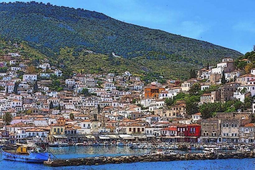
Hydra Port is a deep-water harbor and the primary settlement of Hydra, located on the north coast of the island in the Saronic Gulf. It is an amphitheater-shaped port defined by its total prohibition of wheeled vehicles, including bicycles and cars.
Visual Characteristics
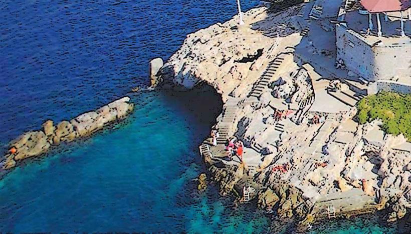
The harbor is lined with gray stone mansions (archontika) featuring red-tiled roofs and white-trimmed windows. The waterfront is paved with marble and cobblestone, bordered by high stone bastions equipped with 18th-century iron cannons. The water depth at the quay allows for the docking of large sailing yachts and ferries directly against the limestone pier.
Location & Access Logistics
Access is strictly by sea via hydrofoils or catamarans from Piraeus Port (approximately 1.5 to 2 hours) or by water taxi from the mainland town of Metochi (15 minutes). Once at the port, all transport of goods and luggage is conducted by mules, donkeys, or handcarts. The harbor is the central terminus for all island water taxi routes.
Historical & Ecological Origin
The port rose to prominence in the late 18th century as a major maritime commercial hub, often referred to as "Little Venice." During the Greek War of Independence in 1821, the port served as the primary naval base for the Greek fleet, utilizing the wealth generated by its merchant marine to fund the revolution.
Key Highlights & Activities
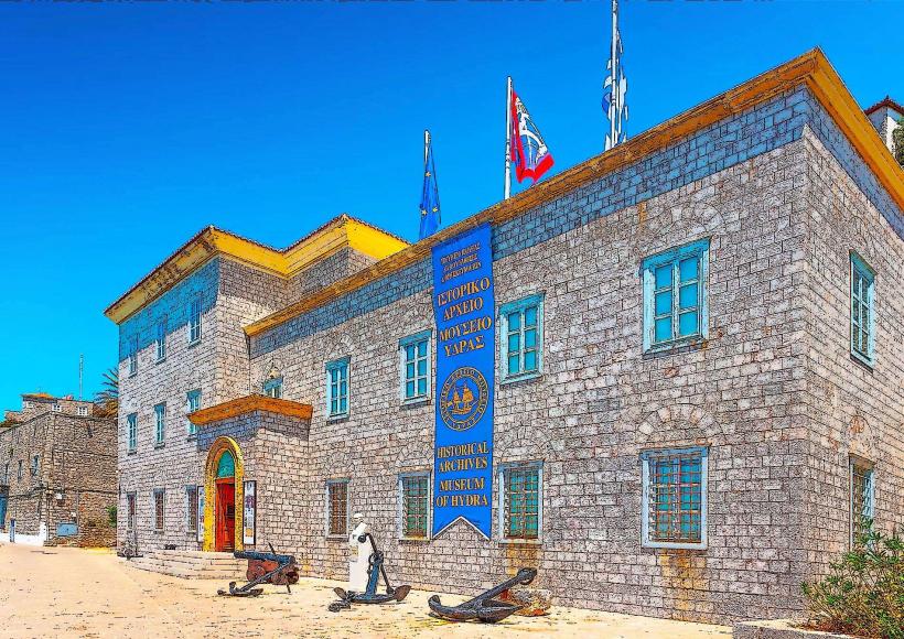
Visitors can walk the marble-paved waterfront to the Historical Archives-Museum of Hydra on the eastern side. The bastions at the harbor entrance provide vantage points for observing the arrival of traditional wooden caïques. Mule trekking paths originate at the central quay, leading into the upper town of Kiafa.
Infrastructure & Amenities
The port serves as the island's infrastructure hub, containing the central post office, banks, and a 24-hour medical center. Public restrooms are located near the ferry arrival area. High-speed 5G cellular signal is consistent across the harbor. Numerous food vendors, pharmacies, and grocery stores are concentrated within 100 meters of the waterfront.
Best Time to Visit
The harbor is most active between 09:00 and 11:00 when major ferries arrive. For photography, the late afternoon "blue hour" provides optimal lighting as the sun sets behind the western hills, illuminating the stone facades. September offers stable weather and reduced visitor density compared to the peak months of July and August.
Facts & Legends
The port's specific architecture was heavily influenced by the "Lighthouse Law," which taxed residents based on the width of their house facades facing the water, resulting in many homes being built narrow but very deep. A local fixture is the red-carpeted area of the quay traditionally reserved for the island's most prominent captains.
Nearby Landmarks
Historical Archives-Museum of Hydra: 0.1km East
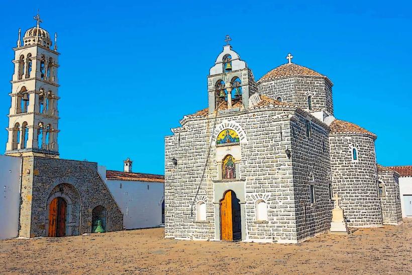
Cathedral of the Assumption: 0.05km South (at harbor center)
Lazaros Kountouriotis Mansion: 0.4km West
Kamini Village: 1.2km West
Mandraki Bay: 2.5km East