Information
Landmark: Lough OughterCity: Cavan
Country: Ireland
Continent: Europe
Lough Oughter, Cavan, Ireland, Europe
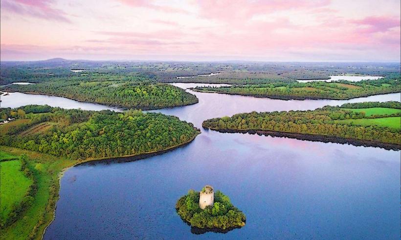
Lough Oughter is a complex lake system covering approximately $10$ $\text{km}^2$ in County Cavan. It is a core component of the Marble Arch Caves Global Geopark and is internationally recognized as a sanctuary for wildlife and a site of medieval historical significance.
Visual and Geological Characteristics
The lake is a "flooded drumlin" landscape, formed by the melting of glaciers which left behind hundreds of small hills.
Topography: A labyrinthine network of waterways, bays, and over $90$ individual islands.
Water System: Part of the River Erne catchment, connecting to the Shannon-Erne Waterway.
Flora: Dense reed beds and riparian woodlands consisting of willow, alder, and hazel.
Location & Access Logistics
Region: Central County Cavan, primarily accessed via Killykeen Forest Park.
Transit: Private vehicle is required to reach the main access points (Killykeen or Killashandra).
Water Access: The lake is best navigated by kayak, canoe, or small motorboat. Public slipways are located at Killykeen and near Killashandra.
Accessibility: Shoreline access is limited due to the heavily indented and often marshy coast. Killykeen Forest Park provides the most accessible viewing and walking points.
Historical & Archaeological Significance
Clough Oughter Castle: The lake's most prominent landmark. It is a 13th-century circular stone tower house built on a man-made island (crannog).
Crannogs: The lake contains numerous prehistoric and medieval artificial islands used for defensive habitation.
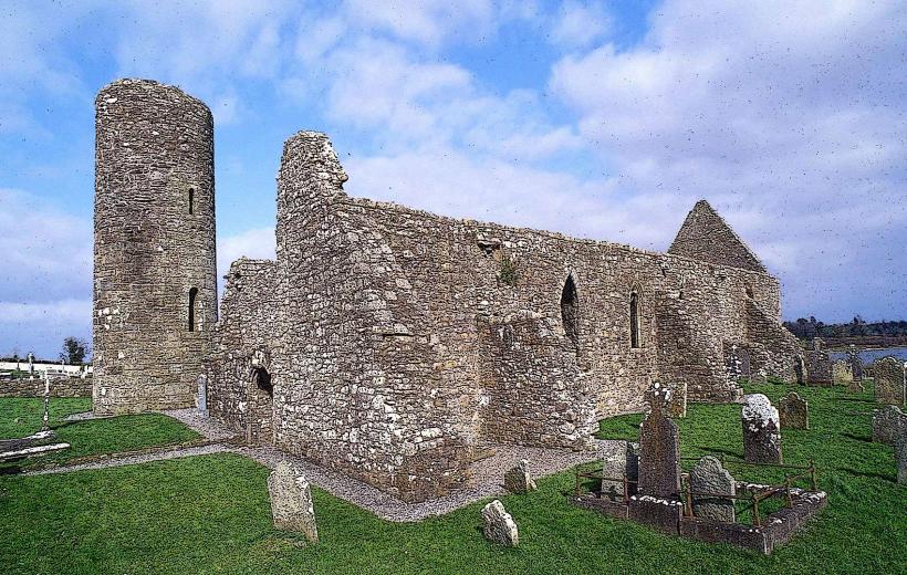
Trinity Island: Features the ruins of a 13th-century Augustinian priory, reachable only by boat.
Key Activities
Angling: A premier destination for pike fishing; also contains significant stocks of bream, roach, and perch.
Paddling: The sheltered nature of the channels makes it a major hub for canoeing and kayaking.
Wildlife Observation: A designated Special Protection Area (SPA). It supports the largest concentration of Great Crested Grebes in Ireland and provides wintering grounds for Whooper Swans.
Infrastructure & Amenities
Hubs: Killykeen Forest Park (East) and Killashandra (West).
Services: Boat and kayak rentals are available seasonally at Killykeen and from private operators in Killashandra.
Sanitation: Public facilities are located within Killykeen Forest Park.
Connectivity: 4G coverage is generally stable on open water but drops in the deep drumlin hollows and forested islands.
Technical Details
The lake's water levels are managed as part of the Erne drainage scheme. Its intricate shape means it has a shoreline-to-surface-area ratio significantly higher than standard circular lakes. The underlying geology is predominantly Carboniferous limestone and shale, which contributes to the high alkalinity of the water.
Nearby Landmarks
Cavan Town – $10$ km East
Killykeen Forest Park – Situated on the eastern shore
Marble Arch Caves – $40$ km Northwest
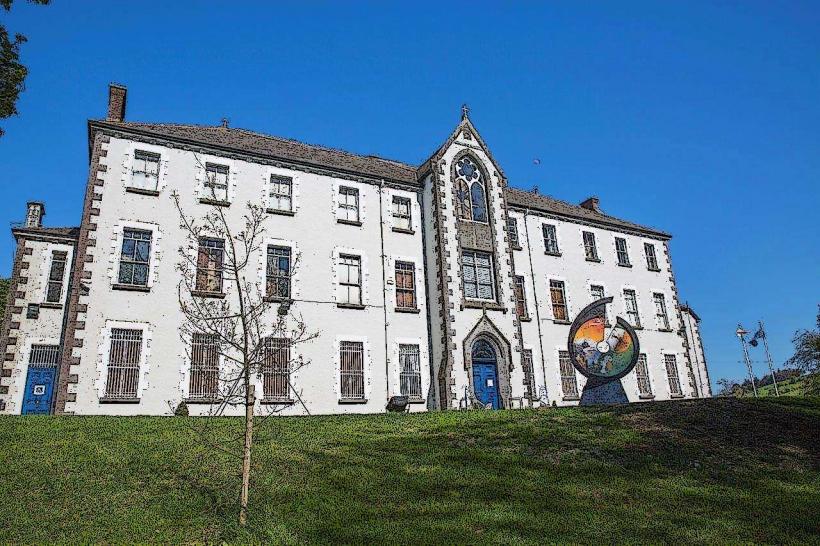
Cavan County Museum – $25$ km Southeast