Information
Landmark: Luleå ArchipelagoCity: Lulea
Country: Sweden
Continent: Europe
Luleå Archipelago, Lulea, Sweden, Europe
Visual Characteristics
The archipelago features a diverse physical appearance, ranging from larger, forested islands with pine and spruce trees to smaller, barren rock skerries. Shorelines consist of a mix of exposed bedrock, gravel beaches, and occasional sandy coves. Water in the Gulf of Bothnia is brackish, with clarity varying seasonally. During winter months, typically from December to May, the entire archipelago becomes ice-bound, forming a vast frozen expanse.
Location & Access Logistics
Access to the Luleå Archipelago is primarily by boat from the city of Luleå. Public ferry services operate from Södra Hamn (South Harbor) in Luleå to several larger islands, including Sandön, Junkön, and Klubbviken, with varying schedules depending on the season. Private boat rentals and charter services are also available. Parking facilities are located at the Södra Hamn terminal. No direct road access connects the mainland to the islands.
Historical & Ecological Origin
The Luleå Archipelago is a result of post-glacial rebound, a geological process where land rises after the melting of ice sheets from the last ice age. This uplift continues at a rate of approximately 0.8 to 0.9 centimeters per year. Historically, the islands served as important bases for fishing, sealing, and pilotage, with many featuring remnants of old fishing villages and navigation aids. Ecologically, it is classified as a brackish water archipelago, supporting unique flora and fauna adapted to the low salinity environment.
Key Highlights & Activities
Activities include boating, kayaking, and fishing for species such as pike, perch, and whitefish. Designated hiking trails are maintained on several islands, including Junkön and Brändöskär. Swimming is possible at various beaches during the summer. During winter, the frozen sea facilitates ice skating, cross-country skiing, and ice fishing. Guided boat tours are available seasonally.
Infrastructure & Amenities
Basic infrastructure is present on some of the more frequently visited islands. This includes dry toilets, designated picnic areas with fire pits, and simple shelters. Cell phone signal (4G/5G) is generally available across the main islands. Seasonal kiosks and small restaurants operate on islands like Klubbviken and Småskär during the summer months. Fresh water access is limited to specific locations.
Best Time to Visit
The period from June to August offers the warmest weather and longest daylight hours, ideal for boating, swimming, and hiking. For ice-related activities, January to March provides the most stable ice conditions. Photography is optimal during the summer's extended 'golden hour' around sunrise and sunset, which lasts for several hours due to the high latitude and low sun angle.
Facts & Legends
A unique characteristic of the Luleå Archipelago is its continuous land uplift, which means that old maps quickly become outdated as new land emerges from the sea and former deep channels become shallow. This phenomenon has historically required the relocation of harbors and the adjustment of navigation routes. Local lore sometimes attributes the formation of the numerous small islands to ancient giants throwing rocks into the sea.
Nearby Landmarks
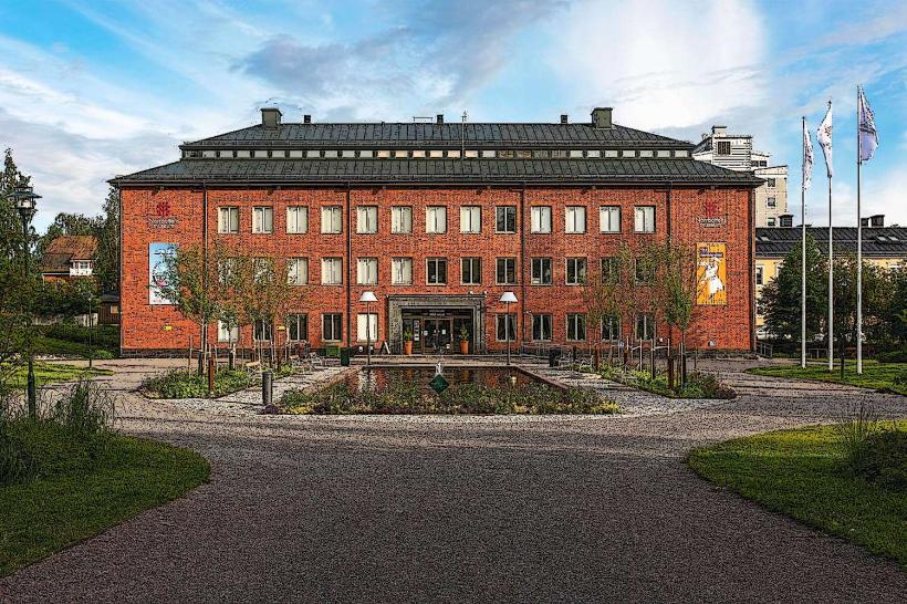
- Kulturens Hus (House of Culture): 0.5km West
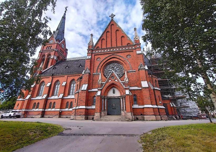
- Lulea-cathedral_lulea" class="underline">Luleå Cathedral: 0.8km West
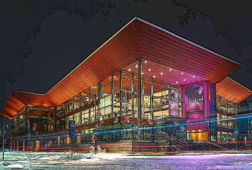
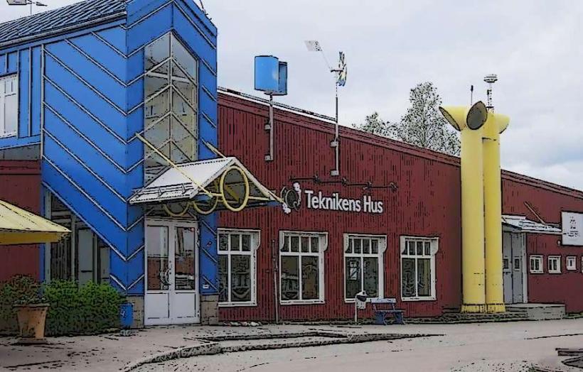
- Teknikens Hus (Science Centre): 2.5km North
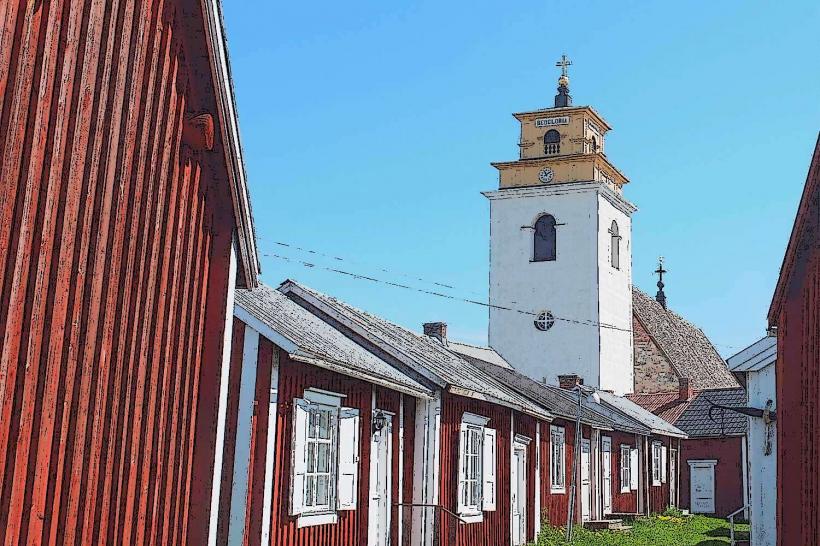
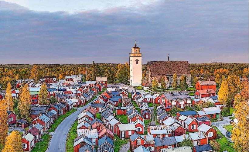
- Gammelstad Church Town (UNESCO World Heritage Site): 10km Northwest