Information
City: AgadirCountry: Morocco
Continent: Africa
Agadir, Morocco, Africa
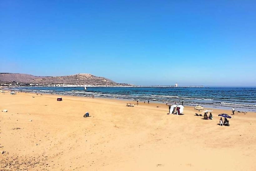
Agadir is the capital of the Souss-Massa region and the primary beach resort destination in Morocco. It is situated on the Atlantic coast, bordered by the Anti-Atlas Mountains to the east and the Sahara Desert to the south.
Historical Timeline
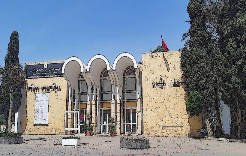
Agadir was founded by Portuguese merchants in 1505. The primary event shaping its current urban form was the catastrophic earthquake of February 29, 1960, which destroyed the entire city in 15 seconds. Unlike other Moroccan cities, Agadir lacks a traditional ancient medina because it was completely rebuilt in the 1960s and 70s using modern seismic-resistant architecture, wide boulevards, and a grid system.
Demographics & Population
The estimated metropolitan population for 2026 is 980,000. The primary ethnic demographic is Tachelhit-speaking Berbers (Chleuh), making it the world’s largest Berber-speaking city. There is a significant population of European retirees and seasonal surfers. The median age is 29.4 years.
Urban Layout & Key Districts
The city is organized linearly along the coastline. Key districts include:
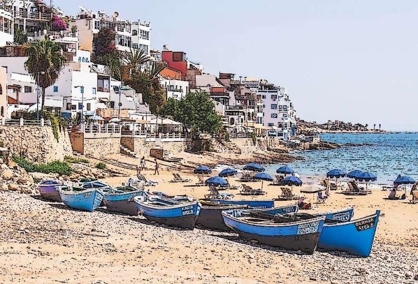
Sector Touristique: The beachfront strip dominated by luxury hotels and the Promenade.
Talborjt: The modern commercial and residential center built to replace the destroyed old town.
City Centre: The administrative hub with government buildings and wide avenues.
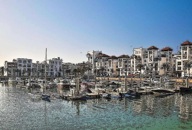
Agadir Marina: A luxury residential and yachting complex at the northern end of the bay.
Anza: A northern industrial and surfing suburb.
Top City Landmarks
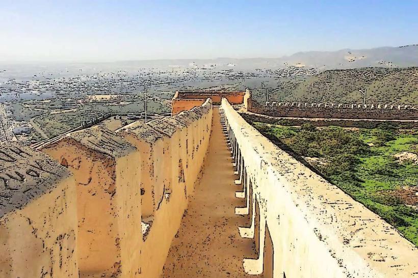
Agadir Oufella (The Casbah): The 16th-century ruins on the hill offering panoramic views.
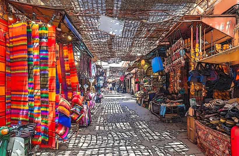
Souk El Had: One of the largest urban markets in Africa with over 6,000 stalls.
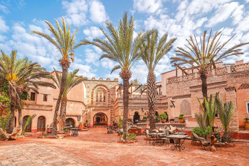
La Médina d'Agadir (Coco Polizzi): A 1992 reconstruction of a traditional medina using local stone.
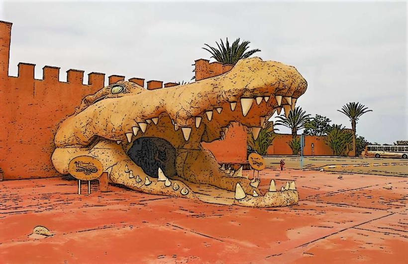
Crocoparc: A botanical garden and crocodile conservation park.
Vallee des Oiseaux: A central bird park and wildlife corridor.
Transportation Network
Intra-city transit is managed by orange "Petit Taxis" and an extensive ALSA bus network. There are no metro or tram systems. Ride-sharing via Yango is established. Traffic density is moderate, though the "Corridor de la Mort" (the N1 highway bypass) experiences high congestion and safety risks. Agadir is currently the southern terminus of the national motorway network, with plans for high-speed rail expansion.
Safety & "Red Zones"
The general safety level is very high. Petty theft is less frequent than in Marrakech. There are no specific "red zones," though the beach areas south of the main promenade can be isolated and poorly lit at night. Common scams involve "unlicensed surf instructors" and inflated prices for camel rides on the beach.
Digital & Financial Infrastructure
The average internet speed is 40-60 Mbps. Main mobile carriers are Maroc Telecom, Orange, and Inwi. Credit card acceptance is high in the Sector Touristique and supermarkets, but cash (Dirham) is essential for Souk El Had and taxis. ATMs are widely available along Avenue Hassan II.
Climate & Air Quality
Temperatures range from 10°C in winter to 28°C in summer. The city experiences 300 days of sunshine annually. Air quality is high due to Atlantic breezes. A significant weather risk is the "Chergui," a hot, dry wind from the Sahara that can cause temperatures to spike to 45°C for 2-3 days in summer.
Culture & Social Norms
Tipping is expected at 10% in restaurants. Handshakes are the standard greeting. Dress codes are the most liberal in Morocco due to the tourism industry, though modest attire is required for the administrative center and the Souk. Alcohol is widely available in beach clubs, hotel bars, and dedicated retailers (e.g., Uniprix).
Accommodation Zones
Sector Touristique: Recommended for beach access, nightlife, and resort amenities.
Talborjt: Recommended for authentic local dining, lower costs, and proximity to the Souk.
Local Cost Index
1 Espresso: 15 MAD ($1.50 USD)
1 Standard Lunch (Fish Tagine): 85 MAD ($8.50 USD)
1 Petit Taxi Trip: 15 MAD ($1.50 USD)
Nearby Day Trips
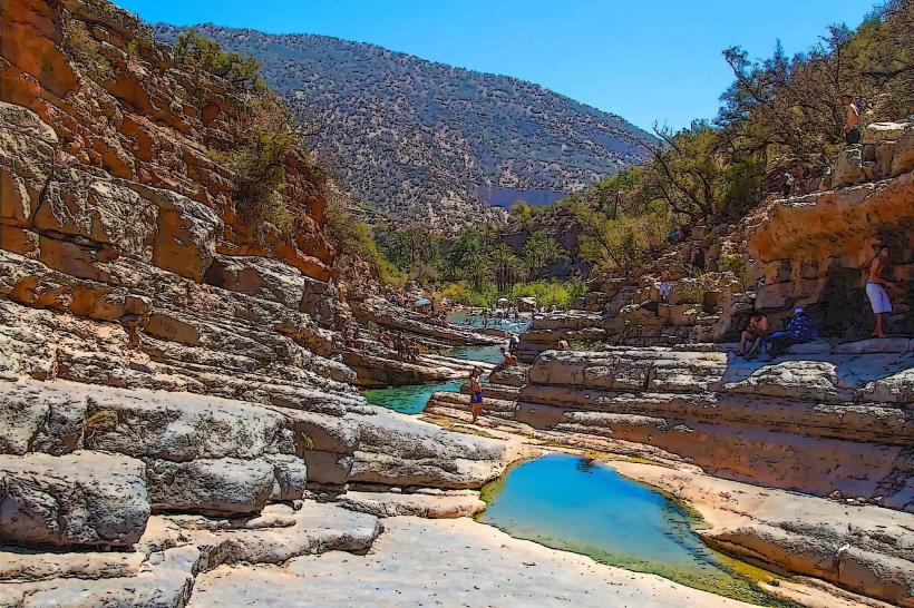
Paradise Valley: 35 km (Atlas mountain pools)
Taghazout: 20 km (World-class surfing village)
Tifnit: 45 km (Traditional fishing village)
Souss-Massa National Park: 60 km (Bird sanctuary)
Facts & Legends
The inscription on the hill (Agadir Oufella) reads "God, King, Country," which is illuminated at night and visible from almost anywhere in the city. A local historical oddity is that the 1960 earthquake was so localized that ships in the harbor felt nothing, while the city itself was leveled. Legend says the name "Agadir" refers to a "fortified granary," a staple of Berber architectural history used to protect tribal wealth from invaders.