Information
City: An GiangCountry: Vietnam
Continent: Asia
An Giang, Vietnam, Asia
An Giang serves as a critical agricultural powerhouse and the primary gateway for fluvial trade between Vietnam and Cambodia. It is situated in the upper reaches of the Mekong Delta, bordered by Cambodia to the northwest and the Hau River (Mekong) to the east.
Historical Timeline
The region was part of the ancient Funan Kingdom and later the Khmer Empire before being integrated into Vietnamese territory in 1757. Governance shifted from the Nguyen Dynasty to French colonial administration in 1867. The most significant architectural and political reconstruction occurred post-1975, following the resolution of the border conflicts with the Khmer Rouge. The 2013 elevation of Long Xuyen to a Class I city and the 2018 opening of the Vam Cong Bridge shaped the current urban form by integrating the province more tightly with the Ho Chi Minh City economic corridor.
Demographics & Population
The provincial population is approximately 1.91 million. Long Xuyen City contains roughly 280,000 residents, while Chau Doc City houses 120,000. The demographics are the most diverse in the Delta: Kinh (95%), Khmer (4%), and small but culturally significant Hoa (Chinese) and Cham (Muslim) communities. The median age is 32.6 years.
Urban Layout & Key Districts
The province is organized between two major urban centers. Long Xuyen (South) is the administrative and educational hub. Chau Doc (Northwest) is the religious and border commerce center located at the confluence of the Hau and Vinh Te rivers. The districts are connected primarily by National Highway 91, which follows the river's western bank.
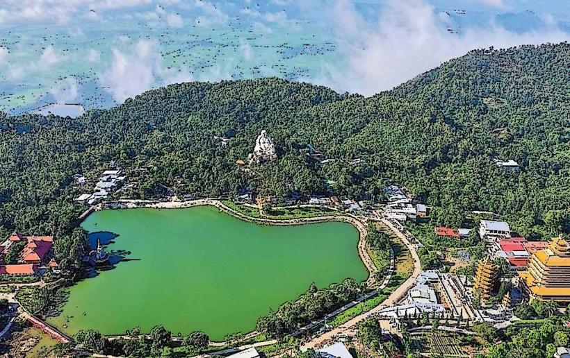
Top City Landmarks
Ba Chua Xu Temple (Sam Mountain)
Long Xuyen Floating Market
Tra Su Cajuput Forest
Chau Giang Cham Village
Oc Eo Cultural Relic (Ancient Funan site)
Transportation Network
Movement within Long Xuyen and Chau Doc relies on private motorbikes and local bus lines. There is no metro or tram system. Grab (Car/Bike) is operational in Long Xuyen and Chau Doc. Official taxis are green (Mai Linh) or white (Taxi Long Xuyen). River ferries (phà) are a critical logistical component for crossing the Hau River. Traffic density is moderate, though heavy truck volume is constant near the Tinh Bien and Vinh Xuong border gates.
Safety & "Red Zones"
The province maintains a high general safety level. Caution is advised at night in the immediate vicinity of border crossings (Tinh Bien) due to unregulated trade activity. Common scams are localized to the Sam Mountain area in Chau Doc, involving aggressive bird-releasing rituals, forced incense "donations," and fraudulent fortune-telling.
Digital & Financial Infrastructure
Average internet speed is 68 Mbps. Main mobile carriers are Viettel, Vinaphone, and Mobifone. Card acceptance is moderate in Long Xuyen’s modern hotels and supermarkets but low in Chau Doc’s religious sites and border markets. ATMs are abundant in Long Xuyen (Ward My Long) and Chau Doc (Ward Chau Phu A).
Climate & Air Quality
Temperatures range from 24°C to 28°C in the cool season (December–January) and 28°C to 36°C in the dry season (March–May). Air quality is generally high due to low heavy-industry density. The rainy season runs from May to November, with the "Floating Season" (Mùa nước nổi) in October bringing significant but expected flooding that is integral to local agriculture.
Culture & Social Norms
Tipping is not standard. Handshakes are the common greeting, though a slight bow is used when meeting Khmer monks. Dress code is strictly conservative at Sam Mountain and in Cham villages (shoulders and knees covered). A specific social norm is the observance of Islamic customs in Cham communities, where alcohol and pork are restricted.
Accommodation Zones
Long Xuyen (Ward My Binh): Recommended for administrative proximity, high-end hotels, and riverside dining.
Chau Doc (Nui Sam): Recommended for proximity to religious sites and panoramic views of the Cambodian border.
Local Cost Index
1 Espresso: 25,000 VND ($1.05)
1 Standard Lunch (Bun Ca): 45,000 VND ($1.85)
1 Local Ferry Ticket: 5,000 VND ($0.20)
Nearby Day Trips
Tra Su Cajuput Forest: 25 km (45 minutes)
Cam Mountain (Nui Cam): 35 km (1 hour)
Tinh Bien Border Market: 25 km (45 minutes)
Oc Eo Relic: 40 km (1 hour)
Facts & Legends
A prominent local legend surrounds Ba Chua Xu (The Lady of the Realm) at Sam Mountain; it is said that 40 strong men could not move her stone statue until 9 virgin girls were chosen, who then moved it effortlessly to its current location. A verified historical oddity is that the Vinh Te Canal, bordering Cambodia, was dug manually by tens of thousands of workers in the early 19th century, remaining one of the largest ancient engineering feats in Southeast Asian history.