Information
City: Ca MauCountry: Vietnam
Continent: Asia
Ca Mau, Vietnam, Asia
Ca Mau serves as the southernmost economic pole of Vietnam and a strategic maritime hub for the Mekong Delta. It is characterized by its unique "three-sided sea" geography, serving as the nation’s primary gateway to the Gulf of Thailand and the East Sea.
Historical Timeline
The region was established as a settled territory approximately 300 years ago during the southern expansion (Nam Tien). Historically known as a land of mangroves and alum swamps, it was formally organized as a province under French administration. The most critical geopolitical shift occurred in June 2025, when the National Assembly merged Bac Lieu Province into Ca Mau Province. This merger integrated the energy and aquaculture sectors of both regions, positioning Ca Mau City as the central political and administrative heart of the expanded provincial territory.
Demographics & Population
The provincial population is approximately 2.6 million following the 2025 merger. The population is predominantly Kinh (Vietnamese), with the Khmer being the most significant ethnic minority (approx. 12%), followed by a small Hoa (Chinese) community. The median age is approximately 31.5 years.
Urban Layout & Key Districts
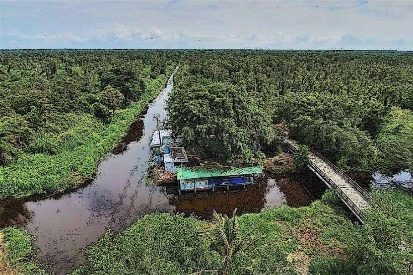
The city is organized around a dense network of over 7,000 km of rivers and canals, notably the Ganh Hao River.
Ca Mau City (Central): The primary administrative, industrial, and oil/gas service hub.
Dat Mui (South): The symbolic southern tip of mainland Vietnam and a protected ecological zone.
U Minh (North): A specialized district defined by vast cajuput forests and peatland ecosystems.
Bac Lieu Ward (Northeast): Formally a separate city, now integrated into the expanded Ca Mau metropolitan structure.
Top City Landmarks
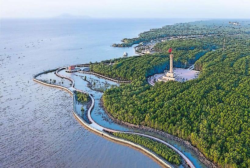
Mui Ca Mau (Ca Mau Cape): The National GPS Coordinate Marker (GPS 0001).
Mui Tau Monument: A 21-meter high monument shaped like a ship’s bow.
City Bird Garden: Located within the Lam Vien May 19th Park.
Monivongsa Bopharam Pagoda: A major Khmer Buddhist cultural center.
Hon Da Bac (Silver Stone Islet): A cluster of rocky islands connected to the mainland by a bridge.
Transportation Network
Movement is dominated by a combination of road and water-based transport.
Road: National Route 1 terminates here. Construction is currently underway for the Ca Mau-Dat Mui Expressway.
Air: Ca Mau Airport (CAH) is currently undergoing an upgrade and expansion (scheduled for 2026 completion) to accommodate larger aircraft.
Water: High-speed boats (tau cao toc) and barges remain the primary method for heavy cargo and reaching remote coastal districts.
Ride-sharing: Grab (Car and Bike) is operational and reliable in Ca Mau City.
Safety & "Red Zones"
Ca Mau is exceptionally safe with low crime rates. There are no designated "red zones." The primary safety risks are environmental: occasional storms/typhoons from August to November and flash flooding in low-lying riverside wards. Visitors should exercise caution when navigating remote mangrove forests without a local guide due to the risk of becoming disoriented in the canal network.
Digital & Financial Infrastructure
Average internet speed is 70 Mbps. Ca Mau signed a strategic Digital Transformation Agreement with VNPT in late 2025 to modernize its 5G and e-government systems by 2030. Card acceptance is high in central hotels and the Gas-Power-Fertilizer Complex service areas but remains non-existent in floating markets and rural districts. ATMs are concentrated along Tran Hung Dao and Phan Ngoc Hien streets.
Climate & Air Quality
Temperatures range from 25°C to 28°C in the cool-dry season (December–January) and 28°C to 35°C in the dry season (March–May). Air quality is high due to coastal wind exchange and 100,000 hectares of mangrove coverage. The rainy season (May–November) is characterized by regular afternoon downpours and rising water levels.
Culture & Social Norms
Tipping is not standard. Handshakes are the professional norm. Dress code is conservative; modest attire is mandatory for the Monivongsa Bopharam Pagoda. A unique social norm is the "river-trade" etiquette, where many transactions occur between boats on the Ganh Hao River rather than in traditional storefronts.
Accommodation Zones
Ca Mau City Center: Recommended for administrative proximity, modern dining, and airport access.
Dat Mui Tourist Area: Recommended for a 1-night stay to witness the unique sunrise and sunset over the sea from the same point.
Local Cost Index
1 Espresso: 30,000 VND ($1.25)
1 Standard Lunch (Ca Mau Crab): 150,000 VND ($6.20)
1 Taxi trip (3km): 55,000 VND ($2.30)
Nearby Day Trips
U Minh Ha National Park: 40 km (1 hour)
Thi Tuong Lagoon: 45 km (1.2 hours)
Hon Khoai Island: 15 km offshore from Nam Can (requires boat permit)
Hon Da Bac: 50 km (1.5 hours)
Facts & Legends
A prominent local legend involves the "Uncle Ba Phi" stories-humorous, exaggerated tales about the wild nature of Ca Mau (e.g., mosquitoes as big as fans or pythons as long as rivers) that reflect the resilience and humor of the early settlers. A verified historical oddity is that Ca Mau is the only place in mainland Vietnam where one can view the sunrise over the East Sea and the sunset over the West Sea (Gulf of Thailand) from a single land position at Cape Ca Mau.