Information
City: ChlefCountry: Algeria
Continent: Africa
Chlef, Algeria, Africa
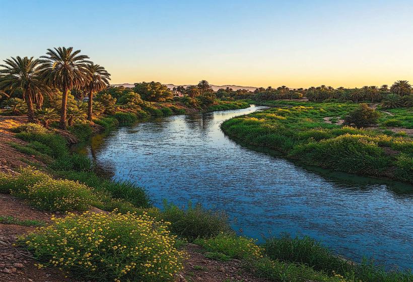
Chlef functions as the primary logistical and agricultural pivot of the central Chélif Valley in northwestern Algeria. Situated at the midpoint between Algiers and Oran, it serves as a specialized node for intensive cereal production, dairy logistics, and cross-border transit. In January 2026, the city is defined by a state of monumental infrastructure recovery and climate adaptation, following record-breaking Mediterranean storms that triggered flash floods in the region.
Historical Timeline
1st Century AD: Established by Romans as Castellum Tingitanum; specialized as a military garrison in Mauretania Caesariensis.
10th Century: Re-founded as El Asnam (The Idols); specialized as a Berber trading node.
1954 & 1980: Site of two catastrophic earthquakes; the 1980 event (M 7.3) led to the city’s renaming to Chlef and a complete structural overhaul.
2025 (Nov): Integration of Chlef into the national $5.84 billion agriculture budget, targeting modernization of the Chélif valley irrigation systems.
2026 (Jan 1): Financial Calibration. Implementation of the 2026 Finance Law, increasing the national minimum wage (SNMG) to 24,000 DZD, impacting the city's high-density industrial and public sector.
2026 (Jan 10–11): Cultural Heritage. Cultural institutions hosted exhibitions for Yennayer 2976 (Amazigh New Year) to document regional heritage.
2026 (Jan 20): Climate Crisis. Record-breaking rainfall from Storm Harry caused deadly flash floods in the province, claiming the life of a 13-year-old girl and triggering specialized emergency rescue operations.
Demographics & Population
The metropolitan population is approximately 178,616 (2026 estimate), with the wider Chlef Province exceeding 1.1 million. The demographic is characterized by a high density of agricultural technicians and students at Hassiba Benbouali University, a specialized node for hydraulics and agritech research.
Urban Layout & Key Districts
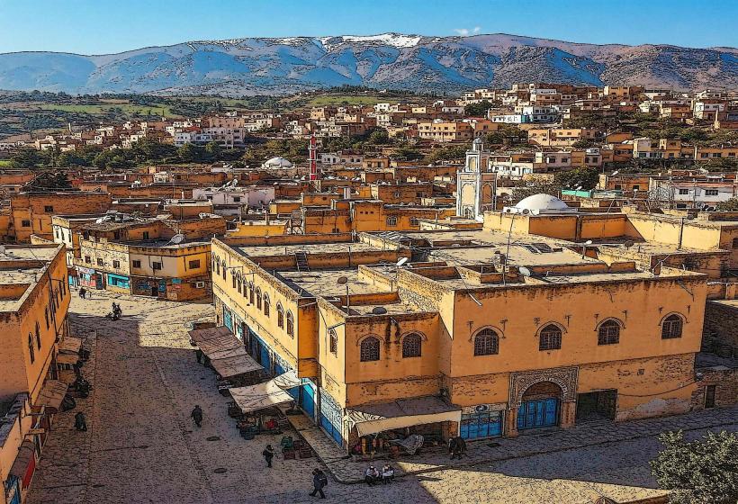
The New Center: Characterized by earthquake-resistant low-rise architecture and a high-fidelity colonial-era grid.
Ech Chettia: A specialized northern satellite; the largest high-density residential extension of the Chlef metropolitan area.
Ouled Mohamed: The primary administrative district; home to the provincial headquarters and specialized public service nodes.
Ténès: A specialized coastal satellite (50km north); functions as the region's primary maritime port and archaeological node.
Ghriss Plain: The specialized agricultural hinterland; utilized for high-density cereal and fruit production.
Top City Landmarks
St. Reparatus Basilica: One of Africa's oldest early Christian churches (4th century), containing the specialized mosaic of the Labyrinth.
The Martyrs' Memorial: A specialized architectural node commemorating the 1980 earthquake victims and the War of Independence.
The Roman Aqueduct: Specialized structural remnants of Castellum Tingitanum irrigation systems.
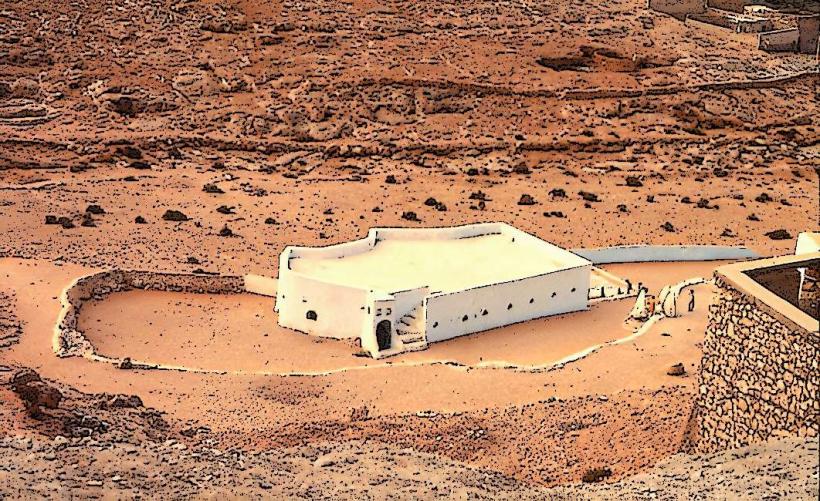
Ténès Old Town (Vieux Ténès): A specialized medieval ksar located to the north; features 9th-century urban layouts and traditional crafts.
Sidi Maamar Forest: A specialized ecological node providing the primary recreational green space for the Chélif valley.
Transportation & 2026 Logistics
A1 East-West Highway: The specialized logistical spine; Chlef serves as the primary waystation for freight moving between Algiers (200km) and Oran (210km).
Algiers-Oran Railway: A specialized high-capacity rail corridor; in 2026, Chlef is a focal point for freight digitalization to streamline grain transfers.
Aboubakr Belkaid Airport (CFK): A specialized domestic and seasonal international hub for technical personnel and the diaspora.
Water Infrastructure: In January 2026, the government confirmed progress on a 300,000 m³/day desalination plant for Chlef to secure drinking water and stabilize industrial usage.
Safety & Environment
The general safety level is High. Warning: As of January 22, 2026, the region is under Red Alert for soil saturation and flood risk following Storm Harry; specialized drainage maintenance is the city's current priority. Environmental Note: Chlef is a high-priority node for the "Mediterranean Desalination Program," designed to reduce the city's chronic reliance on depleted groundwater aquifers.
Local Cost Index (2026 Estimates)
1 Night (Secure Business Hotel): DZD 7,000 – 11,500 (~$52 – $85)
Traditional "Chélif Cereal" Meal: DZD 500 – 850
Taxi (City Center to Ech Chettia): DZD 400 – 700
Median Monthly Rent (2-BR Apartment): DZD 22,000 – 38,000
1L Gasoline: DZD 45.00
Facts & Legends
Chlef is the site of the "Legend of the Seven-Year Drought," a local oral history regarding the city's resilience before the 1980 reconstruction. A verified fact is that Chlef houses the National Center for Applied Research in Earthquake Engineering, the specialized technical node for seismological safety in North Africa. Historically, the city was the birthplace of Hassiba Ben Bouali, a key heroine of the Battle of Algiers. In 2026, the city remains the specialized global epicenter for "Earthquake-Resilient Arid Urbanism," hosting technical delegations in January to audit post-disaster architectural standards.