Information
City: Dien BienCountry: Vietnam
Continent: Asia
Dien Bien, Vietnam, Asia
Dien Bien Phu serves as the primary political and administrative center of Dien Bien Province and acts as a critical border trade gateway between Vietnam and Northern Laos. It is situated in the Muong Thanh Valley, the largest valley in the Northwest highlands, approximately 450 km west of Hanoi.
Historical Timeline
The city’s modern history is defined by its role as a Tai ethnic stronghold before the French colonial administration established a military presence in the early 20th century. The primary era of governance shifted from French Indochina to the Democratic Republic of Vietnam following the Battle of Dien Bien Phu in 1954. The most significant architectural and political reconstruction occurred in 2003 when the town was officially upgraded to a city. The 1954 battle remains the primary event that shaped the current urban form, with the city’s layout specifically preserved to integrate battlefield monuments and military bunkers into the residential grid.
Demographics & Population
The city population is approximately 82,000, while the provincial population is 630,000. The demographic profile is dominated by the Thai ethnic group (approx. 53%), followed by the Kinh (33%) and the H'mong (11%). The median age of the population is 27.8 years.
Urban Layout & Key Districts
The city is organized along the Nam Yum River within the Muong Thanh Valley. Muong Thanh Ward (Central) is the hub for tourism and historical sites. Tan Thanh (North) serves as the modern administrative and residential expansion zone. Him Lam (Northeast) is the primary commercial entry point from National Highway 279.
Top City Landmarks
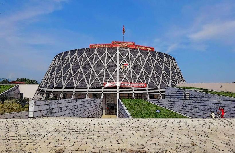
Dien Bien Phu Victory Museum
Hill A1 (Eliane 2)
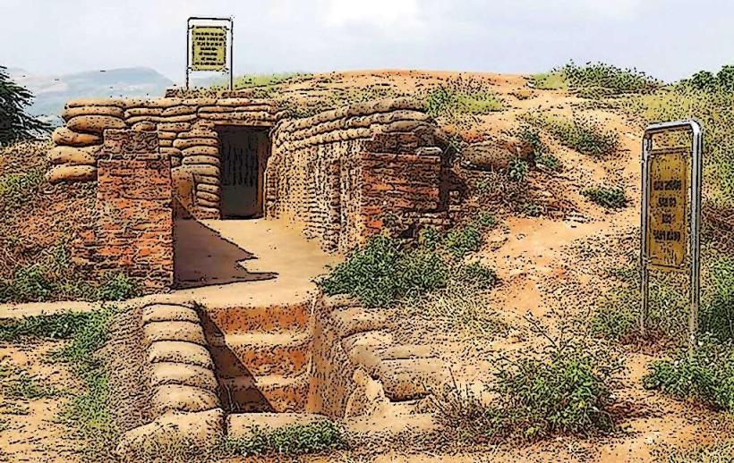
De Castries Bunker
Dien Bien Phu Victory Monument (D-1 Hill)
Muong Thanh Bridge
Transportation Network
Movement within the city is conducted via private motorbikes and local taxis. Public bus lines connect the city to outlying districts like Muong Lay. There are no metro or tram systems. Grab has a very limited presence; traditional taxis are the reliable standard. Official taxis include Taxi Dien Bien (yellow) and Mai Linh (green). Traffic density is low, though congestion occurs near the central market and during commemorative anniversaries.
Safety & "Red Zones"
The city maintains a very high safety level. There are no specific neighborhoods to avoid. Caution is advised when traveling to remote border areas near Laos due to strict permit requirements and unexploded ordnance (UXO) risks in non-reclaimed agricultural lands. Scams are uncommon, but visitors should verify prices for motorbike rentals at independent guesthouses.
Digital & Financial Infrastructure
Average internet speed is 55 Mbps. Main mobile carriers are Viettel, Vinaphone, and Mobifone. Card acceptance is limited to major hotels and the victory museum; cash is required for almost all other transactions. ATMs are primarily located along Vo Nguyen Giap Street.
Climate & Air Quality
Temperatures range from 12°C to 20°C in winter and 24°C to 33°C in summer. Air quality is generally high. Specific weather risks include heavy fog during winter months which impacts flights at Dien Bien Airport, and a severe dry-hot season from March to May.
Culture & Social Norms
Tipping is not expected. A handshake is the standard greeting in official settings, while a respectful nod is used socially. Dress code is conservative; modest clothing is mandatory when visiting the Martyrs' Cemetery and ethnic Thai villages. The "Xoe Thai" dance is a critical social norm and often involves communal participation with visitors during local festivals.
Accommodation Zones
Muong Thanh Ward: Recommended for walking access to the museum, historical hills, and the central market.
Him Lam: Recommended for higher-end resort-style stays and proximity to the airport.
Local Cost Index
1 Espresso (Phin coffee): 25,000 VND ($1.05)
1 Standard Lunch (Sticky rice and grilled pork): 55,000 VND ($2.30)
1 Taxi trip (3km): 45,000 VND ($1.85)
Nearby Day Trips
Pa Khoang Lake: 20 km (45 minutes)
Muong Phang (General Vo Nguyen Giap's Headquarters): 35 km (1 hour)
Tay Trang Border Gate: 35 km (1 hour)
Hua Pe Hot Springs: 5 km (15 minutes)
Facts & Legends
A local legend among the Thai people concerns the "Giant Pumpkin" that landed in the Muong Thanh Valley. According to the myth, all ethnic groups in the region emerged from this single giant pumpkin, explaining the diversity and brotherhood of the local tribes. Historically, the city is home to the "Pha Din Pass," which translates to "Heaven and Earth," marking the legendary boundary where the sky meets the mountains.