Information
City: Flic en FlacCountry: Mauritius
Continent: Africa
Flic en Flac, Mauritius, Africa
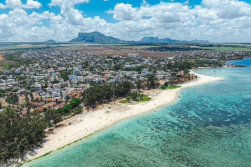
Flic en Flac serves as the primary tourism and maritime leisure hub on the west coast of Mauritius within the Black River District. It functions as a critical economic driver for the region through its concentration of international resorts, luxury real estate developments, and dive-related commerce.
Historical Timeline
Flic en Flac originated as a small fishing village in the 17th century, with its name likely a Dutch corruption of Fried Landt Flaak ("free flat land"). It remained an isolated hamlet known primarily for hunting and its local cemetery until the 1970s. The primary event shaping the current urban form was the rapid liberalization of the tourism sector in the late 1990s and early 2000s, which triggered the conversion of sugar estate buffer zones into high-density commercial strips and residential complexes.
Demographics & Population
The permanent population within the village limits is approximately 2,100, though this figure fluctuates to over 15,000 during peak tourist seasons. The demographics are 60% Indo-Mauritian, 30% Creole, and 10% foreign expatriates (predominantly French and South African); the median age of the permanent population is 39 years.
Urban Layout & Key Districts
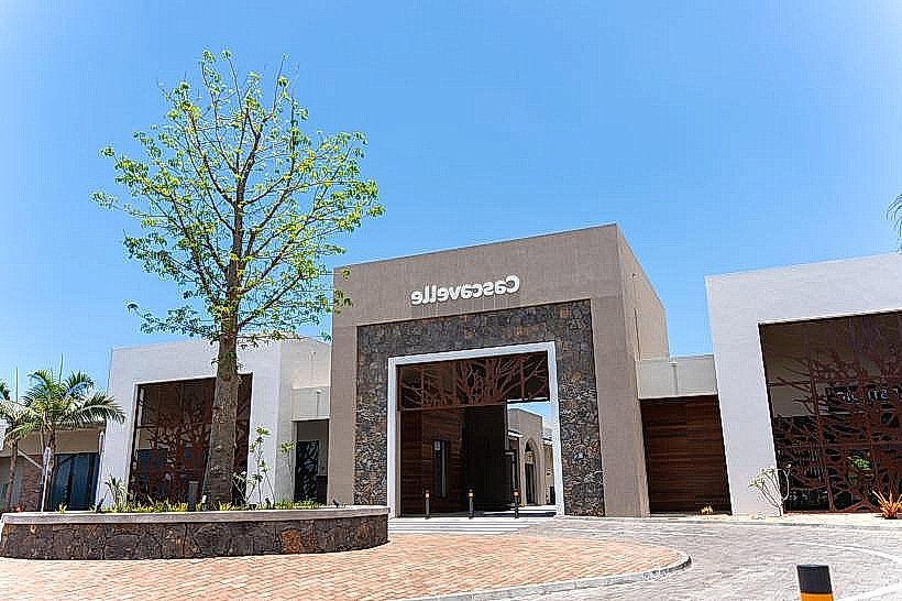
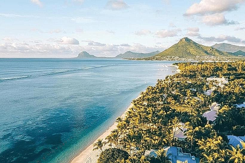
The village is organized linearly along a 13-kilometer coastline, bordered by the Rempart River to the north and the Wolmar forest to the south. Key districts include the Coastal Road (Center), containing the primary retail and nightlife infrastructure; Wolmar (South), an exclusive zone reserved for high-end resorts; and Cascavelle (East), the modern commercial and educational gateway situated on the inland plateau.
Top City Landmarks
Flic en Flac Public Beach (one of the island's longest)
Cascavelle Shopping Village
Casela Nature Parks (located on the city periphery)
The "Cathedral" (renowned underwater dive site)
Wolmar Forest Reserve
Transportation Network
Movement within the town is facilitated by the Coastal Road. Reliable bus lines connect the village to Port Louis and Quatre Bornes via the A3 highway. Ride-sharing is available via the Yugo app. Official taxis are white with yellow signage and operate primarily from stands near the Spar supermarket. Traffic density is moderate during weekdays but severe on weekends and public holidays due to local beach-bound traffic.
Safety & "Red Zones"
The general safety level is high. Avoid unlit sections of the public beach and the industrial outskirts of the Cascavelle junction after midnight. Common scams involve unlicensed "dolphin watch" operators and overcharging for seafood at beachside stalls without printed menus.
Digital & Financial Infrastructure
Average internet speed is 60-95 Mbps. Main mobile carriers are my.t and Emtel, with 5G coverage active throughout the village. Card acceptance is high in restaurants and supermarkets; cash is necessary for local "snacks" (food trucks) and craft vendors. ATMs are concentrated at the Cascavelle Shopping Village and near the Pasadena building.
Climate & Air Quality
Temperatures range from 17°C to 24°C in winter (June–August) and 23°C to 32°C in summer. The region enjoys a dry microclimate, sheltered from the southeast trade winds by the central mountains. Air quality is excellent, aided by constant sea breezes and the absence of heavy industry.
Culture & Social Norms
A tipping rate of 10% is standard in tourist restaurants. Handshakes are the common greeting. Dress code is highly casual, though swimwear is strictly prohibited in supermarkets and shops. Public consumption of alcohol on the beach is common during the day but regulated near nightclubs at night.
Accommodation Zones
Stay in Wolmar for luxury resort seclusion and direct beach access.
Stay in the Central Coastal Road area for walking access to nightlife, supermarkets, and public transport.
Local Cost Index
1 Espresso: 120 MUR ($2.65 USD)
1 Standard Lunch (Gadjaks/Street Food): 150-300 MUR ($3.30 - $6.60 USD)
1 Bus Ticket: 35-45 MUR ($0.75 - $1.00 USD)
Nearby Day Trips
Tamarin Bay (Dolphin watching): 8 km (15 minutes)
Le Morne Brabant (UNESCO site): 30 km (45 minutes)
Chamarel Seven Coloured Earth: 25 km (40 minutes)
Black River Gorges National Park: 15 km (25 minutes)
Facts & Legends
Local legend suggests the name "Flic en Flac" mimics the sound of "clop, flac"-the noise made by 18th-century constables wading through the former marshes in pursuit of runaway slaves (maroons). A verified historical oddity is the presence of an old cemetery located directly on the coastline, which was the only reason many travelers visited the area prior to its 20th-century development.