Information
City: KatsinaCountry: Nigeria
Continent: Africa
Katsina, Nigeria, Africa
Katsina serves as the administrative capital of Katsina State and functions as a significant agricultural and educational hub in Northern Nigeria. It is situated in the far northern region of the country, approximately 30 kilometers from the border with the Republic of Niger.
Historical Timeline
Katsina was established as a Hausa city-state in the early 11th century, with oral traditions dating its first dynasty to 1015 CE. The city transitioned through the Sarauta era of the Hausa Kingdoms, the Fulani Jihad/Sokoto Caliphate (1806–1903), and British colonial rule (1903–1960). The primary event shaping its current urban form was the 1987 creation of Katsina State, which prompted the large-scale expansion of administrative layouts and modern infrastructure. The city's most significant political reconstruction took place between 1987 and 1999 during the transition from military to civilian rule.
Demographics & Population
The metro area population is estimated at 586,000 as of 2026. The population is almost exclusively Hausa and Fulani, with a small minority of southern Nigerian ethnic groups residing in commercial sectors. The median age is approximately 18.3 years, reflecting a high youth dependency ratio.
Urban Layout & Key Districts
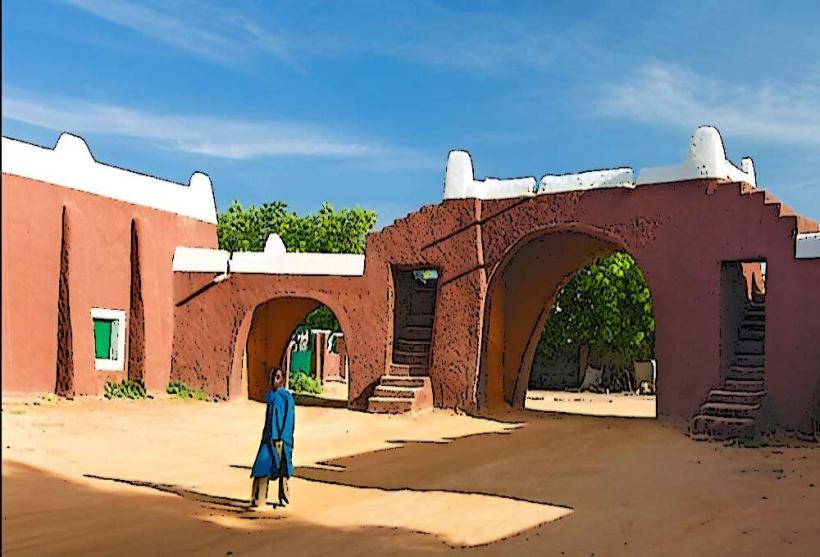
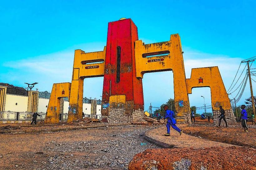
The city is organized by its ancient perimeter walls, which feature seven historic gates. Key districts include the Old City (Birni), containing the royal and religious core; the Government Reserved Area (GRA) to the east, housing administrative buildings and upscale residences; and Kofar Kaura/Kofar Kwaya (West), which serve as modern commercial extensions. Development follows a radial pattern emanating from the Emir's Palace.
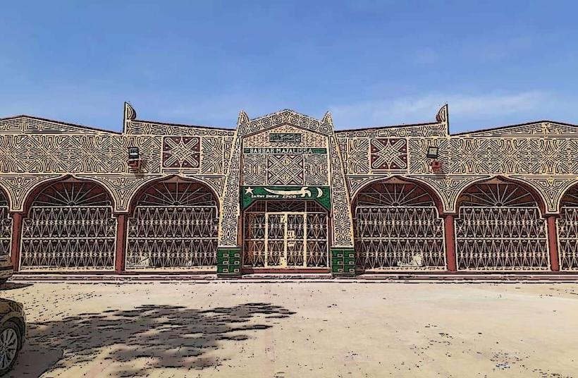
Top City Landmarks
Gobarau Minaret (15th-century mud-brick tower)
Emir of Katsina Palace (Gidan Korau)
Old Katsina Teachers College (1921 red-brick monument)
The Seven Ancient City Gates (Kofar Durbi, Kofar Sauri, etc.)
Transportation Network
Movement within Katsina is facilitated by a grid of paved arterial roads. Internal transit is dominated by "Keke" (tricycles) and local minibuses. There is no metro or rail system. Ride-sharing services like Bolt have limited availability compared to larger hubs. Official taxis are typically painted yellow with black stripes. Traffic density is generally low, except near the central markets during peak business hours.
Safety & "Red Zones"
The general safety level within the city limits is stable but requires situational awareness. Travelers should avoid the border roads leading to Jibia at night due to regional banditry and smuggling activities. Public demonstrations can occur at the central city gates; visitors are advised to avoid large unsanctioned gatherings.
Digital & Financial Infrastructure
Average internet speeds range from 20 to 40 Mbps on 4G networks. Primary carriers include MTN, Airtel, and Glo. Card acceptance is high in government-linked hotels and modern retail outlets, but the economy remains heavily cash-based. ATMs are primarily located along the Yahaya Madaki Way and the GRA commercial corridor.
Climate & Air Quality
Temperatures range from a minimum of 12°C in January to a maximum of 41°C in April. The city has a semi-arid climate with a short rainy season from June to September. Air quality is severely impacted by Harmattan dust from December to February, which frequently reduces visibility to less than 1,000 meters.
Culture & Social Norms
Social conduct is governed by Islamic traditions and Hausa customs. Tipping is not required but common for personal services (5–10%). Conservative dress is mandatory for all genders; shoulders and knees must be covered. Alcohol is strictly prohibited in public spaces under Sharia law and is only available in designated private clubs or high-end hotels.
Accommodation Zones
Katsina GRA: Recommended for security, quiet environment, and proximity to government offices.
Kofar Kaura Area: Recommended for logistical access to the airport and commercial centers.
Local Cost Index
1 Espresso: ₦2,800 ($1.85)
1 Standard Lunch: ₦7,500 ($5.00)
1 Metro/Bus Ticket: ₦450 ($0.30) - Keke/Minibus rate.
Nearby Day Trips
Daura (Historic Emirate): 78 km (70 minutes)
Jibia Border Town: 45 km (50 minutes)
Tiga Dam (Kano State): 165 km (150 minutes)
Zaria (Academic Hub): 160 km (130 minutes)
Facts & Legends
The Gobarau Minaret, standing at 15 meters, was originally part of the city's first mosque built over 600 years ago. Local legend claims it was constructed using a mixture of mud, straw, and honey to ensure its structural integrity. It is whispered that during the communal wars of the 18th century, the tower’s height allowed sentries to see the torches of invading armies as far away as the Niger border.