Information
City: MajuroCountry: Marshall Islands
Continent: Australia
Majuro, Marshall Islands, Australia
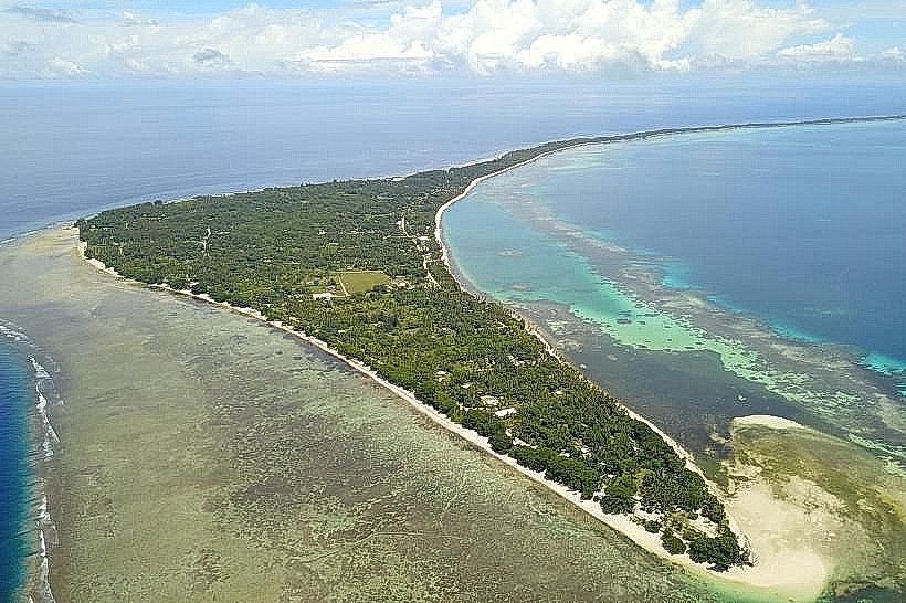
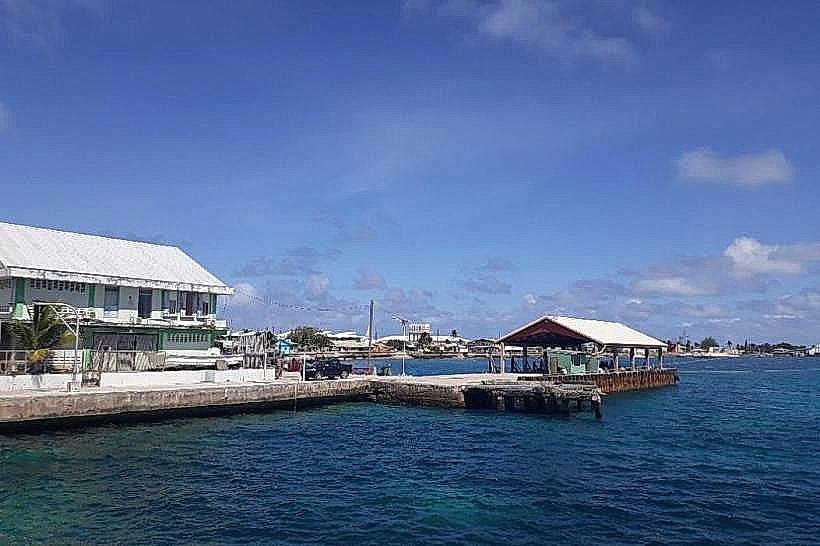
Majuro is the capital and largest city of the Marshall Islands, located in the central Pacific Ocean. Situated on an oval-shaped coral atoll of 64 islands, it serves as the administrative, economic, and transport hub of the republic. In 2026, Majuro is a focal point for international discussions on climate adaptation and sustainable tuna fisheries.
Historical Timeline
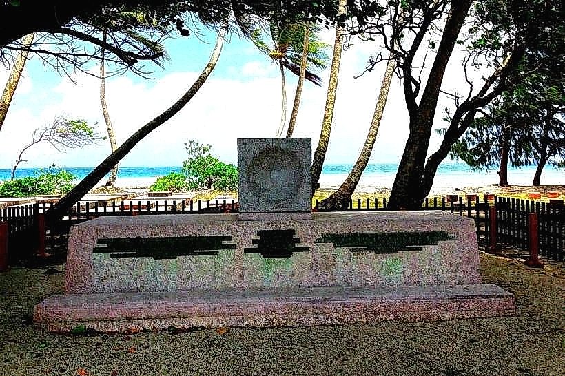
Inhabited by Micronesian navigators for approximately 2,000 years. A critical historical event occurred in 1885 when the Marshall Islands became a German protectorate. Following World War I, the islands were mandated to Japan. In 1944, U.S. forces captured the atoll from Japan during World War II, later establishing it as the capital (replacing Jaluit). The region was part of the Trust Territory of the Pacific Islands until the Republic of the Marshall Islands (RMI) achieved independence in 1986 under the Compact of Free Association with the United States.
Demographics & Population
The 2026 estimated population is approximately 28,500. The demographics are predominantly Marshallese, with small communities of Filipinos, Americans, and Chinese. The economy is driven by Government Spending, Fishing Services (Majuro is the world's busiest tuna transshipment port), Copra production, and Foreign Aid.
Urban Layout & Key Districts
The atoll consists of a very thin strip of land, often only a few hundred meters wide.
D-U-D Area (Delap-Uliga-Djarrit): The most densely populated and developed eastern section.
Delap: The administrative center containing the capital building (Capitol) and major government offices.
Uliga: The commercial heart, featuring the College of the Marshall Islands, shops, and hotels.
Djarrit (Rita): Primarily a residential area at the northern tip of the eastern arm.
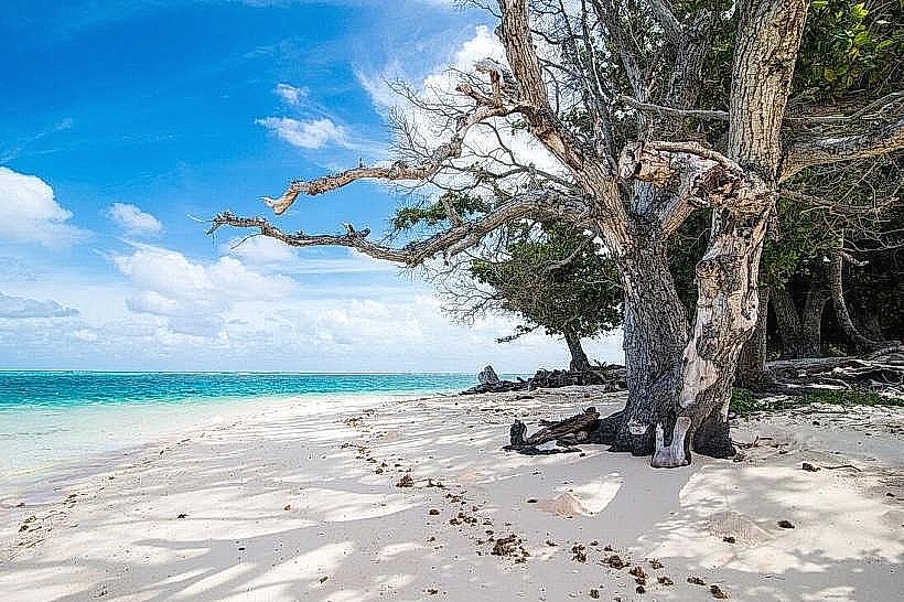
Laura: Located at the western tip of the atoll; the most rural and fertile area, providing much of the atoll's local produce and featuring the best beaches.
Long Island: A residential transition zone between the D-U-D area and the airport.
Top Landmarks
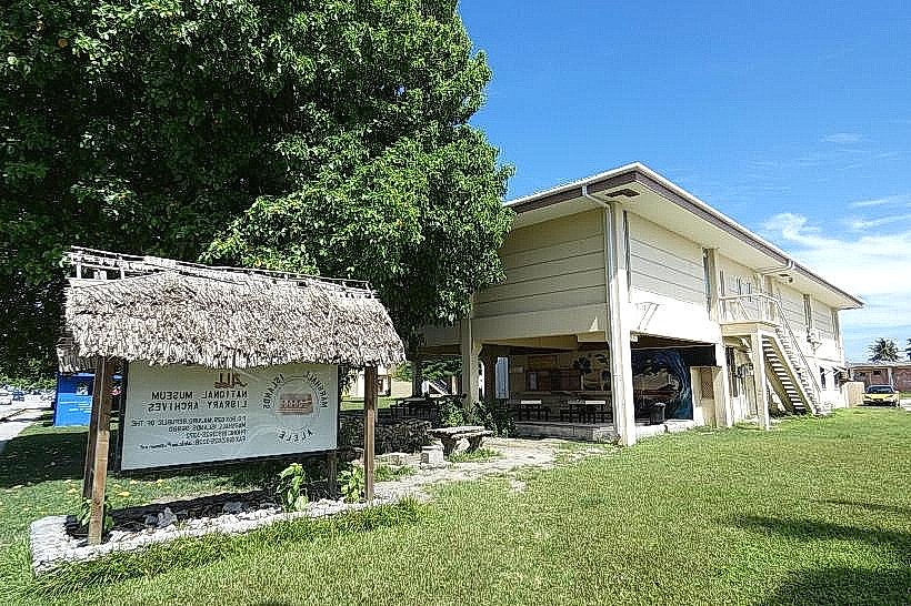
Alele Museum and Public Library: The primary cultural repository for Marshallese history, navigation charts, and traditional artifacts.
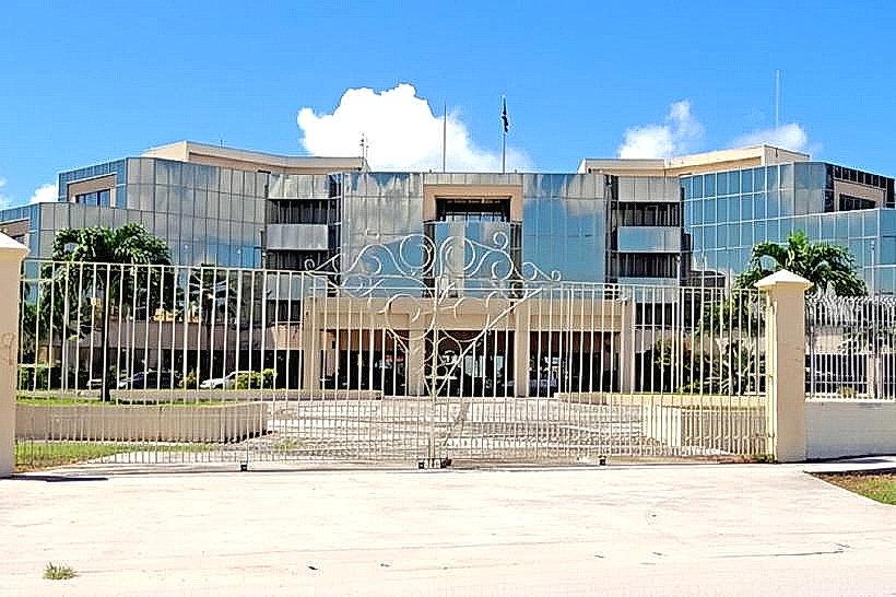
Marshall Islands Capitol Building: A modern architectural landmark in Delap where the Nitijela (Parliament) meets.
Laura Beach Park: The only expansive sandy beach on the atoll, popular for picnics and swimming.
The Marshall Islands Resort (MIR): A central social and dining hub overlooking the lagoon.
Enemanit Island: (Short boat ride away); a popular weekend getaway for snorkeling and diving among WWII shipwrecks and planes.
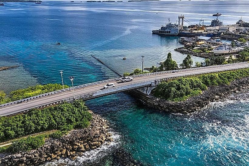
Transportation Network
Movement is facilitated by a single main road running the length of the atoll. Amata Kabua International Airport (MAJ) provides critical links to Honolulu, Guam, and Kiribati via United Airlines' "Island Hopper." Local transport relies on a high-frequency shared taxi system (flat rate per person) and private cars. In 2026, the atoll is increasing its use of electric vehicles to reduce reliance on imported fuel.
Safety & "Red Zones"
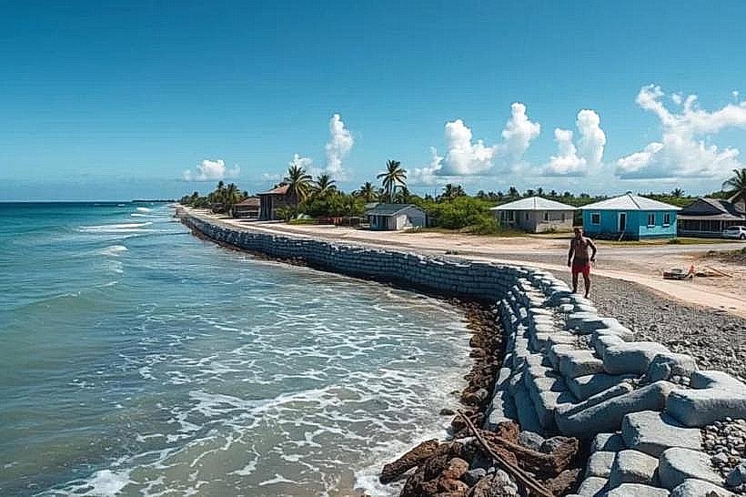
General safety is high; violent crime is rare. Standard awareness is advised regarding unlit roads at night. Environmental hazards are the primary concern, specifically king tides and coastal flooding which can wash over the main road. "Red Zones" for health include non-potable tap water; residents and visitors must rely on treated or bottled water.
Digital & Financial Infrastructure
High-speed internet is available via the HANTRU-1 undersea cable. U.S. Dollars (USD) are the official currency. UPI is not available; the banking system is dominated by the Bank of Guam and the Bank of the Marshall Islands. Credit cards are accepted at major hotels and larger supermarkets, but cash is essential for taxis and small vendors.
Climate & Air Quality
The climate is tropical, with temperatures consistently between 25°C and 30°C. Humidity is high year-round. Air quality is pristine due to constant trade winds. In 2026, the atoll faces significant pressure from rising sea levels, with average land elevation only 2 meters above sea level.
Culture & Social Norms
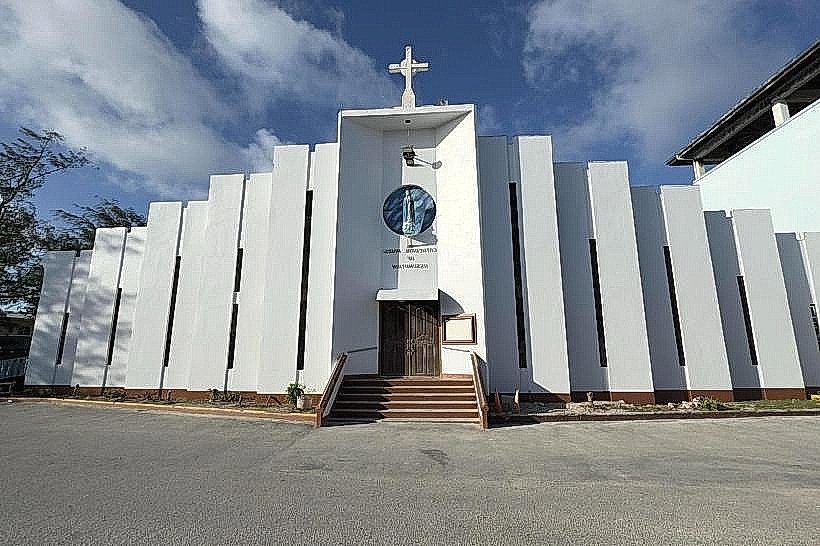
The standard tipping percentage is not customary but appreciated in tourist areas. A "Respectful-Communal" greeting (Iokwe) is standard. Dress codes are Modest; women are expected to wear skirts or dresses that cover the knees, and swimming in public areas (outside of resorts) should be done in shorts and a t-shirt. The culture is defined by Navigational Heritage, Matrilineal Land Rights, and Christianity.
Local Cost Index
1 Coffee: $4.50 USD
1 Standard Lunch: $12.00–$18.00 USD
1 Taxi Ride (within D-U-D): $1.00–$2.00 USD.
Nearby Day Trips
Arno Atoll: (Visible across the channel); a more traditional, less developed atoll famous for its "Love School" legends and kessar (hand-woven baskets).
Eneko Island: A small island in the Majuro lagoon offering overnight stays in rustic bungalows.
Facts & Legends
Majuro is one of the few places where you can stand on the main road and see the open Pacific Ocean on one side and the calm lagoon on the other. Historically, the Marshallese were the world's most sophisticated wave pilots, using "stick charts" to map ocean swells. A local legend involves Letao, a trickster god known for his cunning and for bringing fire to the islands. Another legend concerns the origin of the coconut, said to have grown from the buried head of a king's son to provide for his people.