Information
City: ManusCountry: Papua New Guinea
Continent: Australia
Manus, Papua New Guinea, Australia
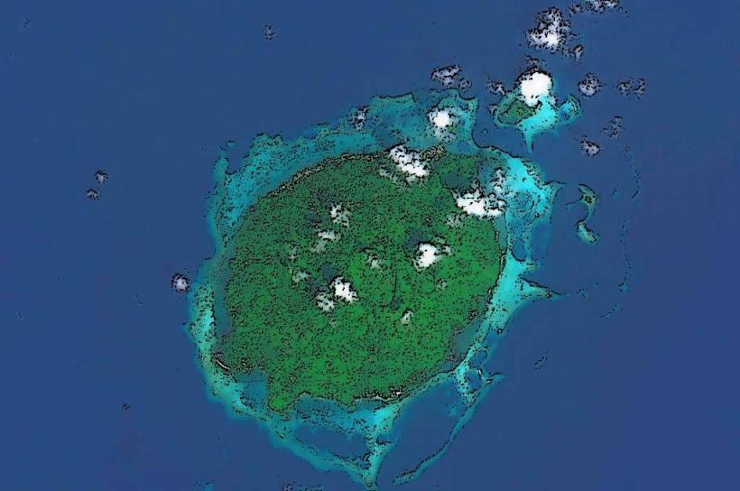
Manus Province is the smallest province in Papua New Guinea, serving as a strategic maritime outpost in the Bismarck Archipelago. It is located approximately 2 degrees south of the equator, comprising the Admiralty Islands and several scattered atolls.
Historical Timeline
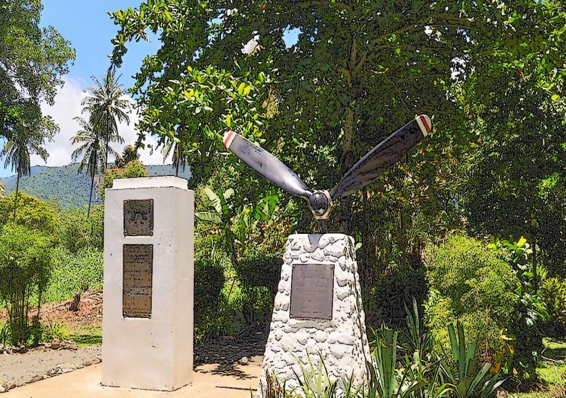
The islands were settled approximately 40,000 years ago, with the first European sighting by Spanish explorers in 1545. Primary eras of governance include German colonial rule (1884–1914), Australian administration, and Japanese occupation during WWII (1942–1944). The city of Lorengau was significantly reconstructed after 1944 following its liberation by Allied forces. The primary event shaping the current urban form was the establishment of the Lombrum Naval Base and the subsequent infrastructure developed during the Pacific War.
Demographics & Population
The total population of Manus Province is approximately 60,000, with roughly 7,000 residing in the provincial capital, Lorengau. The demographics are predominantly Melanesian, divided into the Manus Tru (saltwater people) and the Lauis (inland people). The median age is approximately 20.4 years.
Urban Layout & Key Districts
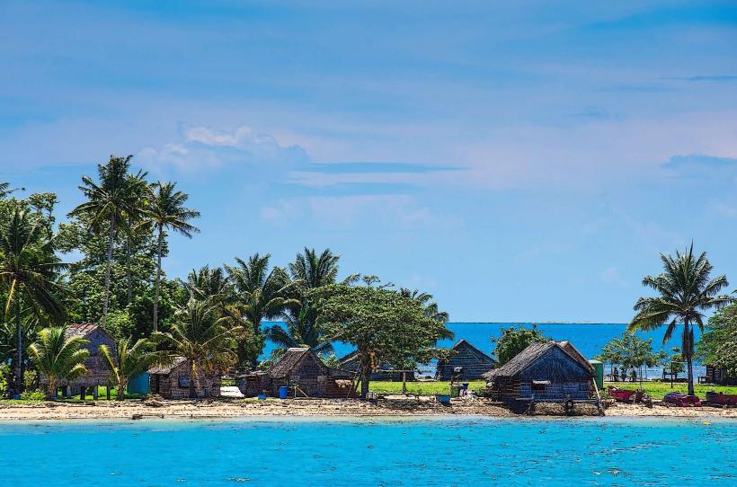
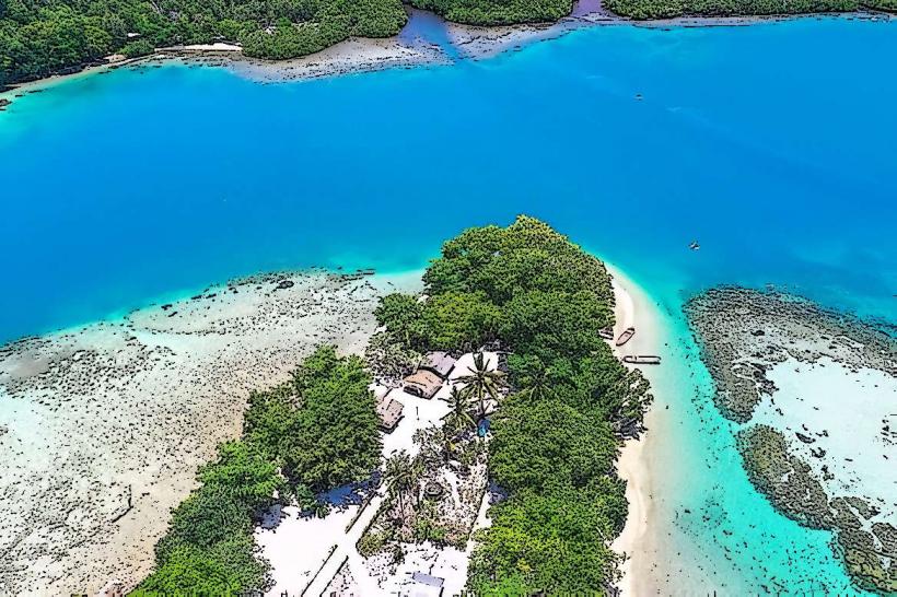
Lorengau is organized linearly along the coastline of Seeadler Harbour. The most important districts are the Lorengau Town Centre (administrative and commercial hub, located centrally) and Lombrum (military and historical district, located to the East on Los Negros Island).
Top City Landmarks
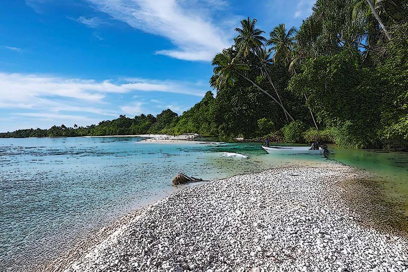
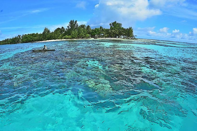
Seeadler Harbour
Lorengau Market
Lombrum Naval Base
Momote Airport (WWII historical site)
Lorengau Waterfall
Transportation Network
Movement within Lorengau is primarily via PMVs (Public Motor Vehicles), which are open-sided trucks or small buses. There is no metro or tram system. Movement between islands requires fiberglass "banana" boats with outboard motors. Local taxis are unmarked private vehicles, and ride-sharing apps do not operate. Traffic density is low, though road conditions are often poor outside the town center.
Safety & "Red Zones"
The safety level is moderate; tribal tensions can occasionally result in localized unrest. Avoid walking alone at night in the Ward 1 and Ward 2 residential areas of Lorengau. Common risks include "bush-knife" robberies in isolated coastal spots and opportunistic theft in the market area.
Digital & Financial Infrastructure
Internet speeds average 5–10 Mbps, primarily delivered via satellite or 4G. Main mobile carriers are Digicel and Telikom PNG. Card acceptance is very low; most transactions are cash-only. There are only a few ATMs located in Lorengau (Bank South Pacific and Kina Bank), which frequently run out of cash.
Climate & Air Quality
Temperatures are consistent year-round, ranging from 24°C to 31°C. Air quality is high due to lack of heavy industry. The primary weather risk is the monsoon season from December to March, which causes significant sea swells and disrupts maritime transport.
Culture & Social Norms
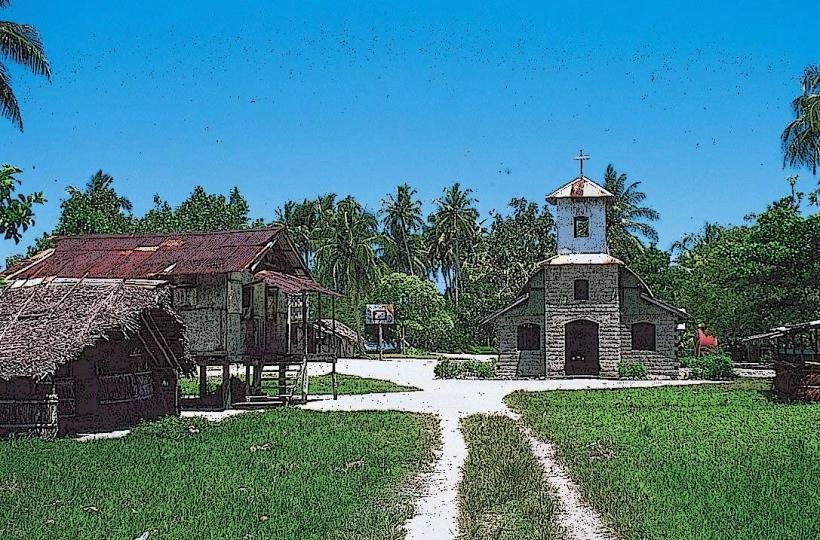
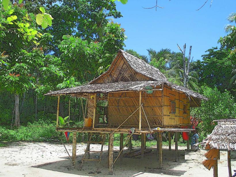
Tipping is not practiced and may be viewed as offensive. Handshakes are the standard greeting. Dress code is conservative; swimwear should be restricted to beaches, and modest clothing (covering shoulders and knees) is expected in town. Public consumption of alcohol is restricted, and the chewing of betel nut (buai) is ubiquitous but prohibited in many government buildings.
Accommodation Zones
Lorengau Waterfront: Stay here for logistical proximity to government offices, the market, and boat transport.
Seeadler Harbour (Resorts): Stay here for relative quiet and security away from the town center.
Local Cost Index
1 Espresso: 12.00 PGK ($3.15) - Note: Instant coffee is more common.
1 Standard Lunch: 35.00 PGK ($9.20)
1 PMV Fare: 2.00 PGK ($0.53)
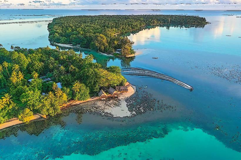
Nearby Day Trips
Los Negros Island: Connected by bridge (15 km)
Pityilu Island: 45 minutes by boat
Tuluman Island: 1 hour 30 minutes by boat
Nigoherm Islands: 2 hours by high-speed boat
Facts & Legends
Manus is the home of the "Manus True" legend involving the origins of the Paliau Movement. Following WWII, local leader Paliau Maloat established a new social order that combined indigenous beliefs with Western organizational structures, leading to an urban legend that the Americans would return with "cargo" (goods) from the gods, a phenomenon known as a Cargo Cult.