Information
City: NatitingouCountry: Benin
Continent: Africa
Natitingou, Benin, Africa
Natitingou (informally Nati) serves as the administrative capital of the Atakora Department and the primary gateway to northern Benin’s rugged mountainous landscapes. It is situated in a valley formed by the Atakora Mountains, approximately 645 km north of Cotonou.
Historical Timeline
Natitingou was founded by the Waama ethnic group, with the name derived from the Waama word Nantibatingou, meaning "to crush"-a reference to the local tradition of grinding sorghum and millet. During the colonial era, it served as a French military and administrative post. In the post-independence period, it gained national prominence as the home region of Mathieu Kérékou, Benin’s longest-serving president, which led to significant infrastructural investment in the late 20th century.
Demographics & Population
As of 2026, the population of Natitingou is estimated at 112,000. The city is a multi-ethnic hub comprising the Waama, Ditammari (Somba), Dendi, and Fula. It is noted for high levels of religious syncretism, where residents often practice Christianity or Islam alongside indigenous animist traditions.
Urban Layout & Key Districts
Centre Ville: The commercial heart featuring the Grand Marché and the central mosque.
Quartier Administratif: Home to the Prefecture of Atakora and regional government offices.
Yarakou: A traditional neighborhood known for its local "Tchoucoutou" (millet beer) production.
Kantaborifa: A residential zone extending toward the surrounding hills.
Top City Landmarks
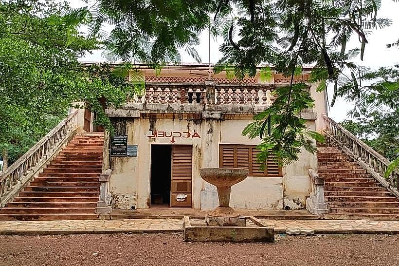
Natitingou Regional Museum: Housed in a colonial-era building, it showcases Ditammari artifacts and the history of the Atakora region.
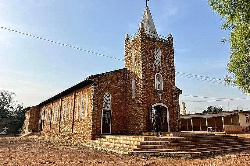
St. Sauveur Cathedral: A large, distinctive red-brick cathedral that dominates the local skyline.
Kota Waterfalls (Chutes de Kota): Located 15 km away, offering scenic pools and hiking trails.
Statue of Mathieu Kérékou: A central monument dedicated to the former president.
Tanougou Falls: Located further north (approx. 70 km), these are among the most beautiful waterfalls in West Africa.
Transportation Network
Natitingou is a critical node on the RNIE 3, the highway connecting Benin to the Togo and Burkina Faso borders.
Local: Transit is dominated by Zémidjans (motorcycle taxis).
Bus: Daily "confort" buses (e.g., ATT, Baobab Express) connect Nati to Cotonou and Parakou.
Air: Natitingou Airport (NAE) exists but currently handles very limited, mostly chartered, flights.
Road Conditions: The paved road from Parakou to Natitingou is generally in good condition, but rural tracks toward the Tata Somba houses require 4WD in the rainy season.
Safety & "Red Zones"
CRITICAL SECURITY ADVISORY (January 2026):
Red Zones: Most foreign governments (including US, UK, and Australia) advise Against All Travel to the Atakora Department north of Natitingou. This includes Pendjari National Park and the borders with Burkina Faso and Niger due to a high risk of terrorism and kidnapping.
City Safety: Natitingou city remains under a "High Degree of Caution" status. Following a thwarted coup in December 2025, military presence is high. Avoid all political rallies.
Digital & Financial Infrastructure
Internet speeds average 10–30 Mbps; 4G is reliable within the city limits. The currency is the CFA Franc (XOF).
Payments: Cash is king. MTN/Moov Mobile Money is the primary digital payment method.
Banking: ATMs (Ecobank, BOA) are available in the city center. Card acceptance is virtually non-existent outside of 1-2 major hotels (e.g., Hotel Tata Somba).
Climate & Air Quality
Tropical savanna climate. January 2026 is the peak of the Harmattan season.
Weather: Highs of 34°C, with nights dropping to 17°C. Humidity can fall as low as 10%.
Air Quality: Often Unhealthy (AQI 150+) due to thick Saharan dust and smoke from seasonal agricultural fires.
Culture & Social Norms
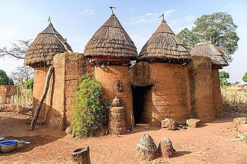
The city is the cultural capital of the Somba people, known for their unique Tata Somba (fortified mud-tower houses).
Alcohol: Tchoucoutou, a local millet beer served in calabashes, is a central part of social life.
Social Norms: Animist beliefs regarding spirits in the surrounding mountains are respected; it is traditionally forbidden to crush grain at night to avoid offending mountain spirits.
Local Cost Index
1 Espresso: 1,200 XOF ($2.15)
1 Standard Lunch: 3,000 XOF ($5.45)
1 Short "Zem" Ride: 400 XOF ($0.72)
1 Liter of Petrol: 650 XOF ($1.18)
Nearby Day Trips
Boukoumbé & Tata Somba Route: A journey into the Atakora hills to see traditional mud fortresses (50 km west; exercise extreme caution).
Perma: A small gold-mining village with local artisanal sites (20 km south).
Facts & Legends
According to local legend, the spirits of the Atakora mountains protect the city from invaders; during the evening, they are said to emit sounds of grinding stones to signal their presence. Geographically, Natitingou sits on the "Dahomeyide" orogenic belt, meaning the surrounding rocks are over 500 million years old, some of the oldest geological formations in West Africa.