Information
City: NegrilCountry: Jamaica
Continent: North America
Negril, Jamaica, North America
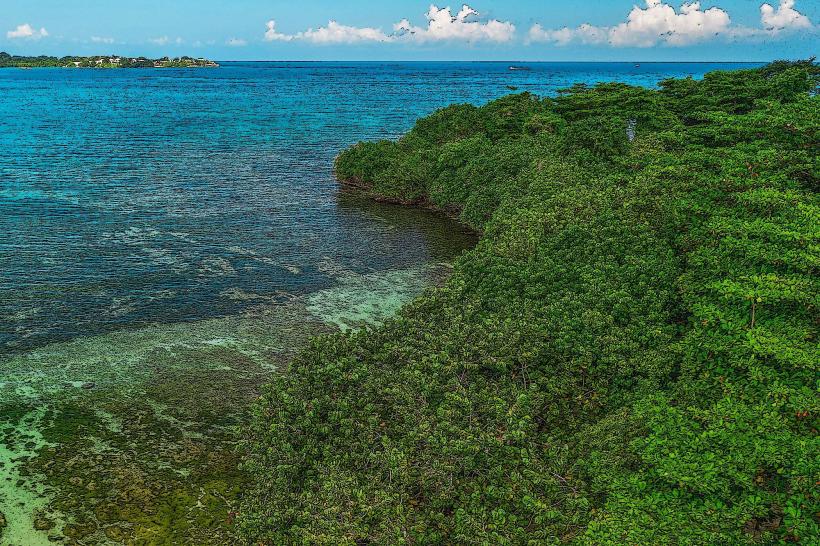
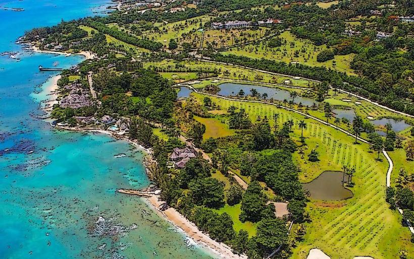
Negril is a major resort town on the westernmost tip of Jamaica, renowned for its coastal geography that combines low-lying coral beaches with elevated limestone cliffs. Originally a remote fishing village, it evolved into a counterculture destination in the 1960s before becoming a pillar of the Jamaican tourism industry.
Historical Timeline
Negril was originally inhabited by the Taino people and later named "Negrillo" (Little Black Ones) by the Spanish in 1494, likely referencing the black eels or the dark cliffs of the West End. It served as a naval base for the British during the 1814 Battle of New Orleans. The most significant architectural reconstruction is currently ongoing following Hurricane Melissa in late 2025, which caused infrastructure damage across western Jamaica. The primary event shaping the current urban form was the 1959 paving of the road from Montego Bay, which ended the town's geographic isolation.
Demographics & Population
The permanent resident population is approximately 7,000. The demographic profile is primarily Afro-Jamaican. Unlike Kingston, Negril has a high density of long-term expatriates from Europe and North America who own and operate boutique hotels. The median age is approximately 29 years.
Urban Layout & Key Districts
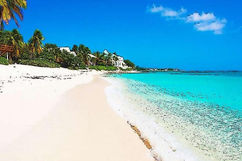
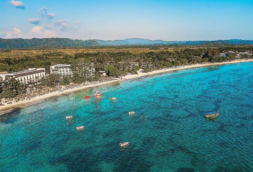
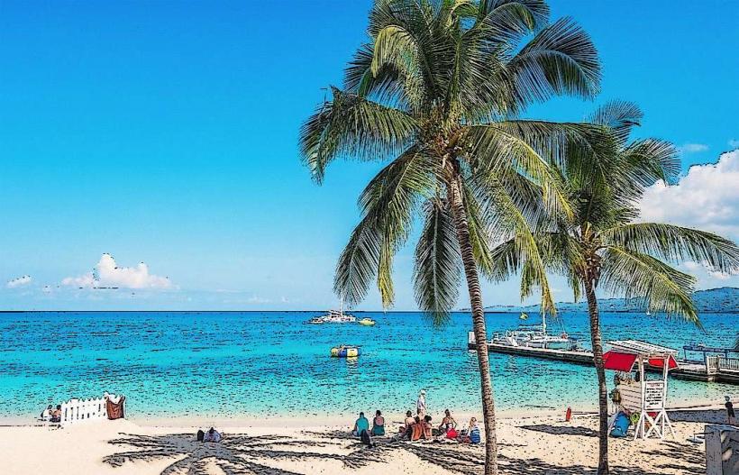
Negril is defined by two distinct geological zones separated by the South Negril River. The 2 most important districts are Seven Mile Beach (a 6.4 km stretch of white sand and all-inclusive resorts, located North) and the West End (a rugged limestone cliff area with boutique lodges and "boho" vibes, located South).
Top City Landmarks
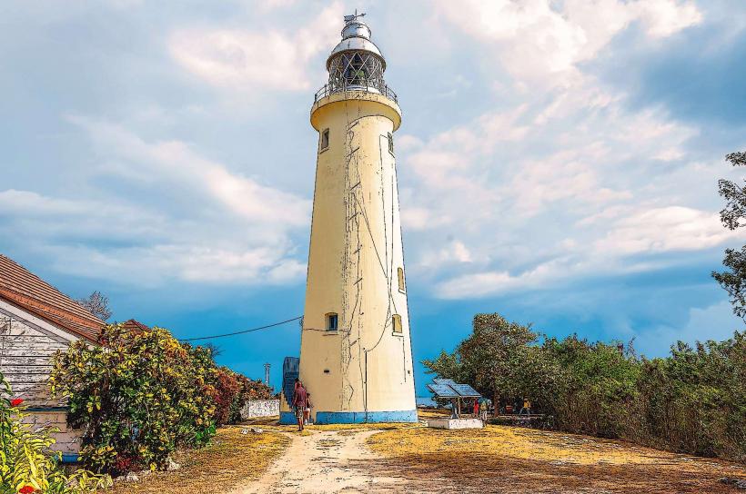
Negril Lighthouse (1894)
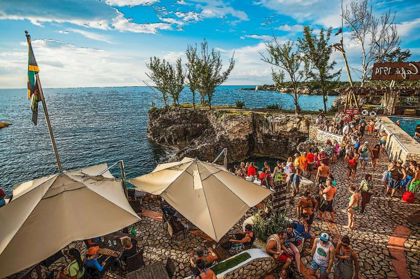
Rick’s Café (Famous for cliff jumping)
Seven Mile Beach (Long Bay)
Bloody Bay (To the north of the main beach)
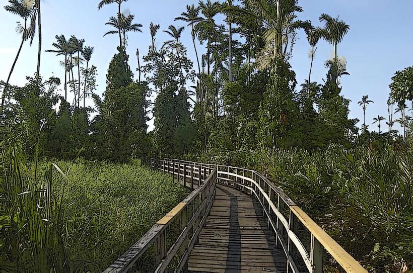
Royal Palm Reserve (Wetlands)
Transportation Network
Movement is dominated by Route Taxis (identifiable by red license plates), which are the most cost-effective method of travel between the Beach and West End. There is no metro or rail system. Private charter taxis (JUTA/JCAL) are available but significantly more expensive. For the Beach road (Norman Manley Blvd), the standard fare is approximately 200 JMD ($1.30 USD). Traffic density is moderate but can slow down near the "Roundabout" (the town center) during peak evening hours when tourists move toward the West End for the sunset.
Safety & "Red Zones"
The general safety level is high within the "Tourist Corridor." However, as of January 2026, visitors are advised to avoid the "Red Ground" and "Whitehall" neighborhoods at night due to localized crime. Common scams include "persistent harassment" from beach vendors and unofficial "tour guides" offering unlicensed excursions. Post-Hurricane Melissa, travelers should confirm that specific cliffside paths and beach access points have been cleared of debris.
Digital & Financial Infrastructure
Internet speeds average 25–60 Mbps; most major resorts utilize fiber-optic lines. Main mobile carriers are Flow and Digicel. Card acceptance is high in hotels and "Hip Strip" restaurants, but cash (JMD/USD) is mandatory for route taxis and roadside jerk stands. ATMs are concentrated in the town center at Scotiabank and NCB.
Climate & Air Quality
Temperatures range from 22°C to 30°C. Air quality is exceptionally high due to the lack of heavy industry and consistent sea breezes. The primary weather risk is the Atlantic hurricane season, and the town is specifically vulnerable to coastal erosion and storm surges.
Culture & Social Norms
Tipping of 10–15% is standard. Social greetings are a requirement for polite interaction; always start a conversation with "Good morning" or "Good afternoon." Dress code is "casual beach"; however, the "no higher than a palm tree" building code (restricting building heights) maintains a low-density, rustic aesthetic compared to Montego Bay.
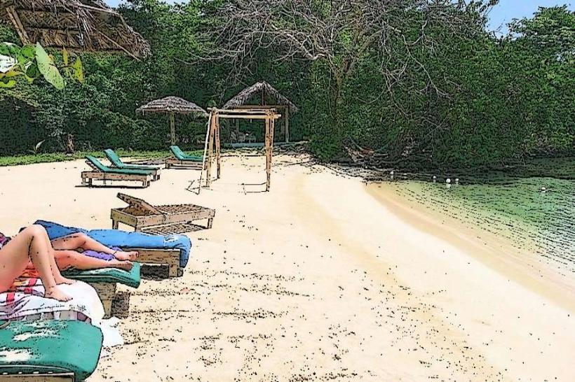
Accommodation Zones
Seven Mile Beach: Stay here for traditional resort amenities and direct access to the sand.
The West End (Cliffs): Stay here for privacy, sunset views, and smaller, eco-conscious boutique hotels.
Local Cost Index
1 Espresso: 550 JMD ($3.50 USD)
1 Standard Lunch (Jerk Pork/Chicken): 1,100 JMD ($7.00 USD)
1 Motor Scooter Rental (per day): 4,600 JMD ($30.00 USD)
Nearby Day Trips
YS Falls: 85 km (1.5–2 hours by car)
Black River Safari: 75 km (1.5 hours by car)
Blue Hole Mineral Spring: 12 km (25 minutes by car)
Mayfield Falls: 35 km (1 hour by car)
Facts & Legends
Negril is famously the "Capital of Casual," a branding that started in the 1970s to distinguish it from the more formal resorts of the North Coast. A local legend involves the "Green Flash," a rare optical phenomenon sometimes seen at sunset on the West End cliffs. A verified historical oddity is that the town was so isolated until the mid-20th century that the only way to reach it was by boat or by traversing the "Great Morass" swampland on foot.