Information
City: PunoCountry: Peru
Continent: South America
Puno, Peru, South America
Puno is a city in southeastern Peru located on the shores of Lake Titicaca, the world’s highest navigable lake. Situated at an elevation of 3,827 m, it is the "Folkloric Capital of Peru," serving as a critical cultural bridge between the Andes of Peru and Bolivia.
Historical Timeline
The region was the ancestral home of the Pukara and Tiwanaku civilizations before being integrated into the Inca Empire. Following the Spanish arrival in the 1600s, Puno became a vital mining hub after the discovery of the Laykakota silver mines. Today, it is the primary gateway for high-altitude lake tourism and a major center for Altiplano agriculture.
Demographics & Population
The population is approximately 135,000. The demographic is a mix of Aymara and Quechua indigenous groups, maintaining one of the highest densities of traditional language speakers in Peru. The economy is driven by tourism, trout farming, and the trade of alpaca wool.
Urban Layout & Key Districts
Historic Core: Centered on the Plaza de Armas and the pedestrian street Jr. Lima, where most tourism services are located.
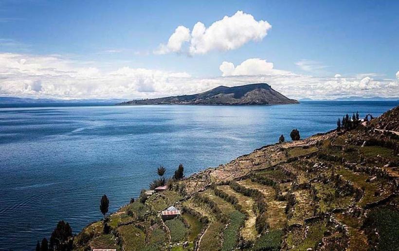
The Port (Puerto de Puno): The departure point for all lake excursions to the Uros, Amantaní, and Taquile islands.
Huajsapata: A hilltop district featuring a natural lookout point over the city and the lake.
Top Landmarks
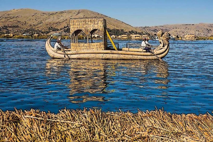
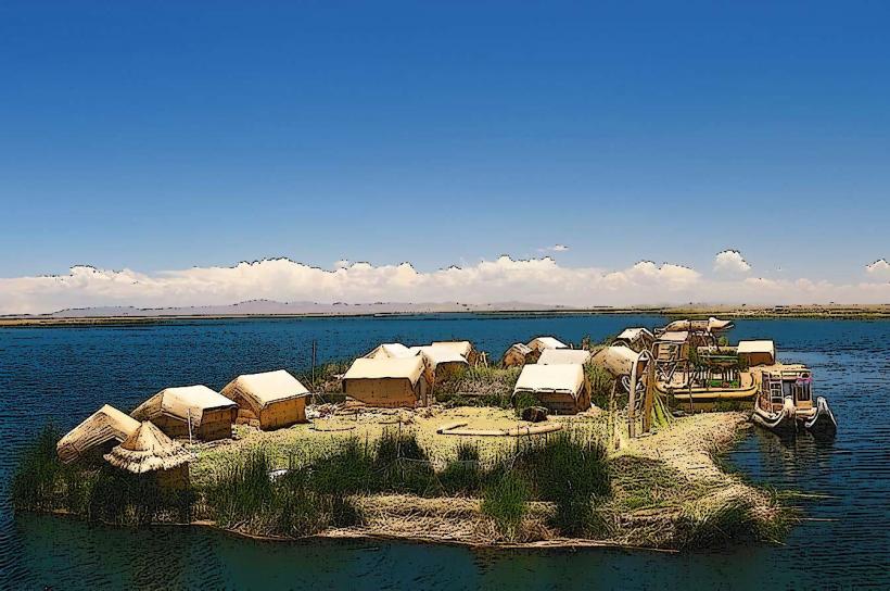
Uros Floating Islands: Man-made islands constructed entirely from Totora reeds by the Uru people.
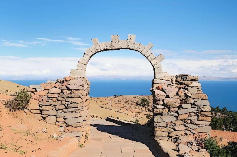
Taquile Island: A UNESCO-recognized site famous for its "knitting men" and high-quality textile traditions.
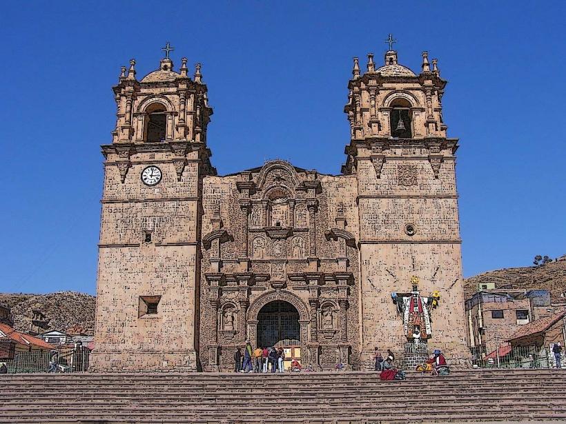
Puno Cathedral: A 17th-century Baroque-Mestizo structure with a stone facade featuring indigenous floral and faunal carvings.
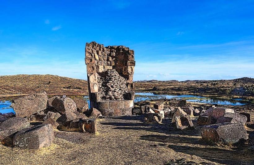
Sillustani: Located 34 km from Puno; a pre-Incan cemetery featuring Chullpas (massive stone funerary towers) overlooking Lake Umayo.
Yavari: A Victorian-era steamship built in England and carried in pieces across the Andes, now a museum moored at the lakefront.
Transportation Network
Air: Inca Manco Cápac International Airport (JUL) is located in the nearby city of Juliaca (45 km away).
Rail: The Belmond Andean Explorer and PeruRail Titicaca provide luxury rail links to Cusco and Arequipa.
Road: Puno is a major stop on the route between Cusco and La Paz, Bolivia.
Water: Motorized launches and traditional reed boats are the primary means of lake transport.
Safety & Health
Altitude: At 3,827 m, altitude sickness is a significant risk. Visitors are advised to avoid alcohol and heavy meals for the first 48 hours.
Temperature: The high-altitude Altiplano climate means nights are consistently near or below freezing, even when days are sunny.
UV Radiation: Atmospheric protection is thin; high-SPF sunscreen is mandatory to prevent severe burns.
Digital & Financial Infrastructure
4G coverage is stable in the city center and on the main islands near the shore. The currency is the Peruvian Sol (PEN). ATMs are found primarily on Jr. Lima. Contactless payment is limited to high-end hotels and restaurants; the port and island communities operate strictly on cash.
Climate & Air Quality
Highland Altiplano climate: dry and cold. The rainy season occurs from December to March. Air quality is excellent, though the air is physically "thin" with lower oxygen saturation.
Culture & Social Norms
Festivals: The Festividad de la Candelaria in February is one of the largest cultural events in South America, featuring thousands of dancers in elaborate masks.
Island Etiquette: When visiting Taquile or Amantaní, it is customary to bring small gifts (coca leaves, school supplies) for host families.
Cuisine: Specialized in Fried Trout (Trucha Frita) from the lake and Alpaca Anticuchos.
Local Cost Index (PEN)
1 Day Tour (Uros & Taquile): S/ 60.00–S/ 100.00
1 Homestay Night (Amantaní): S/ 40.00–S/ 60.00 (includes meals)
1 Taxi (City Center to Port): S/ 5.00–S/ 8.00
Facts & Legends
Legend says that Manco Cápac and Mama Ocllo, the founders of the Inca Empire, emerged from the waters of Lake Titicaca. A geographic fact: Lake Titicaca is so large ($8,372$ km²) that it creates its own microclimate, allowing for agriculture that would otherwise be impossible at this altitude. Historically, Puno was a focal point of the 1780 Túpac Amaru II rebellion against Spanish colonial rule.