Information
City: Quang NamCountry: Vietnam
Continent: Asia
Quang Nam, Vietnam, Asia
Quang Nam serves as a critical cultural and economic pillar of Central Vietnam, housing two UNESCO World Heritage sites and the Chu Lai Open Economic Zone. It is strategically positioned in the South Central Coast region, bordered by Da Nang to the north and the nation of Laos to the west.
Historical Timeline
The region was the heart of the Champa Kingdom (4th–15th century) before being annexed by Dai Viet in 1471. It functioned as a premier international trading port during the 16th and 17th centuries. Significant political and architectural reconstruction followed the heavy destruction of the Vietnam War, particularly after 1975. The primary event shaping the current urban form was the 1999 UNESCO designation of Hoi An and My Son, which transitioned the province from an agrarian economy to a global tourism and industrial hub.
Demographics & Population
The provincial population is approximately 1.52 million. The demographic is predominantly Kinh (over 90%), with significant indigenous Co Tu, Xe Dang, and Gie Trieng ethnic groups residing in the western highlands. The median age is approximately 32.8 years.
Urban Layout & Key Districts
The province is organized between the eastern coastal plains and the western Truong Son mountains. Tam Ky (South) is the administrative capital and political center. Hoi An (North) is the primary cultural and tourism district located on the north bank of the Thu Bon River. Dien Ban (Northwest) serves as the industrial corridor connecting to Da Nang.
Top City Landmarks
Hoi An Ancient Town (UNESCO Site)
My Son Sanctuary (Champa ruins)
Japanese Covered Bridge (Chùa Cầu)
Tam Thanh Mural Village
Fujian Assembly Hall (Phuc Kien)
Transportation Network
Movement within the province relies on an extensive network of local buses and private transport; there is no metro or tram system. Grab (Car/Bike) is highly reliable in Hoi An and Tam Ky. Official taxis are green (Mai Linh) or white/orange (Faifoo). Traffic density is moderate in urban centers but low on the coastal highways, while the North-South Railway services the Tam Ky station.
Safety & "Red Zones"
Quang Nam is characterized by a very high safety level for travelers. There are no specific "red zones" to avoid at night. Common scams are localized to Hoi An, involving tailored clothing "commission" schemes and inflated prices for lanterns or boat rides during the Full Moon Festival.
Digital & Financial Infrastructure
Average internet speed is 68 Mbps. Main mobile carriers are Viettel, Vinaphone, and Mobifone. Card acceptance is high in Hoi An’s tourist zones and Tam Ky’s hotels but remains low in rural districts and local markets. ATMs are abundant in the major urban wards of Hoi An and Tam Ky.
Climate & Air Quality
Temperatures range from 19°C to 24°C in winter and 25°C to 34°C in summer. Air quality is generally high due to coastal winds. Specific weather risks include severe flooding and typhoon landfalls during the peak rainy season from September to December.
Culture & Social Norms
Tipping is not mandatory but 20,000–50,000 VND is appreciated for tour guides and spa staff. Handshakes are the standard greeting for men, while a slight bow of the head is used for elders. Dress code is conservative; shoulders and knees must be covered at My Son and all pagodas. Smoking is prohibited in the pedestrianized zones of the Hoi An Ancient Town.
Accommodation Zones
Cam Chau (Hoi An): Recommended for a quiet stay surrounded by rice paddies while remaining within cycling distance of the center.
Minh An (Hoi An): Recommended for immediate walking access to historical sites and the night market.
Local Cost Index
1 Espresso (Traditional coffee): 35,000 VND ($1.45)
1 Standard Lunch (Cao Lau or Chicken Rice): 65,000 VND ($2.70)
1 Bus Ticket (Tam Ky to Hoi An): 20,000 VND ($0.83)
Nearby Day Trips
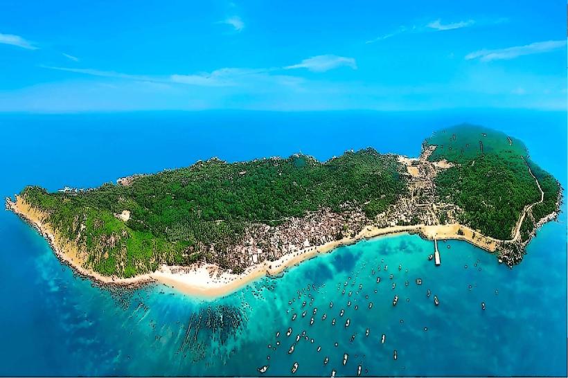
Cham Islands (Cu Lao Cham): 15 km offshore (20 minutes by speedboat)
Da Nang City: 30 km (45 minutes)
Marble Mountains: 20 km (30 minutes)
Ba Na Hills: 60 km (1.5 hours)
Facts & Legends
A prominent local legend surrounds the Japanese Covered Bridge, built in the 1590s. It was allegedly constructed to pin down the "Mamazu," a giant world-spanning monster whose head was in India, body in Vietnam, and tail in Japan. Local lore suggests the bridge acts as a sword piercing the monster's back, preventing its movements from causing earthquakes and floods in the region.