Information
City: Quang NgaiCountry: Vietnam
Continent: Asia
Quang Ngai, Vietnam, Asia
Quang Ngai serves as a vital industrial gateway in Central Vietnam, housing the Dung Quat Economic Zone and the nation's first oil refinery. It is situated on the South Central Coast, approximately 880 km north of Ho Chi Minh City and 130 km south of Da Nang, positioned on the southern bank of the Tra Khuc River.
Historical Timeline
The city's history is rooted in the ancient Sa Huynh culture, followed by the Champa Kingdom, before being integrated into Dai Viet in 1471. Primary eras of governance include the Nguyen Dynasty (19th century), French Colonialism (1883–1945), and the post-war Socialist period. Significant architectural reconstruction occurred after 1975 and again following its re-establishment as a provincial capital in 1989. The primary event shaping its current urban form was the 2005 opening of the Dung Quat refinery, which transitioned the city from an agricultural town to an industrial hub.
Demographics & Population
The city population is approximately 260,000, while the provincial population exceeds 1.24 million. The demographic profile is dominated by the Kinh ethnic group (88.8%), with significant minority populations of Hre (8.6%), Cor (1.8%), and Ca Dong (0.7%). The median age of the population is 32.2 years.
Urban Layout & Key Districts
The city is organized along the Tra Khuc River and National Highway 1A. Nghia Chanh (South) is the primary commercial and transport hub housing the central bus station. Nguyen Nghiem (Central) serves as the administrative core. Tinh Khe (East) is the coastal district containing the city's historical sites and beach access.
Top City Landmarks
Son My Memorial (My Lai Massacre site)
Thien An Mountain and Pagoda
Chau Sa Ancient Citadel (Cham ruins)
Tra Khuc River Bridge
Minh Duc Pagoda (Tallest Guanyin statue in Vietnam)
Transportation Network
Movement within the city relies on private motorbikes and local bus lines, including the specific route to Sa Ky Port. Grab (car and bike) is operational and reliable. Official taxis include Mai Linh (green) and Sun Taxi (white with orange decals). Traffic density is moderate compared to larger hubs, though National Highway 1A sees high industrial freight volume.
Safety & "Red Zones"
Quang Ngai is categorized as highly safe for visitors. There are no designated "red zones" or neighborhoods to avoid. Scams are infrequent, typically limited to minor price inflation at local seafood markets in Tinh Khe. Visitors should exercise caution regarding road safety on the 1A Highway due to heavy truck traffic.
Digital & Financial Infrastructure
Average internet speed is 65 Mbps. Main mobile carriers are Viettel, Vinaphone, and Mobifone. Card acceptance is high in modern hotels and the Vincom Plaza mall but low in local restaurants. ATMs are densely clustered in the Nghia Chanh and Nguyen Nghiem wards.
Climate & Air Quality
Temperatures range from 19°C to 24°C in winter and 28°C to 35°C in summer. Air quality is generally high, though localized smog occurs near the industrial zones in the north. The rainy season runs from September to December, presenting a high risk of river flooding and typhoons.
Culture & Social Norms
Tipping is not traditional but 20,000–50,000 VND is appreciated for service staff. Handshakes are the standard greeting; a slight head nod is used for elders. Dress code is conservative; shoulders and knees must be covered at Thien An Pagoda. Public alcohol consumption is common in "Quan Nhau" (drinking dens) along the river.
Accommodation Zones
Nghia Chanh Ward: Recommended for transit logistics and proximity to the railway and bus stations.
Tinh Khe District: Recommended for quiet coastal access and proximity to historical memorial sites.
Local Cost Index
1 Espresso (Traditional coffee): 25,000 VND ($1.05)
1 Standard Lunch (Don or Goby fish): 55,000 VND ($2.30)
1 Local Bus Ticket: 12,000 VND ($0.50)
Nearby Day Trips
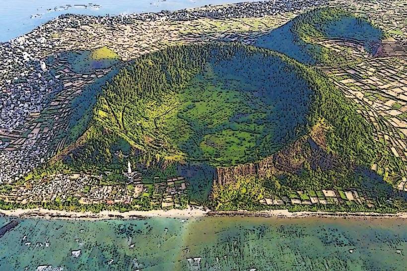
Ly Son Island: 30 km to port + 1 hour ferry
My Lai Memorial: 12 km (20 minutes)
Sa Huynh Salt Fields: 60 km (1 hour)
Thac Trang (White Waterfall): 50 km (1 hour 15 minutes)
Facts & Legends
A local legend surrounds the Tra Khuc River, regarding the "Co Cong" (Giant Water Wheels). Historically, the river was famous for a complex system of massive bamboo water wheels used for irrigation, which became a symbol of the city's ingenuity. An urban legend persists that the Thien An Mountain is the "Seal of the Province," and its pagoda guards a "deep-well" that connects directly to the Tra Khuc River, never running dry even in the most severe droughts.