Information
City: QuetzaltenangoCountry: Guatemala
Continent: North America
Quetzaltenango, Guatemala, North America
Quetzaltenango, also known by its K'iche' Mayan name Xela, is the second-largest city in Guatemala and the primary administrative and commercial hub of the western highlands. It is situated in a high-altitude valley at 2,330 meters above sea level, serving as a center for the textile industry, agricultural trade, and Spanish-language education.
Historical Timeline
The city was founded by the Spanish in 1524 on the site of the indigenous settlement Xelajú. Its primary era of governance occurred in the late 19th century when it served as the capital of the State of Los Altos, a short-lived sixth state within the Federal Republic of Central America. The most significant architectural reconstruction followed the 1902 Santa María volcanic eruption and earthquake, which destroyed much of the city. This event prompted a rebuilding in the neoclassical style, which defines the current urban form of the historic center.
Demographics & Population
The city has a population of approximately 225,000, while the metropolitan area exceeds 600,000. The demographics are notably diverse, consisting of K'iche' Maya (50%), Ladino (45%), and a small international community (5%). The median age is approximately 25.8 years.
Urban Layout & Key Districts
The city is organized into 12 Zones, with the most critical activity concentrated in the central highland basin.
Zone 1 (Centro Histórico): The neoclassical core centered on Parque Centro América.
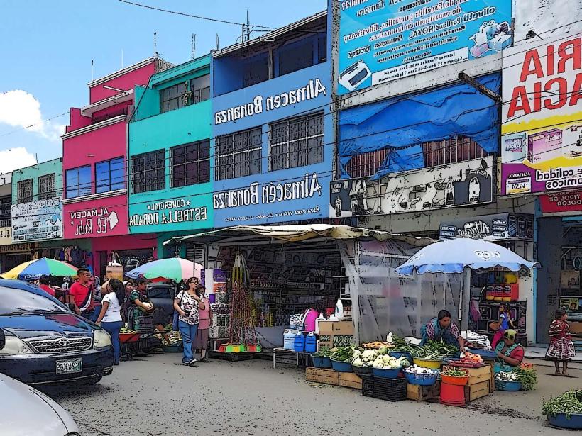
Zone 3 (La Democracia): The primary commercial district, containing the largest traditional market and the Minerva bus terminal.
Zone 7 & 8: Rapidly expanding residential and industrial areas to the west.
Zone 9: A developing modern sector featuring newer shopping centers and medical facilities.
Top City Landmarks
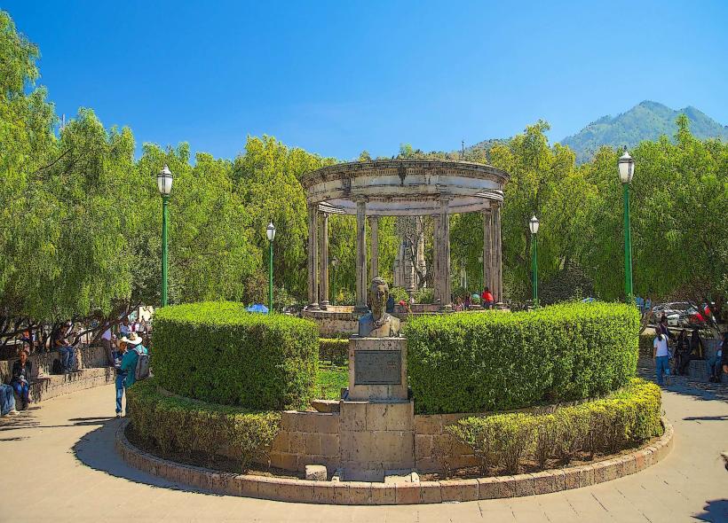
Parque Centro América: A massive neoclassical plaza flanked by monumental buildings.
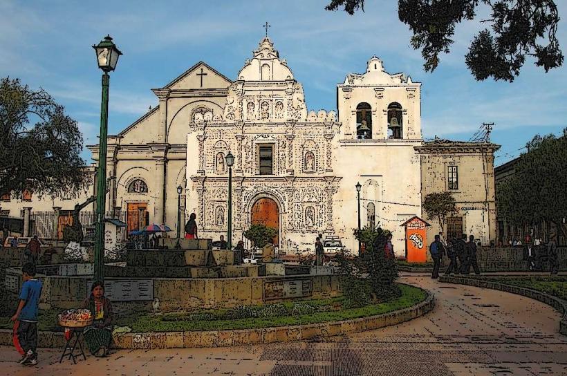
Catedral del Espíritu Santo: Features a preserved 16th-century colonial facade in front of a modern 20th-century structure.
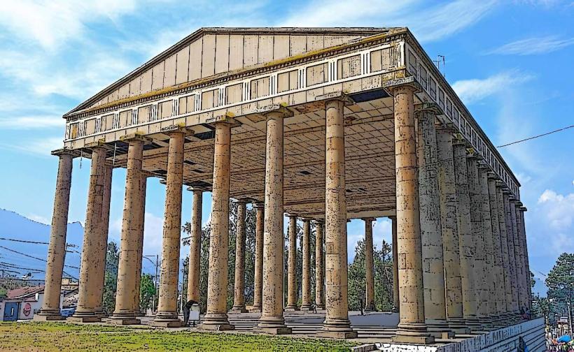
Teatro Municipal: A premier example of neoclassical architecture and the city's cultural heart.
Pasaje Enríquez: A stone-arched commercial gallery dating to 1900.
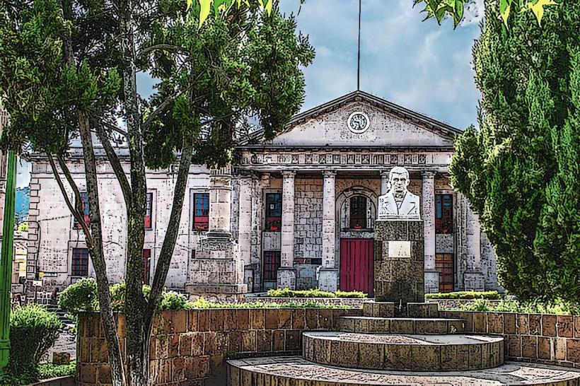
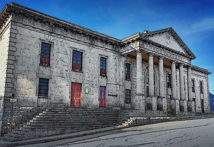
Municipalidad (City Hall): A grand stone edifice with distinctive Corintian columns.
Transportation Network
Public transit consists of microbuses (minivans) and larger buses that follow specific routes between zones. There is no metro or BRT system. For visitors, Uber is operational and safer than red city buses. Short-distance transit within the center is often done via tuk-tuks. Traffic density is high, particularly around the "Las Rosas" and "Marimba" intersections during peak morning and evening hours.
Safety & "Red Zones"
The general safety level is moderate. Explicit "Red Zones" to avoid include Zone 2 and the areas surrounding the Minerva Market/Terminal after dark. Common scams include overcharging at the bus terminal and opportunistic pickpocketing in crowded markets. Walking in Zone 1 is generally safe during the day, but use vehicle transport for inter-zone movement at night.
Digital & Financial Infrastructure
Average internet speed is 40 Mbps. Main mobile carriers are Tigo and Claro. Card acceptance is high in Zone 1 hotels and restaurants, but the city remains cash-heavy, especially in Zone 3 markets. ATMs (5B and BI) are ubiquitous around the central park and in the Pradera Xela mall.
Climate & Air Quality
Quetzaltenango has a cold highland climate. Temperatures range from 2°C (night) to 22°C (day). During the dry season (November–February), nighttime temperatures frequently drop below freezing. Air quality is moderate but can be poor near the bus terminal and main arteries due to unregulated diesel emissions and the valley's geography trapping pollutants.
Culture & Social Norms
Tipping of 10% is standard in restaurants. Greetings are formal and essential; an audible "Buenos días" is required when entering small establishments. Dress code is conservative; due to the cold, locals wear heavy woolens (ponchos), and visitors should avoid wearing shorts or revealing clothing. Public behavior is more reserved compared to the tropical coast.
Accommodation Zones
Zone 1 (Centro Histórico): Best for architectural interest, walking access to language schools, and dining.
Zone 9/Pradera: Best for modern hotel amenities and proximity to larger shopping centers.
Local Cost Index
1 Espresso: Q18.00 ($2.30)
1 Standard Lunch (Menu del Día): Q35.00 ($4.50)
1 Tuk-Tuk Trip: Q10.00 ($1.30)
Nearby Day Trips
Fuentes Georginas: 25 km (Hot sulfur springs in a cloud forest).
Lake Atitlán (Panajachel): 80 km (2.5 hours via the Inter-American Highway).
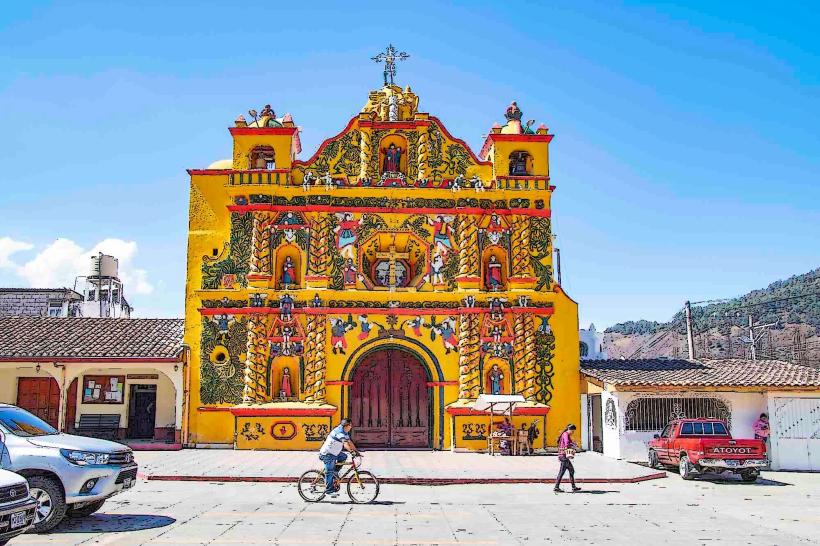
San Andrés Xecul: 15 km (Home to a world-famous bright yellow church).
Santa María Volcano: 10 km to trailhead (Challenging high-altitude hike).
Facts & Legends
A prominent local legend is that of Tecún Umán, the K'iche' prince who was killed by Pedro de Alvarado; it is said a Quetzal bird landed on his chest, staining its breast red with his blood. A verified historical oddity: the city’s Cemetery (Cementerio General) contains the grave of Gypsy woman Vanushka, which has become a shrine for those seeking luck in love. Urban legends also speak of the "Tunnel of the State of Los Altos," a supposed secret passage used by 19th-century rebels to move between government buildings.