Information
City: QuiriguaCountry: Guatemala
Continent: North America
Quirigua, Guatemala, North America
Quiriguá is an ancient Maya archaeological site and UNESCO World Heritage destination in the Izabal Department. It is situated in the lower Motagua River valley, functioning as a critical historical link between the Maya highlands and the Caribbean coast.
Historical Timeline
The city was founded in the late 2nd century AD, initially as a vassal state of the larger city-state Copán. The primary era of governance and regional dominance began in 738 AD, when the Quiriguá ruler K'ak' Tiliw Chan Yopaat captured and beheaded the king of Copán, securing the city's independence and control over the lucrative Motagua River jade and obsidian trade routes. The most significant modern reconstruction followed the site's rediscovery by Frederick Catherwood in 1840. The 738 AD military victory is the primary event that enabled the construction of the city's monumental Great Plaza and its record-breaking stelae.
Demographics & Population
The archaeological site is uninhabited. The nearby modern village of Quiriguá has a population of approximately 3,500. The demographics are predominantly Mestizo (92%) and Q'eqchi' Maya (6%). The median age in the surrounding agricultural region is 22.8 years.
Urban Layout & Key Districts
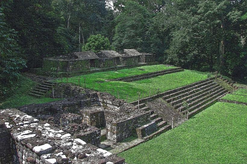
The ancient site is organized into three main architectural groups.
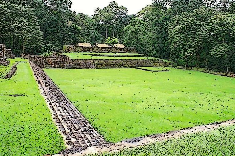
The Great Plaza: An expansive public space containing the largest collection of monolithic monuments in the Maya world.
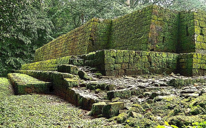
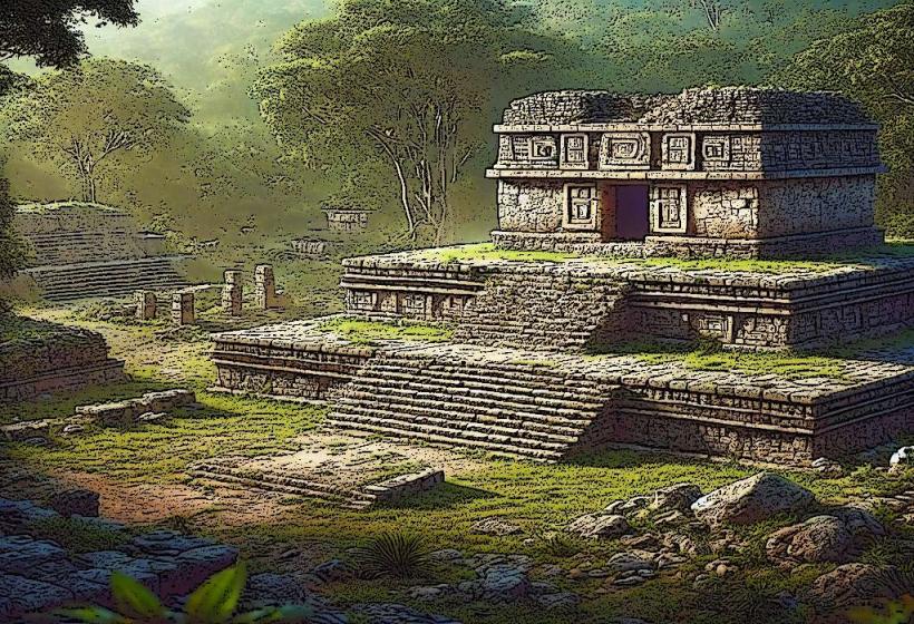
The Acropolis: The elevated residential and administrative core for the city's elite.
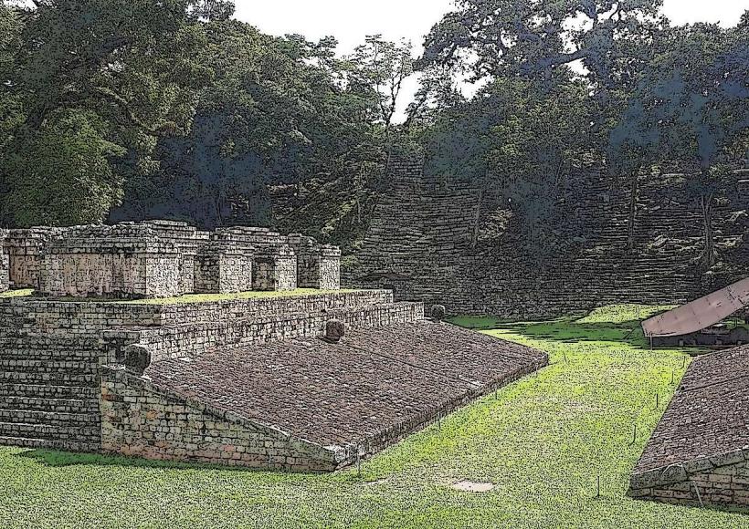
The Ball Court: Located between the Plaza and the Acropolis, used for ritual athletic competition.
Modern Quiriguá: A small roadside town on the CA-13 highway serving as the commercial entry point.
Top City Landmarks
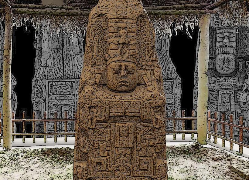
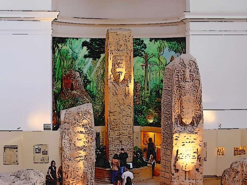
Stela E: The tallest Mayan monolith ever discovered, standing 10.6 meters (35 feet) high and weighing 65 tons.
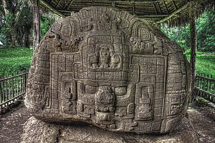
Zoomorph P: A massive, intricately carved boulder representing a cosmic turtle or crocodile.
Stela F: Known for its exceptionally well-preserved hieroglyphic texts detailing the city's history.
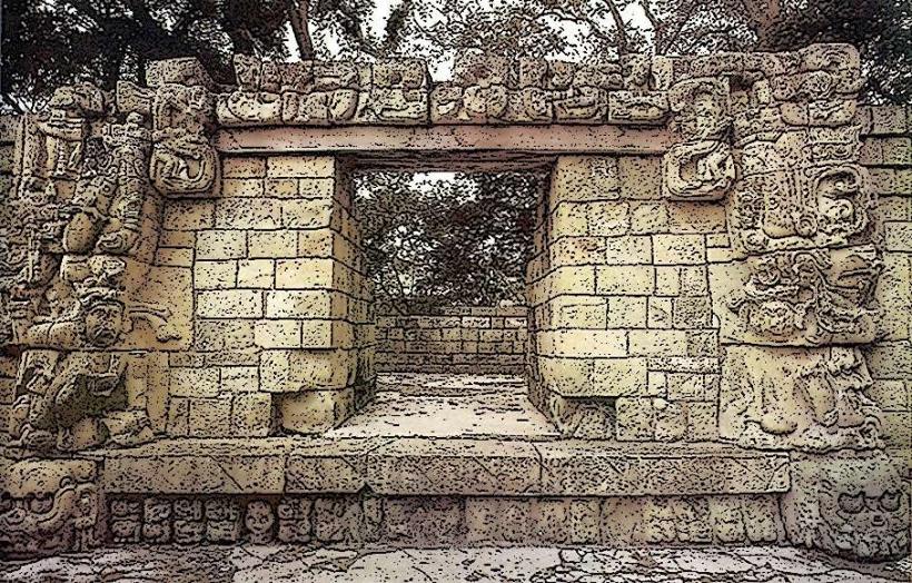
The Acropolis Palace: Featuring rare zoomorphic altars and carved stairways.
Motagua River: The natural boundary and ancient transport artery located adjacent to the ruins.
Transportation Network
Movement within the archaeological park is conducted entirely on foot via groomed gravel paths. There is no internal motorized transit. Inter-city transit is managed by "Litegua" and "Fuente del Norte" buses along the CA-13 highway. To reach the ruins from the highway, visitors utilize tuk-tuks or private taxis. Uber is non-functional in this region. Traffic density is low on the access road but high on the CA-13 Atlantic Highway due to container truck traffic from Puerto Barrios.
Safety & "Red Zones"
The general safety level within the park is high. There are no designated "red zones," but visitors should avoid walking the isolated railway tracks or the CA-13 highway shoulders after dark. Common scams are infrequent but include overcharging for "private tours" at the park entrance; hire only guides with official INGUAT credentials.
Digital & Financial Infrastructure
Average internet speed is 20 Mbps (limited to mobile data and small hotels). Main mobile carriers are Tigo and Claro. Card acceptance is very low; the park entrance and local diners are strictly cash-based. The nearest reliable ATMs (5B and BI) are located in the town of Los Amates, 5 kilometers west.
Climate & Air Quality
The climate is tropical and extremely humid. Temperatures range from 23°C to 36°C. The region experiences high rainfall year-round, with peak intensity from June to October. Air quality is high due to the surrounding banana plantations and rainforest. The primary weather risk involves the flooding of the Motagua River, which has historically buried monuments in silt.
Culture & Social Norms
Tipping is not expected in local diners (comedores) but appreciated for park guides. Standard greetings are "Buenas" or "Hola." Dress code is utilitarian; due to high heat and aggressive mosquitoes, lightweight long trousers and insect repellent are standard. Photography is permitted, but using tripods requires a special permit from the Ministry of Culture.
Accommodation Zones
Los Amates: Recommended for proximity to banks, better dining, and diverse hotel options.
Quiriguá Village: Recommended for budget stays within walking distance or a short tuk-tuk ride to the ruins.
Local Cost Index
1 Espresso: Q15.00 ($1.95) - rare; instant coffee is more common.
1 Standard Lunch (Pollo Frito/Beans): Q40.00 ($5.20)
1 Tuk-Tuk Trip (Highway to Ruins): Q10.00 ($1.30)
Nearby Day Trips
Castillo de San Felipe (Rio Dulce): 75 km (1 hour 15 mins).
Copán Ruinas (Honduras): 160 km (3.5 hours - requires international border crossing).
Puerto Barrios: 90 km (1.5 hours).
Finca El Paraiso (Hot Springs Waterfall): 95 km (2 hours).
Facts & Legends
A verified historical oddity is that the stone used for the massive stelae was quarried 5 kilometers away and transported without the use of the wheel or beasts of burden, likely utilizing the flooding of the Motagua River. A localized legend suggests that the massive Zoomorphs (carved boulders) were once living prehistoric creatures turned to stone by the gods to protect the city's secrets. Modern archaeologists have noted that the site’s rapid abandonment in the 9th century coincided with a massive shift in the river's path, effectively cutting the city off from its economic lifeline.