Information
City: Saint LucyCountry: Barbados
Continent: North America
Saint Lucy, Barbados, North America
Saint Lucy is the northernmost parish of Barbados and the only one named after a female saint. It is a rugged, windswept peninsula defined by towering coral limestone cliffs, deep sea caves, and a traditional, rural way of life.
Historical Timeline
1645: Formed as one of the original six parishes.
18th–19th Century: Became the center of the island’s northern sugar production and whale watching.
1817: Birthplace of Charles Duncan O'Neal, a national hero and founder of the Democratic League, who fought for the rights of the working class.
2025–2026: Continued development of sustainable energy projects, specifically large-scale wind and solar farms taking advantage of the parish’s open plains.
Geography & Climate
Topography: Features a flat interior plateau that ends abruptly in sheer cliffs rising up to 20 meters above the Atlantic.
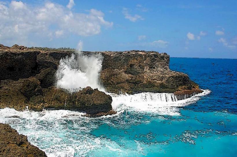
Geology: Contains significant limestone deposits and natural sinkholes that form "blowholes" along the northern coast.
Climate: The parish is exposed to the full force of the Atlantic trade winds, making it significantly cooler and drier than the southern parishes.
Top Landmarks & Attractions
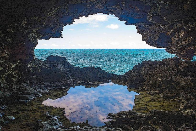
Animal Flower Cave: Located at North Point. This massive sea cave features natural rock pools and sea anemones (locally called "animal flowers"). It offers a unique window-like view of the Atlantic from inside the cliff.
North Point: The northernmost tip of Barbados, where the turbulent Atlantic Ocean meets the Caribbean Sea, creating spectacular crashing waves and spray.
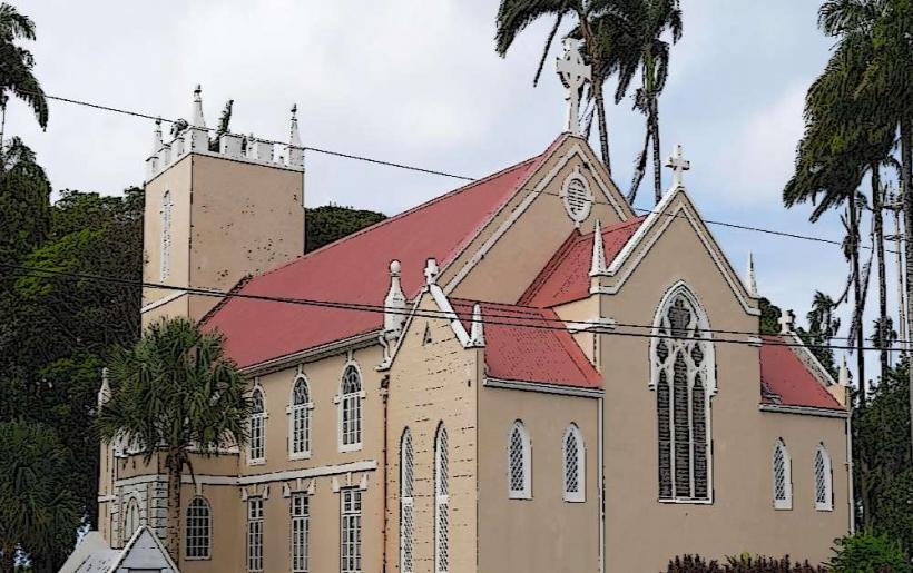
St. Lucy’s Parish Church: Originally built in 1627 and rebuilt in 1837; it is a historic Georgian-style structure that serves as the parish's focal point.
Fustic House: A premier example of a 17th-century plantation house, set within 11 acres of lush parkland, showcasing classic Barbadian colonial architecture.
Little Bay: A secluded beach area where the sea has carved out small natural pools in the rock, allowing for safe dipping despite the surrounding rough surf.
Transportation & Logistics
Road: Accessible primarily via Highway 1C or the Charles Duncan O'Neal Highway. The drive from Bridgetown takes approximately 50–60 minutes.
Public Transport: Served by the "St. Lucy" buses (Route 1C) departing from the Princess Alice Terminal in Bridgetown.
Driving: Roads are generally well-paved but become very narrow and quiet once away from the main settlements.
Safety & Health
Marine Safety: The northern coast is lethal for swimming. The current is extremely strong, and there are no reefs to break the Atlantic swells. Swimming is only safe in the natural rock pools at Little Bay or River Bay during low tide.
Security: This is the least populated parish and is considered very safe. However, secluded coastal areas are remote; it is advised not to visit cliff edges alone or after dark.
Health: The St. Lucy District Hospital and a local polyclinic in the village of Checker Hall provide healthcare for the northern region.
Digital & Financial Infrastructure
4G and 5G coverage is reliable in the main villages like Checker Hall and Nesfield but can be non-existent at the base of the northern cliffs. There are very few ATMs in the parish; the nearest major financial hub is in Speightstown (Saint Peter).
Local Cost Index
1 Entry to Animal Flower Cave: ~$40.00 BBD ($20.00 USD)
1 Lunch at the Cave Restaurant: ~$45.00 – $75.00 BBD ($22.50 – $37.50 USD)
1 Local Rum & Coke (Rural Rum Shop): ~$5.00 BBD ($2.50 USD)
Facts & Legends
A verified geographical fact is that Saint Lucy is the most "oceanic" parish; on exceptionally clear days, the spray from the northern blowholes can be seen from the central highlands of St. Thomas. Local legend tells of the "North Point Light," a phantom lantern said to appear on the cliffs during storms, historically blamed for luring ships toward the jagged rocks of the "Graveyard of the Caribbean."