Information
City: Saint ThomasCountry: Barbados
Continent: North America
Saint Thomas, Barbados, North America
Saint Thomas is a central, landlocked parish of Barbados, often referred to as the "Highlands" of the island. Situated at a higher elevation than the coastal parishes, it is defined by its dramatic limestone caves, deep gullies, and sweeping views of the west coast.
Historical Timeline
1645: Established as one of the original six parishes created by Governor Philip Bell.
17th–19th Century: Dominated by large sugar estates due to the fertile upland soil.
1970s: Transitioned from a purely agricultural region to a hub for eco-tourism following the development of Harrison’s Cave.
2024–2026: Significant expansion of the Warrens commercial district on the parish border, making it a primary economic engine for the island’s interior.
Geography & Climate
Topography: Features the island's most rugged terrain, characterized by the First Ridge and Second Ridge of the coral limestone cap.
Elevation: Reaches approximately 250–300 meters above sea level.
Climate: Notably cooler and wetter than the coast. It receives higher annual rainfall, resulting in lush, tropical vegetation and the presence of rare fern species in the gullies.
Top Landmarks & Attractions
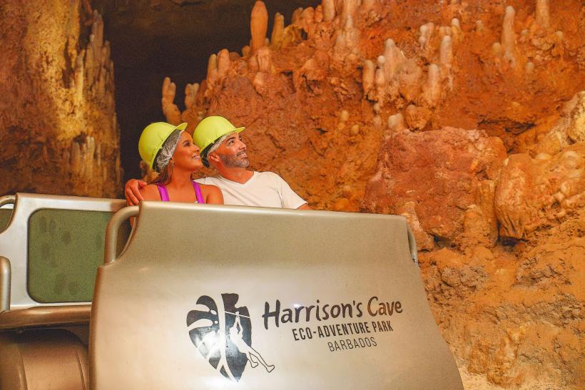
Harrison’s Cave: The island's premier tourist attraction. An underground limestone cavern system featuring active stalactites, stalagmites, and deep emerald pools. Visitors tour the cave via an electric tram.
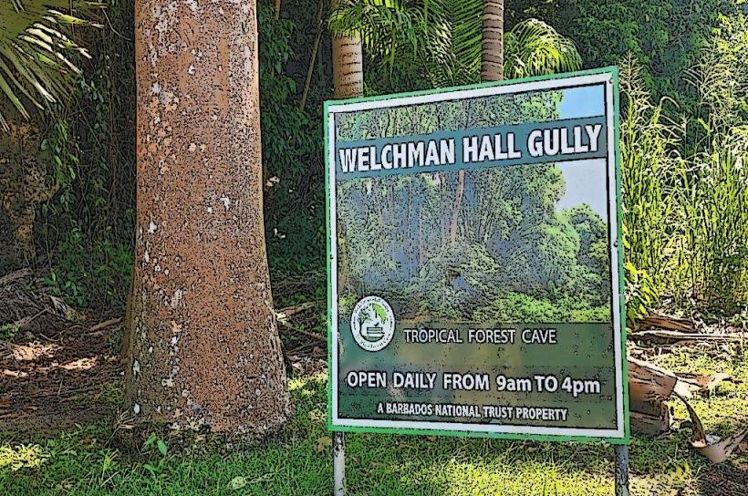
Welchman Hall Gully: A deep, tropical ravine that formed when the roof of a series of caves collapsed. it is home to wild green monkeys and a variety of exotic fruit and spice trees (including nutmeg and clove).
Earthworks Pottery: A world-renowned workshop and gallery where local artisans create hand-finished ceramic ware. It serves as a central hub for the "Potters' Tea Shop."
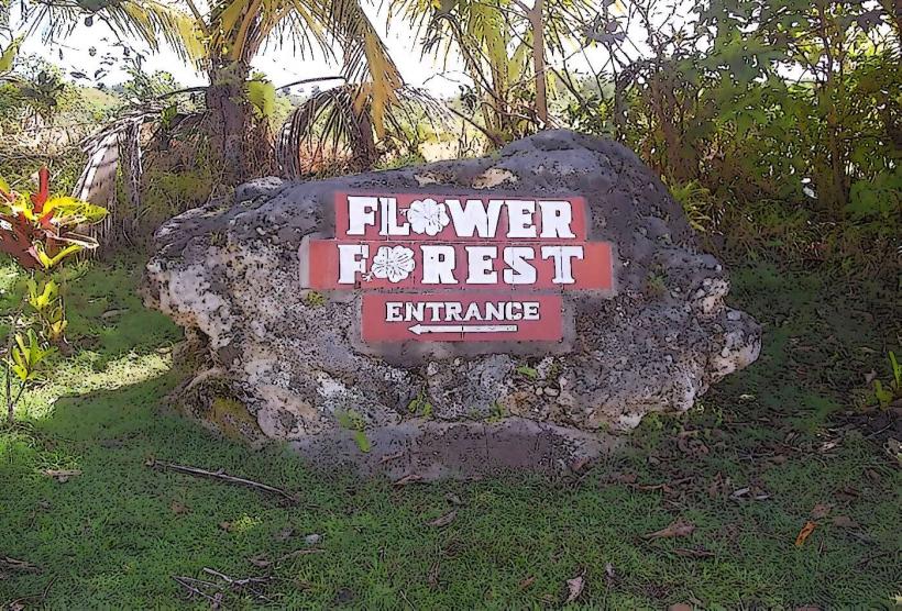
Flower Forest: A 53-acre botanical garden located on a former sugar plantation, offering panoramic views of the Atlantic (East) coast.
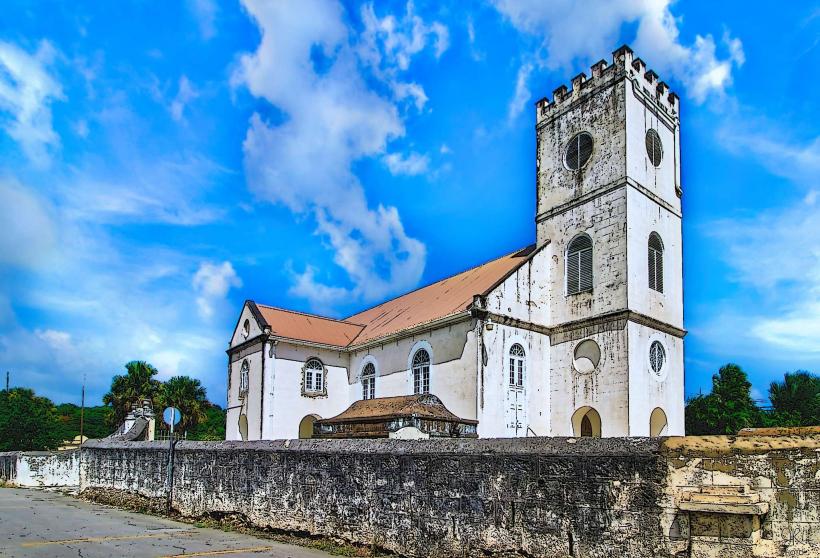
St. Thomas Parish Church: Rebuilt in 1836 after the Great Hurricane of 1831, it features classic Anglican architecture and serves as the geographical heart of the parish.
Transportation & Logistics
Road: Saint Thomas is the central junction for north-south travel. The ABC Highway (Adams-Barrow-Cummins) clips the southern edge of the parish at the Warrens interchange.
Public Transport: Accessible via government buses and "ZR" vans from the Princess Alice Terminal in Bridgetown. The most frequent routes are those heading toward Arch Hall or Sturges.
Driving: Roads are often narrow, winding, and steep. Fog can occur at higher elevations during the rainy season (June–November).
Commercial Hub: Warrens
The southern tip of St. Thomas contains part of Warrens, the island's fastest-growing business district.
Services: Houses the headquarters for major banks, utility companies, and the island’s largest supermarkets (Massy Stores).
Infrastructure: Features modern office complexes and a high density of fast-food outlets and retail centers.
Safety & Health
Safety: Very safe and residential. The main risks are related to driving on narrow, unlit country roads at night.
Health: The Sandy Crest Medical Centre (located in nearby Holetown) or the Queen Elizabeth Hospital (in Bridgetown) are the nearest emergency facilities.
Digital & Financial Infrastructure
4G and 5G coverage is excellent, supported by the high concentration of telecommunications infrastructure in the Warrens area. ATMs are plentiful in the Warrens commercial zone, but rare in the more rural villages like Sturges or Holy Innocents.
Local Cost Index
1 Entry to Harrison’s Cave: ~$60.00 – $100.00 BBD ($30.00 – $50.00 USD)
1 Entry to Welchman Hall Gully: ~$30.00 BBD ($15.00 USD)
1 Hand-painted Earthworks Mug: ~$40.00 – $60.00 BBD ($20.00 – $30.00 USD)
Facts & Legends
A verified botanical fact is that the grapefruit is believed to have originated in the gullies of Barbados (specifically near the St. Thomas/St. George border) as a natural cross between a sweet orange and a pomelo. Local legend tells of "The Sturges Light," a mysterious glowing orb occasionally reported by residents in the deep gullies of the parish, traditionally attributed to spirits guarding buried plantation wealth.