Information
City: TiaretCountry: Algeria
Continent: Africa
Tiaret, Algeria, Africa
Tiaret functions as the primary agricultural and equestrian pivot of the Sersou Plateau in western Algeria. Situated at an elevation of 1,100m, it serves as a specialized node for cereal production, purebred Arabian horse breeding, and Saharan-Mediterranean transit. In January 2026, the city is defined by a state of monumental railway integration, with the finalized Tiaret–Tissemsilt rail link beginning operations to solidify the city's role as a regional logistical hub.
Historical Timeline
761 AD: Founded as Tahert by Abd al-Rahman ibn Rustam; specialized as the capital of the Rustamid Imamate, a cosmopolitan Ibadi theocracy.
909 AD: Destroyed by the Fatimids; the population retreated south to found the M'zab valley (Ghardaïa).
1843: Occupied by French forces; established as a primary military and agricultural center on the High Plateaus.
2025 (Dec 3): Logistics Mobilization. Local authorities instructed project managers to accelerate the Relizane–Tiaret–Tissemsilt rail line to meet 2026 deadlines.
2026 (Jan 17): Sporting Event. The city's primary football club, JSM Tiaret, hosted JS El Biar at the Ahmed Kaid Stadium as part of the Ligue 2 2025/26 season.
2026 (Q1 Forecast): Infrastructure Commissioning. The 63.5 km Tiaret–Tissemsilt railway section is slated for operational delivery, enabling passenger and freight speeds of 160 km/h.
Demographics & Population
The metropolitan population is approximately 195,000 (2026 estimate), with the wider Tiaret Province exceeding 950,000. The demographic is characterized by a specialized agrarian workforce and a significant academic population at the University of Ibn Khaldoun, which specializes in veterinary science and agronomy. In 2026, the city remains a primary node for the "Sersou" tribal identity, blending high-altitude Berber and Arab pastoral traditions.
Urban Layout & Key Districts
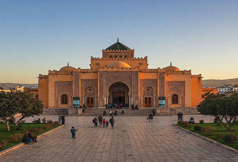
The Citadel (Vieux Tiaret): The specialized historical core built on the site of Roman Tingartia; characterized by steep streets and colonial-era administrative buildings.
Tagdemt: Located 10km west; the specialized site of the ancient Rustamid capital and later a headquarters for Emir Abdelkader during the resistance against France.
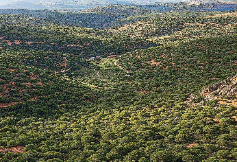
Sersou Plateau: The specialized agricultural hinterland; known as the "Granary of Algeria" due to its high-density wheat and barley cultivation.
Chaouchaoua: A specialized district to the north; home to the National Stud Farm, the largest of its kind in Africa.
The Commercial Strips: Specialized new urban developments along the structuring transit roads; characterized by high-density retail trade and services.
Top City Landmarks
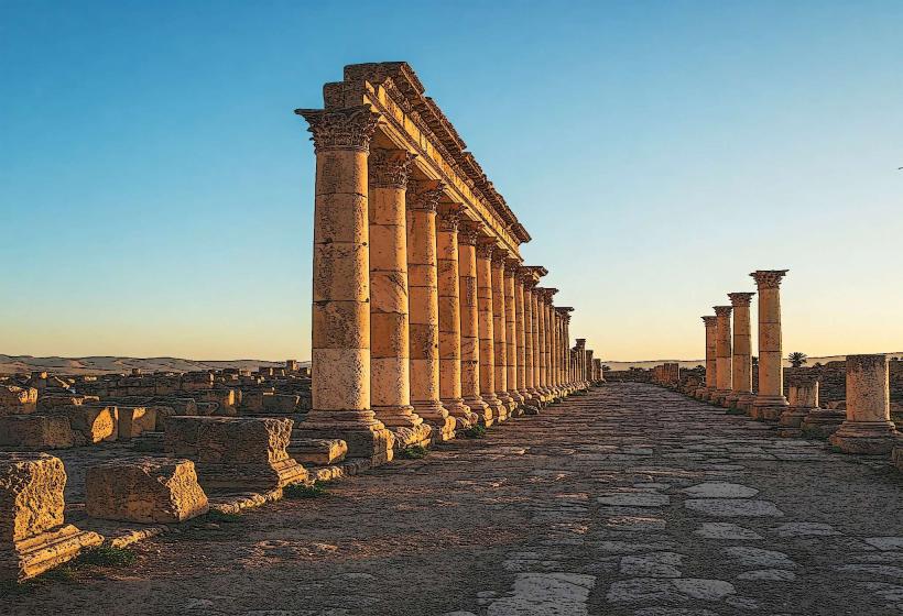
The Djedars: Located 30km southwest; a specialized group of 13 pyramidal stone tombs on square foundations (6th–7th centuries) belonging to Berber princes.
Chaouchaoua National Stud: A specialized equestrian node; globally recognized for its high-fidelity breeding of purebred Arabian and Barbary horses.
Tagdemt Ruins: A specialized archaeological node; the remains of the Ibadi capital that served as an intellectual center for the medieval Maghreb.
Mechra-Sfa: A specialized prehistoric site nearby; features a large concentration of megalithic monuments and carved stones.
The Grotte d'Ibn Khaldoun: Located in Frenda (nearby); the cave where the historian Ibn Khaldoun is believed to have written parts of the Muqaddimah.
Transportation & 2026 Logistics
Tiaret–Tissemsilt Railway: In January 2026, the city is a focal point for the Relizane–Tiaret–Tissemsilt corridor, designed to reduce dependence on road transport and link the High Plateaus to the northern rail spine.
Regional Road N23 & N40: The specialized logistical junctions; Tiaret functions as the primary "station" (from its Berber name Tihert) between the northwest and the deep south.
Bou Chekif Airport (TID): A specialized domestic hub; providing essential technical and administrative links for the wilaya's growing industrial and agricultural sectors.
Urban Mobility: The city’s development in 2026 is prioritized around the "Return to the Street" planning model, emphasizing commercial densification and improved pedestrian flow in central districts.
Safety & Environment
The general safety level is High. Warning: As of January 2026, the city is experiencing -1°C night temperatures and periodic fog, necessitating specialized caution on the mountain passes of the Tell Atlas. Environmental Note: Tiaret is a high-priority node for "Soil Degradation Mitigation," utilizing specialized reforestation programs to protect the Sersou Plateau from intensive agricultural erosion.
Local Cost Index (2026 Estimates)
1 Night (Secure Business/Equestrian Hotel): DZD 6,500 – 11,000 (~$48 – $81)
Traditional "Sersou Wheat" Meal: DZD 500 – 900
Guided Tour of the Djedars: DZD 3,500 – 5,500
Median Monthly Rent (2-BR Apartment): DZD 20,000 – 35,000
1L Gasoline: DZD 45.00
Facts & Legends
Tiaret is the site of the "Legend of the Lioness," as its ancient name Tahart is Berber for "lioness," referring to the predators that once inhabited the surrounding massifs. A verified fact is that Tiaret remains the equestrian capital of North Africa, holding the highest concentration of purebred Arabian registries in the region. Historically, it served as a primary node for the trans-Saharan slave and gold trade under the Rustamids. In 2026, the city remains the specialized global epicenter for "High-Altitude Cereal Resilience," hosting agricultural researchers in January to audit new frost-resistant seed deployments on the Sersou Plateau.