Information
Landmark: Aveiro CanalsCity: Aveiro
Country: Portugal
Continent: Europe
Aveiro Canals, Aveiro, Portugal, Europe
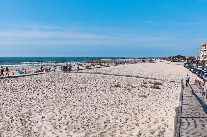
The Aveiro Canals are a network of urban waterways that connect the Ria de Aveiro lagoon to the city center of Aveiro, Portugal. They serve as the primary structural element of the city's coastal landscape, historically facilitating the transport of salt, algae (moliço), and local merchandise.
Visual Characteristics
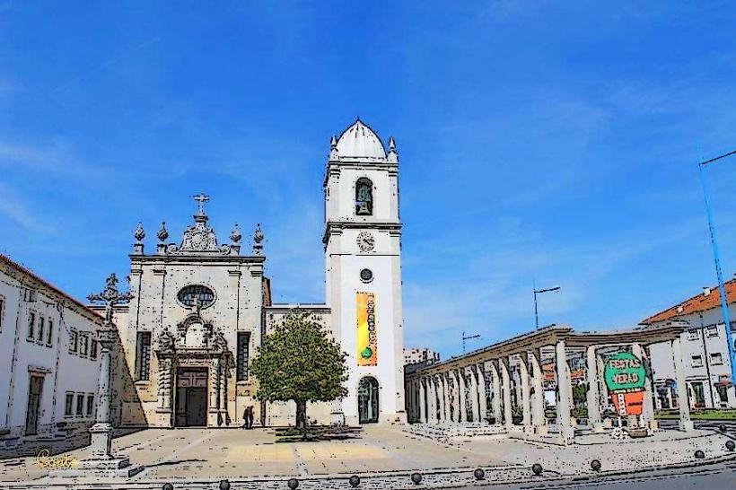
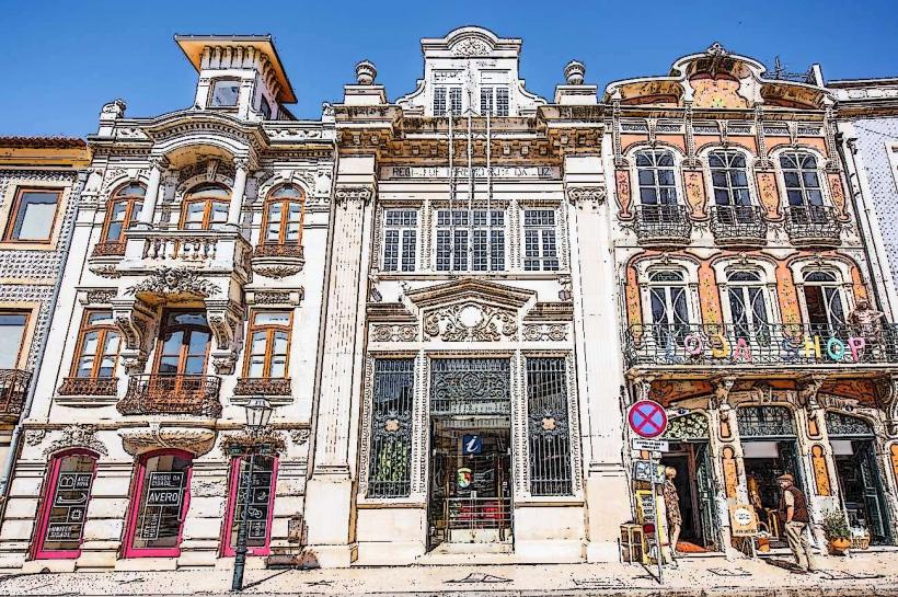
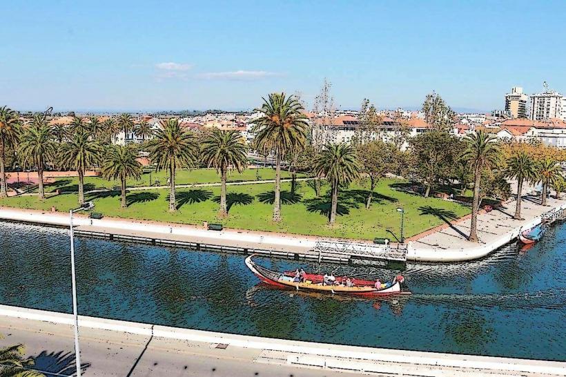
The canals feature green and blue-toned brackish water contained by stone and concrete embankments. They are populated by moliceiros, brightly colored wooden boats with arched prows decorated with folk-art paintings. The architecture bordering the canals is characterized by Art Nouveau facades with elaborate ironwork and colorful tiles, specifically along the Canal Central. Several arched pedestrian bridges, such as the Ponte do Laço, span the waterways.
Location & Access Logistics
The main canal network is centered around the Rossio district and Jardim do Rossio. Aveiro is accessible via the A1 and A25 highways, located 75km south of Porto. The central canal area is a 10-minute walk from the Aveiro Train Station along Avenida Dr. Lourenço Peixinho. Parking is available at the large underground lot in Praça Marquês de Pombal or the open-air lot near the Mercado do Peixe.
Historical & Ecological Origin
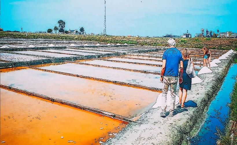
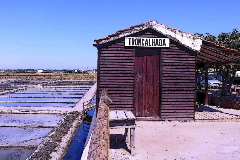
The canals were engineered in the early 19th century to regulate the lagoon's water flow and provide commercial access to the city. Geologically, they are part of the Ria de Aveiro, a complex lagoon system formed in the 16th century when a sandbar closed off the mouth of the Vouga River. The Canal de São Roque, Canal das Pirâmides, and Canal do Cojo are the three main branches that define the city's urban grid.
Key Highlights & Activities
Guided tours on traditional moliceiro boats depart every 15–30 minutes from the docks along Rua João Mendonça. Visitors can walk or cycle the perimeter of the Canal de São Roque to view the historic salt pans (salinas). Kayaking is permitted in specific zones, and the BUGA (Aveiro's free bike sharing system) stations are located near the canal banks for land-based exploration.
Infrastructure & Amenities
The canal-side area is equipped with public benches, trash receptacles, and paved walkways. Public restrooms are located at the Mercado do Peixe and within the Forum Aveiro shopping center adjacent to the Canal do Cojo. 5G cellular signal is consistent throughout the central district. Numerous food vendors, specialized Ovos Moles shops, and restaurants line the canal banks.
Best Time to Visit
The optimal time for photography is during high tide when the water levels are at their peak and reflect the Art Nouveau Buildings. Late afternoon provides the best lighting for the colorful boat prows. The months of May through September offer the driest weather, while the Festa de São Gonçalinho in January features traditional celebrations centered around the canal bridges.
Facts & Legends
A unique local tip is to visit the Ponte dos Laços (Bridge of Ties), where it is a modern tradition for couples to tie colorful ribbons to the railings instead of padlocks. Historically, the moliceiro boats were not tourist vessels but "workhorses" of the lagoon; the humorous and often risqué paintings on their prows were a way for local fishermen to express social and political commentary.
Nearby Landmarks
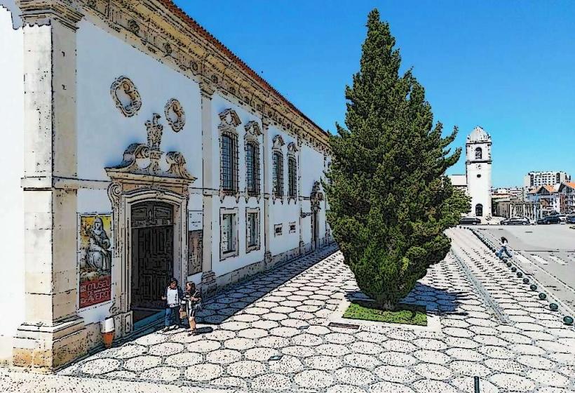
Aveiro Museum (Mosteiro de Jesus) - 0.4km South
Mercado do Peixe (Fish Market) - 0.1km West
Forum Aveiro - 0.2km East
Salinas de Aveiro (Salt Pans) - 0.8km Northwest
Parque Infante D. Pedro - 0.7km South