Information
Landmark: Bois de la HoussièreCity: La Louviere
Country: Belgium
Continent: Europe
Bois de la Houssière, La Louviere, Belgium, Europe
The Bois de la Houssière is a 650-hectare deciduous forest situated on a sandy ridge primarily within the municipality of Braine-le-Comte, approximately 12km north of La Louvière. It represents a significant vestige of the ancient Charcoal Forest (Silva Carbonaria) that once covered much of Middle Belgium.
Visual Characteristics
The terrain is characterized by a prominent sandy ridge reaching an elevation of 160 meters, featuring steep slopes and deep ravines. The forest floor consists of acidic sandy soil, which supports massive stands of European beech and oak. During spring, the ground is covered in dense carpets of bluebells (Hyacinthoides non-scripta). Several abandoned sand quarries have transitioned into humid micro-habitats with unique moss and fern populations.
Location & Access Logistics
The forest is located along the N6 road between Braine-le-Comte and Nivelles.
By Train: The Braine-le-Comte railway station is 2km from the western edge of the forest.
By Car: Use motorway E19, Exit 20 (Houdeng-Gœgnies) or Exit 18 (Nivelles-Sud).
Parking: Multiple free parking areas are situated along the Avenue de la Houssière, including the "Parking de l'Ermitage" and "Parking de la Tour."
Historical & Ecological Origin
The forest sits on Eocene sand deposits (Sables de Bruxelles) formed approximately 50 million years ago. Historically, it was part of the vast forest owned by the Abbey of Nivelles and later served as a vital source of timber and sand for regional construction. It is currently classified as a "Natura 2000" protected site due to its high ecological value and its role as a catchment area for local groundwater.
Key Highlights & Activities
Hiking and Cycling: A network of marked trails includes the "Sentier des Arbres" (Tree Trail) and several mountain bike circuits.
Bluebell Viewing: In late April and early May, the forest is a major site for viewing wild hyacinths.
Geological Observation: The "Sablière du Trieu du Coq" (former sand quarry) provides a visible cross-section of the geological strata.
Jogging: The "Parcours Santé" (Fitness Trail) offers a structured exercise route through the wooded terrain.
Infrastructure & Amenities
Restrooms are not available within the forest interior; facilities are located at nearby establishments like the "Auberge de la Tour." The forest features several designated picnic areas with wooden benches and waste bins. Cellular signal (4G/5G) is generally functional but can be intermittent in deep ravines. There are no food vendors inside the woods, but several restaurants border the Avenue de la Houssière.
Best Time to Visit
The last two weeks of April and the first week of May are optimal for viewing the bluebell bloom. Autumn (late October) provides high-contrast photography of the beech canopy’s orange foliage. Early morning visits are recommended to avoid crowds during the spring flowering season and to observe local roe deer and birds of prey.
Facts & Legends
The forest is notorious in Belgian history as a suspected hideout for the "Gang of Nivelles" (Tueurs du Brabant) during the 1980s; several burned-out getaway cars were discovered in its dense thickets. Local folklore also speaks of the "Ermitage," a site where a religious recluse lived in the 18th century, which remains a landmark within the woods today.
Nearby Landmarks
Braine-le-Comte City Center: 2.5km West
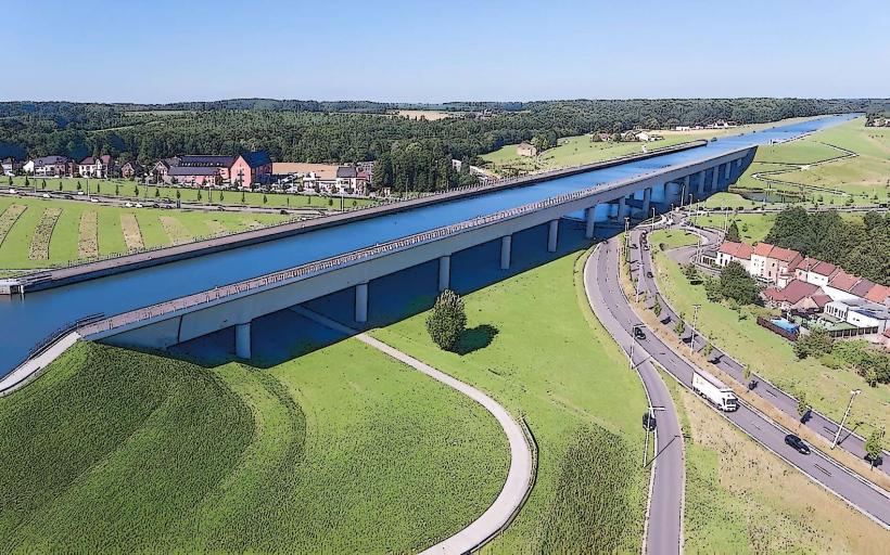
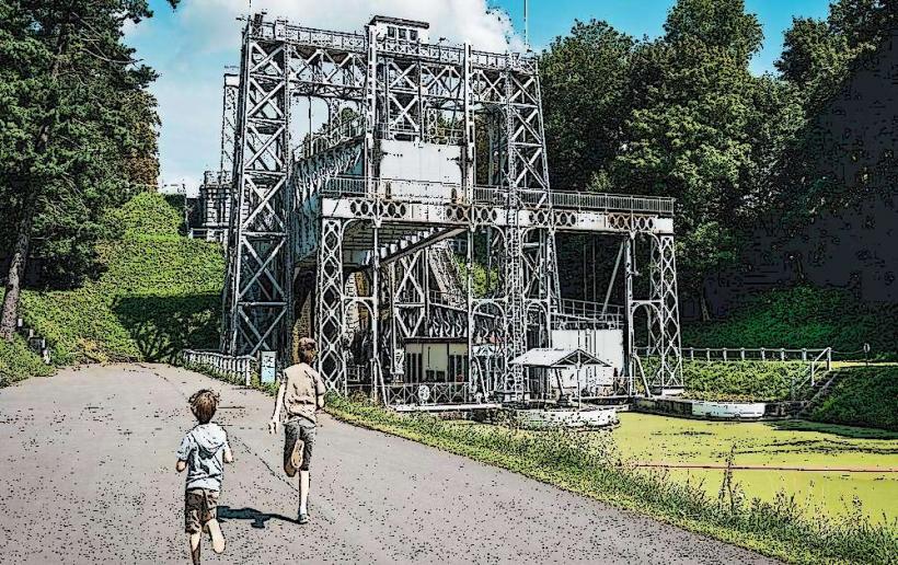
Sloping Lock of Ronquières: 5.0km Northeast
Canal du Centre (Historic Section): 11.5km South
The Domain of Seneffe: 8.5km Southeast
Hallerbos (Bluebell Forest): 15.0km North