Information
Landmark: Gris Gris BeachCity: Souillac
Country: Mauritius
Continent: Africa
Gris Gris Beach, Souillac, Mauritius, Africa
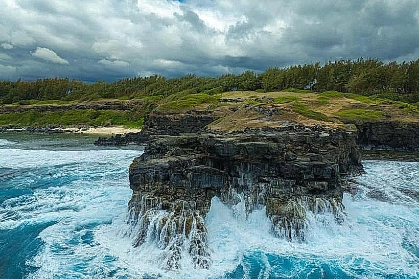
Gris Gris Beach is a coastal landmark located at the southern tip of Mauritius in the village of Souillac. It is defined by its lack of a protective coral reef, allowing the full force of the Indian Ocean to impact the shoreline.
Visual Characteristics
The beach is characterized by high, dark basaltic cliffs and a narrow strip of coarse golden sand. Unlike the turquoise lagoons elsewhere on the island, the water here is deep navy blue with constant white-capped swells. A notable geological feature is "La Roche Qui Pleure" (The Crying Rock), a rock formation where the constant splashing of waves creates the visual effect of tears streaming down the stone face. The surrounding landscape consists of grassy plateaus and wind-sculpted Filao trees.
Location & Access Logistics
The site is located at the terminus of Gris Gris Road in Souillac.
Driving: Access is via the A1 (Southern Main Road) passing through Surinam. A large, paved public parking area is located on the cliff-top directly overlooking the beach.
Public Transport: Buses from Curepipe or Mahébourg stop at the Souillac bus station, followed by a 15-minute walk (approx. 1km) to the viewpoint.
Safety: Swimming is strictly prohibited due to violent currents, large breaking waves, and the absence of a reef.
Historical & Ecological Origin
The beach was named "Gris Gris" by the French cartographer Abbott de la Caille in 1753, reportedly after his pet dog, though local folk etymology suggests the name refers to "grey-grey" or black magic (grigris) due to the site's brooding atmosphere. Geologically, it is a rare section of the Mauritian coastline where the volcanic basalt shelf meets the open sea directly, preventing coral formation.
Key Highlights & Activities
The primary activity is sightseeing from the cliff-top viewpoints. A steep stone staircase leads down to the beach level for shore walking. A well-trodden coastal trail heads east toward "La Roche Qui Pleure," offering panoramic views of the rugged coastline. The site is a popular location for landscape photography, particularly for capturing high-velocity wave impacts against the basalt pillars.
Infrastructure & Amenities
The cliff-top area features several kiosks selling local street food, snacks, and pineapples. There are public restrooms and a few concrete benches under the shade of Filao trees. Cellular signal (4G/5G) is stable. While the upper plateau is accessible, the path down to the beach and the trail to the Crying Rock are uneven and not suitable for wheelchairs.
Best Time to Visit
The beach is most dramatic during the winter months (June to August) when southern swells are strongest. For photography, the late afternoon provides light that illuminates the spray and the basalt cliffs. It is best to visit during high tide to witness the maximum wave action at the Crying Rock.
Facts & Legends
Local legend attributes the name to a "Gris Gris" priestess who supposedly lived in a nearby cave. A verified historical oddity is that this specific coastline was once considered so hazardous by early mariners that it was designated as a "no-go" zone for French and British naval vessels to avoid being driven onto the rocks by the unrelenting southern winds.
Nearby Landmarks
Roche Qui Pleure: 0.6km East
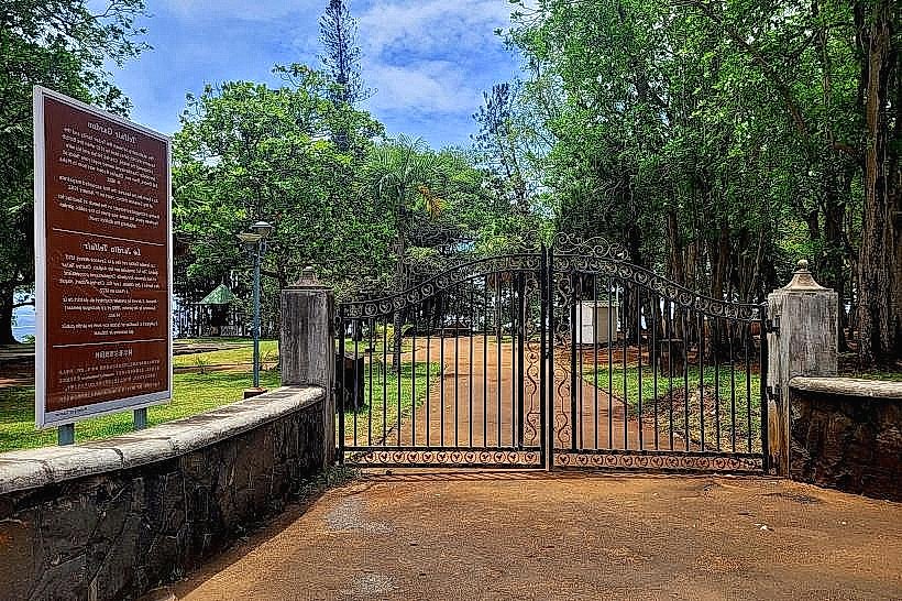
Telfair Garden: 1.2km West
Bain des Negresses: 1.5km Northwest
La Vanille Nature Park: 4.2km Northeast
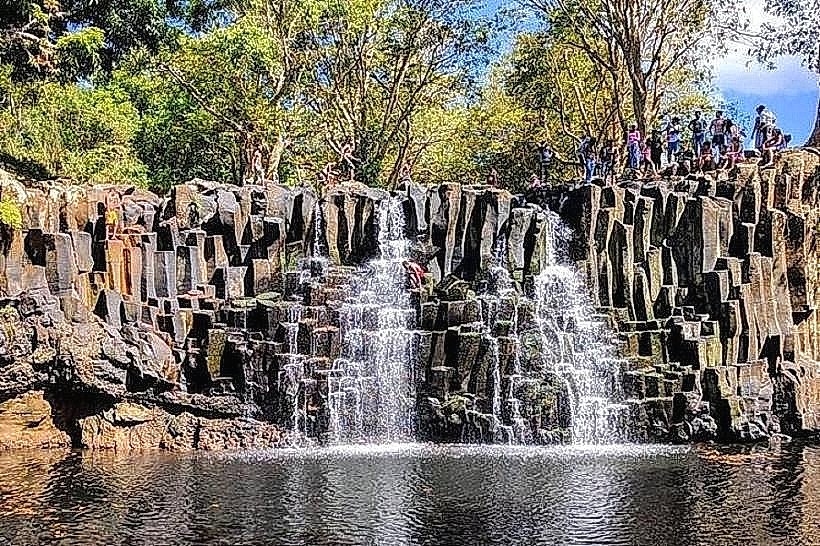
Rochester Falls: 3.5km Northwest