Information
Landmark: Le BatelageCity: Souillac
Country: Mauritius
Continent: Africa
Le Batelage, Souillac, Mauritius, Africa
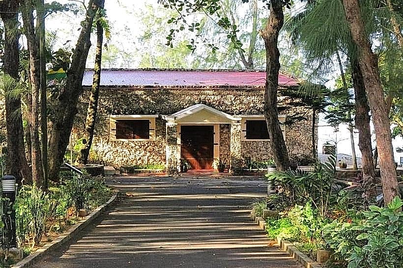
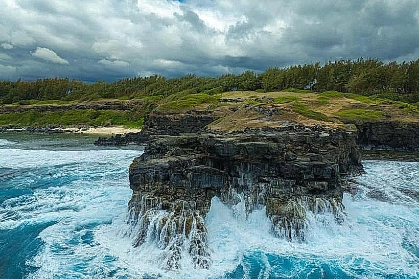
Le Batelage is a historical waterfront site and cultural complex situated at the mouth of the Savanne River in the village of Souillac, Mauritius. It occupies the former site of the town's maritime port, which served as a primary transportation hub for sugar and goods during the 18th and 19th centuries.
Visual Characteristics
The site is composed of several restored 19th-century stone buildings constructed from dark basaltic rock and lime mortar. These structures feature high-pitched corrugated iron roofs and thick masonry walls typical of French colonial industrial architecture. The complex is positioned along a quay overlooking the river estuary and a small sheltered harbor. The surrounding grounds are paved with stone and shaded by large Banyan trees, with the turbulent waters of the southern coast visible beyond the river mouth.
Location & Access Logistics
Le Batelage is located on the B9 road in the heart of Souillac, near the bridge crossing the Savanne River.
Driving: Access is via the A1 (Southern Main Road) or the coastal B9 road. A paved parking area is available directly in front of the complex.
Public Transport: The Souillac bus station is approximately 300 meters away, with regular connections from Port Louis, Curepipe, and Mahébourg.
Access: The site is open to the public; however, the interior of the main building functions as a restaurant (Le Batelage Restaurant) and a local administrative office.
Historical & Ecological Origin
The site was established in the late 18th century during the French administration to facilitate the "batelage" (boating or lighterage) of sugar from the southern estates to the capital, Port Louis. Before the development of the inland railway system, goods were loaded onto small boats (lighters) and ferried to larger ships anchored in deeper water. The main stone building served as a warehouse and customs post. Ecologically, the site sits at the intersection of a freshwater river and a high-energy marine environment.
Key Highlights & Activities
Visitors typically explore the exterior historical architecture and the waterfront promenade. The main stone building currently houses a restaurant specializing in Mauritian seafood and Creole cuisine. The quay provides a vantage point for observing the meeting of the Savanne River and the Indian Ocean. Photography of the colonial stone masonry and the river mouth is a common activity.
Infrastructure & Amenities
The complex includes a restaurant with indoor and outdoor seating and public restroom facilities for patrons. The surrounding area is flat and paved, making it accessible for wheelchairs and strollers. 5G cellular signal is stable throughout the site. Shade is provided by the building verandas and mature trees. Several small grocery stores and pharmacies are located within a 5-minute walk in the Souillac village center.
Best Time to Visit
The site is most active during lunch hours (12:00–14:30) when the restaurant is in operation. For photography and quiet exploration, early morning or late afternoon provides softer lighting on the basalt stone. The winter months (June to August) offer cooler temperatures for walking the waterfront, though the southern wind can be strong at this location.
Facts & Legends
The name "Batelage" refers specifically to the historical transport service provided by the "bateliers" (boatmen) who navigated the dangerous southern currents. A local historical oddity is that the port of Souillac was once the most important maritime outlet for the southern half of the island, a status it lost entirely once the railway reached the district in the late 1800s.
Nearby Landmarks
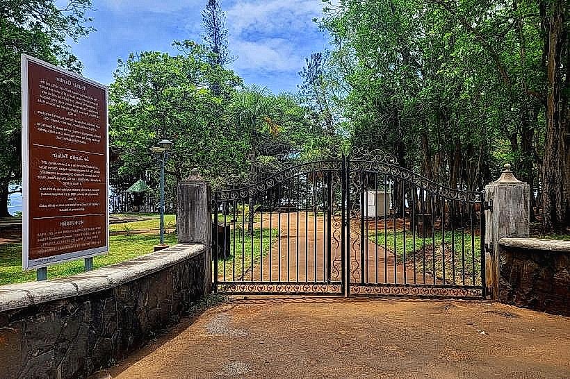
Telfair Garden: 0.2km West
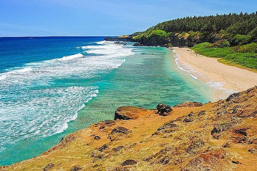
Gris Gris Beach: 1.4km East
Souillac Cemetery: 0.6km West
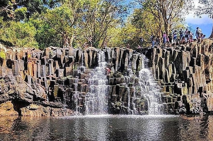
Rochester Falls: 3.6km North
La Vanille Nature Park: 4.5km Northeast