Information
Landmark: Guaíba RiverCity: Porto Alegre
Country: Brazil
Continent: South America
Guaíba River, Porto Alegre, Brazil, South America
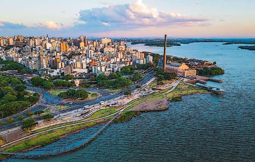
The Guaíba River is a hydrographic basin located in Porto Alegre, Brazil. It is characterized by its wide, estuarine appearance, often mistaken for a bay or lake.
Visual Characteristics
The river's width varies significantly, reaching up to 11 kilometers at its widest point. Its water color can range from a muddy brown to a greenish hue depending on sediment load and algal blooms. The banks are a mix of urban development, including port facilities and residential areas, and natural vegetation in some sections.
Location & Access Logistics
The Guaíba River forms the western boundary of Porto Alegre. Access points are numerous within the city. Major avenues like Avenida Edvaldo Pereira Paiva (Orla do Guaíba) provide direct road access. Parking is available along the Orla, with capacity varying by section. Public transport includes numerous bus lines that run along the waterfront avenues, with stops at regular intervals.
Historical & Ecological Origin
The Guaíba is geologically classified as an estuarine system, formed by the confluence of several rivers (Jacuí, Taquari, Caí, Sinos, and Gravataí) before emptying into the Atlantic Ocean. Historically, it has served as a vital transportation route and a source of livelihood for the region since its early settlement.
Key Highlights & Activities
Activities include walking or cycling along the Orla do Guaíba. Boat tours offer views of the city skyline and the river. Fishing is permitted in designated areas. Sunset viewing is a common activity due to the river's orientation.
Infrastructure & Amenities
The Orla do Guaíba features extensive infrastructure, including paved walkways, cycle paths, public seating, and lighting. Restrooms are available at various points along the Orla. Shade is provided by trees and some covered structures. Cell phone signal (4G/5G) is generally strong along the developed waterfront.
Best Time to Visit
For photography, the late afternoon offers optimal lighting for capturing the sunset. The months of March to May and September to November generally provide pleasant temperatures. High tide is not a significant factor for access or activities on the river itself.
Facts & Legends
A local legend speaks of a mythical creature, the "Boto Cor-de-Rosa" (pink river dolphin), said to inhabit the waters, though sightings are rare and unconfirmed in this urbanized estuary.
Nearby Landmarks
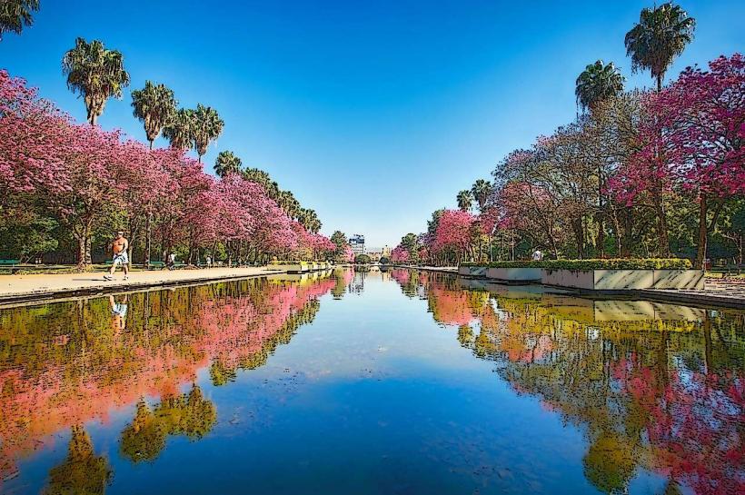
- Parque Farroupilha (Redenção) - 2km East
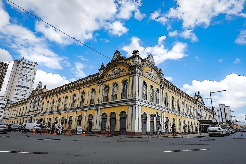
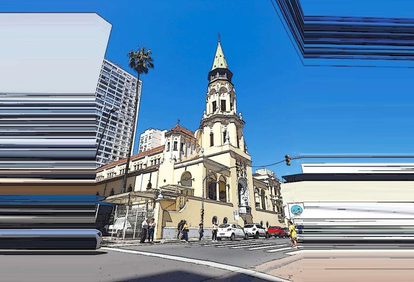
- Mercado Público Central - 3km East
- Estádio Beira-Rio - 1.5km Southwest
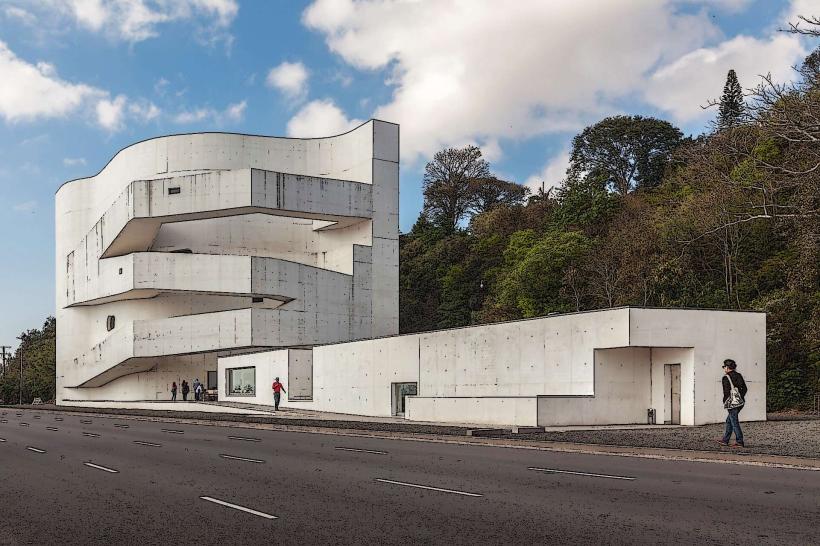
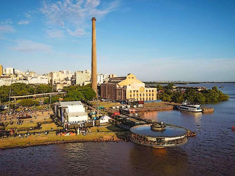
- Usina do Gasômetro Cultural Center - 2.5km West