Information
Landmark: Kamares AqueductCity: Kavala
Country: Greece
Continent: Europe
Kamares Aqueduct, Kavala, Greece, Europe
Kamares is the massive arched aqueduct situated in the center of Kavala, Greece. It serves as the primary architectural link between the Panagia (Old Town) and the modern city.
Visual Characteristics
The structure is 280 meters long and reaches a maximum height of 25 meters. It is composed of 60 double-tiered arches built from local granite and brick. The design features a lower level of massive stone piers supporting a lighter upper tier of arches that carried the water channel. Its scale and well-preserved masonry dominate the central urban landscape.
Location & Access Logistics
The aqueduct spans across Venedokleous Street and connects the foothills of Mount Symbolon to the Panagia peninsula.
Access: It is centrally located and visible from most parts of the city. Visitors can walk directly under and alongside the arches.
Proximity: It is a 5-minute walk from the central port and the Archaeological Museum of Kavala.
Parking: Municipal parking lots are available nearby in the central market area.
Historical & Ecological Origin
While the foundations may date to a Roman bypass for the Via Egnatia, the current structure was built by the Ottoman Sultan Suleiman the Magnificent between 1520 and 1530. It was constructed to replace an earlier Byzantine aqueduct and solve the city's chronic water shortage by transporting water from a spring on Mount Symbolon (6km away) to the Fortress.
Key Highlights & Activities
Structural Observation: The point where the aqueduct meets the modern buildings shows how the city grew around the monument.
The Walking Path: A path follows the line of the aqueduct toward the Old Town, providing elevated views of the masonry.
Photography: The base of the arches at the intersection of the modern city provides a high-contrast urban scale comparison.
Infrastructure & Amenities
The monument is integrated into the city's public space.
Services: The area surrounding the base contains numerous cafes, bakeries, and traditional tavernas.
Lighting: The structure is professionally illuminated at night, making it a focal point for evening walks.
Connectivity: 5G cellular coverage is exceptional.
Information: Detailed historical plaques are located at the base near the main road.
Best Time to Visit
The aqueduct is best viewed at night when the architectural lighting emphasizes the depth of the arches. For photography, late afternoon provides the best natural light on the stone surfaces.
Facts & Legends
The aqueduct remained functional until the early 20th century, providing the primary water source for the city’s inhabitants and the Imaret. It is considered one of the largest and best-preserved Ottoman aqueducts in the world.
Nearby Landmarks
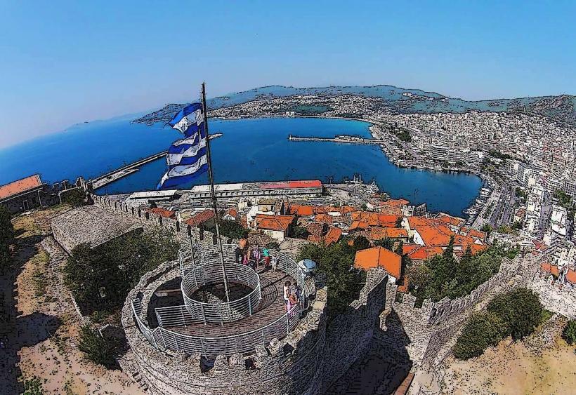
Kavala Castle: 0.5km East
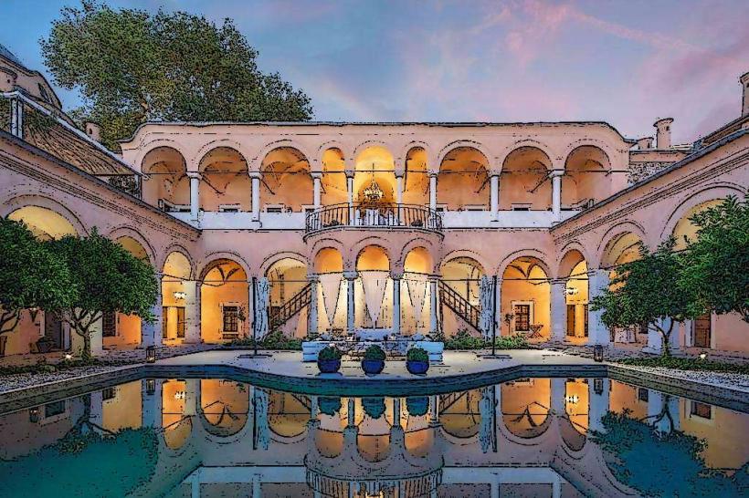
Imaret of Kavala: 0.6km Southeast
Tobacco Museum: 0.8km West
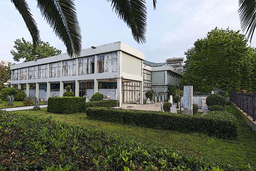
Archaeological Museum of Kavala: 0.6km Southwest
House of Mehmet Ali: 0.7km Southeast