Information
Landmark: Mang DenCity: Kon Tum
Country: Vietnam
Continent: Asia
Mang Den, Kon Tum, Vietnam, Asia
Mang Den is a highland commune located in Kon Plong District, Kon Tum Province, Vietnam. It is recognized for its cool climate and pine forests.
Visual Characteristics
Mang Den features rolling hills covered in dense pine forests. The terrain is characterized by moderate slopes and clearings. The commune is situated at an elevation of approximately 1,100 meters above sea level. Small streams and occasional waterfalls are present within the forested areas.
Location & Access Logistics
Mang Den is located approximately 50 kilometers northeast of Kon Tum city center. Access is primarily via National Route 24 (QL24). The road is paved and generally in good condition. Parking is available at designated areas near tourist sites and accommodations. Public transport options are limited; shared taxis or private vehicles are the most common modes of transport from Kon Tum.
Historical & Ecological Origin
Mang Den is a natural highland plateau. Its ecological classification is a montane forest ecosystem, characterized by its altitude and temperate climate. Historically, the area has been inhabited by indigenous ethnic minority groups, including the M'Nong and Xo Dang peoples, who have utilized the forest resources for generations.
Key Highlights & Activities
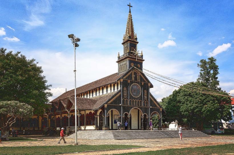
Activities include hiking through the pine forests, visiting the Mang Den Ecological Tourist Area, and exploring the Pa Sy waterfall. Visitors can also observe local agricultural practices, such as coffee and pepper cultivation. The Mang Den Church, a notable architectural structure, is also a point of interest.
Infrastructure & Amenities
Basic infrastructure includes a small number of guesthouses and local eateries. Restrooms are available at the main tourist sites. Shade is provided by the natural forest canopy. Cell phone signal (primarily 2G/3G) can be intermittent in more remote forested areas but is generally available in the commune center.
Best Time to Visit
The best time to visit Mang Den is during the dry season, from November to April, when rainfall is minimal. The mornings offer clear light for photography of the forests. The cool climate is consistent year-round, with average temperatures ranging from 18-22 degrees Celsius.
Facts & Legends
A local legend states that the area was once a sacred site for the indigenous people, with specific trees and springs considered to hold spiritual significance. A unique tip for visitors is to explore the smaller, unmarked trails within the pine forests for a more secluded experience, always exercising caution and awareness of surroundings.
Nearby Landmarks
- Kon Tum Wooden Church (Nhà thờ Gỗ Kon Tum) - 50km Southwest
- Indochina Museum (Bảo tàng Kon Tum) - 50km Southwest
- Ho Chi Minh Trail Museum (Bảo tàng Đường Hồ Chí Minh) - 55km Southwest
- Yaly Hydropower Plant - 70km West