Information
Landmark: Nanuya Lailai IslandCity: Yasawa Islands
Country: Fiji
Continent: Australia
Nanuya Lailai Island, Yasawa Islands, Fiji, Australia
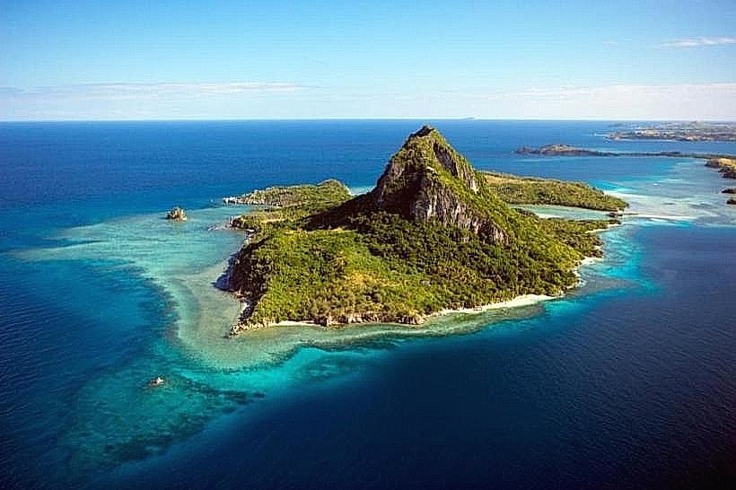
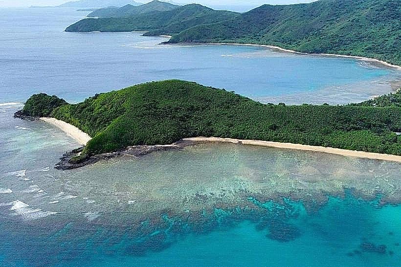
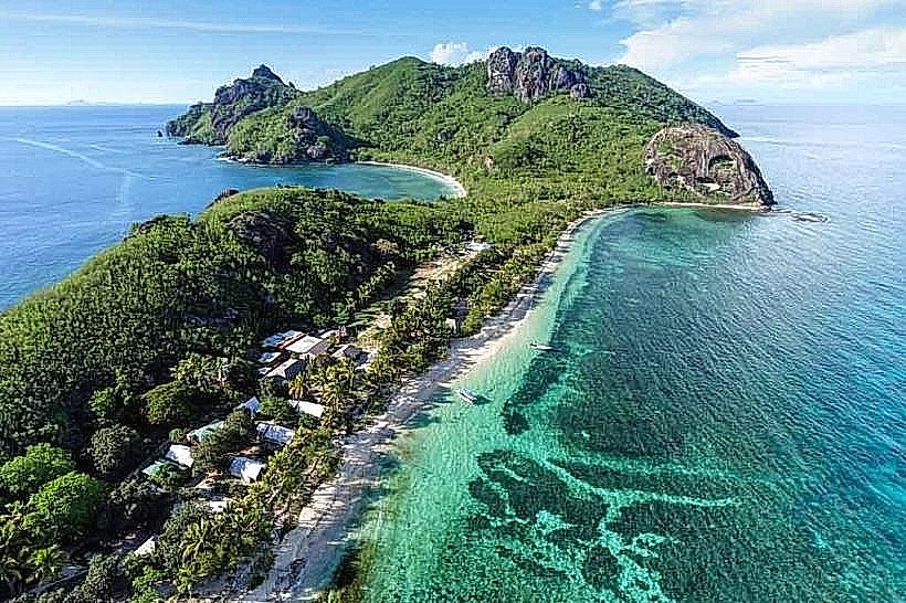
Nanuya Lailai is a volcanic island in the Yasawa Group of Fiji, situated between Nacula Island to the north and Nanuya Levu to the east. It encompasses approximately 1 square kilometer of land and is a primary bordering landmass for the Blue Lagoon marine basin.
Visual Characteristics
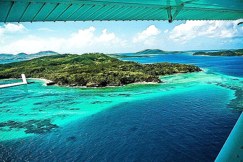
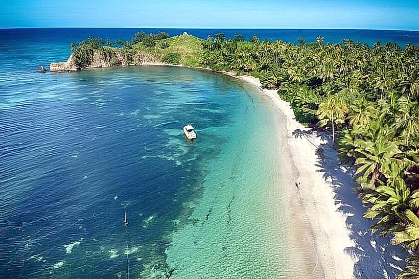
The island features a central ridge of volcanic basalt that rises to approximately 60 meters. Its western coastline is defined by wide white-sand beaches and shallow reef flats, while the eastern side is more rugged with limestone outcroppings and dense mangroves. Vegetation includes coconut palm groves, tropical dry forest, and managed gardens. The surrounding waters transition from pale turquoise over sandy patches to dark blue over deep coral bommies.
Location & Access Logistics
The island is located 85 kilometers northwest of Viti Levu. Access is provided by the Yasawa Flyer ferry, which anchors offshore daily; passengers are transferred to the beach via resort tenders. Seaplanes and helicopters from Nadi International Airport land directly in the adjacent Blue Lagoon. There are no roads or motorized vehicles on the island; a 20-minute sand track connects the western beach to the eastern side of the island.
Historical & Ecological Origin
Formed during the Late Miocene as part of the Yasawa Volcanic Group, the island consists primarily of andesitic and basaltic rock. It rose to prominence as a supply base and location for the 1980 filming of The Blue Lagoon. The island remains under the traditional ownership of local families who lease portions for small-scale eco-tourism. Ecologically, it serves as a nesting site for various tropical bird species and maintains a fringing reef system with high hard-coral cover.
Key Highlights & Activities
Snorkeling is concentrated on the western reef, which is accessible directly from the beach at any tide. A cross-island hike leads to "Lo’s Tea House" on the eastern shore, a well-known local establishment. Shell collecting and beachcombing are permitted on the tidal flats. Small-craft sailing and kayaking are common within the sheltered waters shared with Nanuya Levu.
Infrastructure & Amenities
Infrastructure is limited to small-scale solar power systems and borehole water wells. There are no public restrooms, medical clinics, or ATMs. Basic food service and restrooms are available only to guests of the island's small resorts or visitors to the local tea house. 4G cell signal is available but signal strength fluctuates based on proximity to the Nacula island transmitter.
Best Time to Visit
The dry season from May to October offers the most consistent weather and water clarity. High tide is preferable for swimming directly from the shore to avoid walking over exposed reef flats. For photography, the late afternoon provides optimal light for the western beaches, while the morning light is best for the elevated ridgeline views looking toward the Blue Lagoon.
Facts & Legends
A specific historical oddity is the presence of the "Teahouse," which has operated for decades as a singular commercial point for transiting yacht crews and backpackers in a region otherwise devoid of independent retail. The island is also the site of a traditional "shell market" where local women from nearby Nacula village sell handcrafted jewelry made from materials gathered on the reefs.
Nearby Landmarks
Blue Lagoon – 0.2km West
Nanuya Levu (Turtle Island) – 0.8km East
Nacula Island – 1.5km North
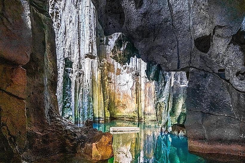
Sawa-i-Lau Caves – 13.0km North
Enuai Beach – 0.3km West