Information
Landmark: Otuoke CreekCity: Yenagoa
Country: Nigeria
Continent: Africa
Otuoke Creek, Yenagoa, Nigeria, Africa
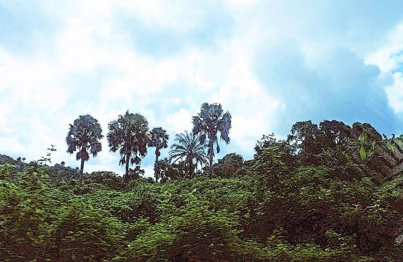
Otuoke Creek is a vital freshwater body situated in the heart of Otuoke Town, which is located in Ogbia Local Government Area of Bayelsa State, Nigeria. This creek is part of the larger network of wetlands, rivers, and estuaries that make up the Niger Delta, one of the largest and most ecologically diverse delta systems in the world.
Geographic and Hydrological Context
Location: Otuoke Creek cuts through the town of Otuoke, flowing from nearby communities such as Elebele, through Otuaba, and merges eventually with Kolo Creek around Ogbia Town.
Topography: The area is low-lying, with elevations averaging about 5 meters (16 feet) above sea level, which makes the town and the creek highly susceptible to seasonal flooding.
Hydrological Role: The creek functions as both a drainage and irrigation system for the area. It plays a crucial part in managing excess rainfall, feeding adjoining rivers, and maintaining the local water table.
Ecological Importance
Wetland Ecosystem: The creek is embedded in a swampy and mangrove-dominated environment, which supports high biodiversity. The wetlands around the creek are rich in aquatic species including:
Tilapia and catfish
Mudskippers and crabs
Mangrove oysters
Water birds such as herons and kingfishers
Vegetation: Mangroves, raffia palms, and swamp forests dominate the area. These plants play a vital role in:
Controlling erosion
Absorbing carbon dioxide
Providing breeding grounds for fish and shelter for other organisms
Socioeconomic Significance
1. Fishing and Livelihoods
Local residents, especially the Ijaw-speaking people of Otuoke, depend heavily on the creek for subsistence fishing.
Fishing is often done using dugout canoes, nets, and hooks.
Shellfish and smoked fish from the creek are sold in nearby local markets such as Kolo Market.
2. Agriculture
The alluvial soil along the banks of the creek is fertile and ideal for cassava, plantain, yam, and pepper cultivation.
Creek water is often used to irrigate farmlands during the dry season.
3. Transportation
The creek serves as a traditional waterway for local transport, especially before the construction of paved roads.
Canoes are used to connect Otuoke with nearby communities and creeks.
Cultural and Educational Relevance
Cultural Practices: The creek is associated with local river deities, ancestral spirits, and traditional rites, especially during festivals and burial ceremonies.
Taboos and Beliefs: Some parts of the creek are considered sacred, and people avoid fishing or bathing there out of respect for local spiritual beliefs.
Education: Otuoke is home to the Federal University Otuoke (FUO), and the creek is sometimes used as a subject for environmental studies and research on wetland conservation and hydrology.
Environmental Challenges
1. Flooding
Otuoke Creek frequently overflows during the rainy season (typically June to October), flooding homes, displacing residents, and damaging farmlands.
The 2022 and 2023 floods were particularly severe, making headlines nationally, and even affecting the residence of former President Goodluck Jonathan.
2. Pollution
Discharge of household waste, agricultural runoff, and petroleum residue from upstream oil activities has led to water quality degradation.
Oil spills and illegal refining ("kpo fire") have impacted water safety and fish populations.
3. Erosion
Deforestation of mangrove vegetation along the banks has led to bank collapse and sedimentation.
This erosion affects farmland and threatens nearby structures.
Conservation Needs and Strategies
To preserve Otuoke Creek, the following measures are needed:
Water Quality Monitoring: Regular testing of creek water to track pollution levels and contaminants.
Flood Control Measures:
Construction of embankments and retention basins
Dredging of silted sections to improve flow
Community Awareness:
Educational campaigns about waste disposal, overfishing, and ecological preservation
Government Intervention:
Enforcement of environmental laws against oil pollution and illegal dumping
Rehabilitation of degraded creek sections
Summary
Otuoke Creek is more than a body of water-it is the lifeblood of the Otuoke community. It sustains economic activities, supports a unique ecosystem, shapes cultural identity, and serves as an academic subject of environmental interest. However, without proactive management, the creek is at risk due to increasing human pressure, climate variability, and infrastructural neglect.
Its preservation is essential not only for the community of Otuoke but also as a representative of the fragile and vital wetlands of the Niger Delta.