Information
Landmark: Parenzana TrailCity: Izola
Country: Slovenia
Continent: Europe
Parenzana Trail, Izola, Slovenia, Europe
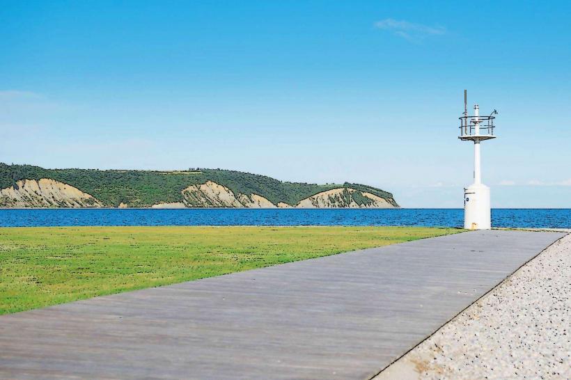
The Parenzana Trail is a 123-kilometer long-distance cycling and hiking path that follows the track of a former narrow-gauge railway connecting Trieste, Italy, to Poreč, Croatia. The section passing through Izola, Slovenia, offers a paved route that transitions from the coastal strip into the terraced hills of the Istrian interior.
Visual Characteristics
The trail consists of a 3-meter-wide asphalt surface through the urban and coastal sections, shifting to stabilized macadam in the rural stretches. The Izola segment features iron-railed bridges, dry-stone retaining walls, and restored railway signals. Vegetation along the path includes Mediterranean pines, olive groves, and vineyards, with several elevated viewpoints offering vistas of the Gulf of Trieste.
Location & Access Logistics
The trail enters Izola from the East (Koper) along the coastal road and exits toward the Southwest (Jagodje/Strunjan). It is accessible at multiple points, including the main trailhead at Prešernova cesta near the Izola industrial zone. Free parking is available at the "Parkirišče pri ladjedelnici" (500m north), and public buses from Koper or Piran stop at the Izola station directly adjacent to the trail.
Historical & Ecological Origin
The Parenzana was a 760mm narrow-gauge railway that operated from 1902 to 1935, primarily transporting salt, wine, olive oil, and stone. After the tracks were dismantled, the route was abandoned until 2002, when it was converted into the "Path of Health and Friendship." Geologically, the Izola section traverses the Eocene flysch layers characteristic of the Slovenian coast.
Key Highlights & Activities
Cycling and long-distance trekking are the primary uses of the trail. In the Izola section, visitors can pass through the 544-meter-long Šalet Tunnel, which is illuminated and maintains a constant cool temperature. Educational boards detailing the history of the railway and local biodiversity are placed at regular intervals.
Infrastructure & Amenities
The Izola portion is fully paved and equipped with street lighting in urban areas. Dedicated resting stations with benches, bicycle repair stands, and drinking water fountains are located near the Jagodje bypass. Cell phone signal (5G) is continuous. Restrooms and food vendors are concentrated at the Simonov zaliv and city center access points.
Best Time to Visit
Spring (April–June) and autumn (September–October) provide the best temperatures for physical activity. For photography, the section between Izola and Strunjan is best during the late afternoon when the sun is low, highlighting the relief of the Istrian hills. The Šalet Tunnel is accessible year-round and provides shelter from midday heat.
Facts & Legends
A historical oddity is that the rails of the Parenzana were supposedly loaded onto a ship for Abyssinia (Ethiopia) by the Italian government in 1935, but the ship was sunk in the Mediterranean, leaving the iron at the bottom of the sea. A local tip: look for the original "Km" stone markers that still denote the distance from the Trieste railway station.
Nearby Landmarks
Marina Izola: 0.5km North
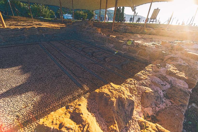
Simon’s Bay Archaeological Site: 0.8km North
Šalet Tunnel: 1.2km Southwest
Strunjan Salt Pans: 4.5km Southwest
Besenghi degli Ughi Palace: 1.2km Northwest