Information
Landmark: Port RoyalCity: Kingston
Country: Jamaica
Continent: North America
Port Royal, Kingston, Jamaica, North America
Port Royal is a historic fortified settlement located at the southeastern tip of the Palisadoes in Kingston, Jamaica.
Once a major hub for English buccaneers and a significant port in the Caribbean, it is now a smaller community with a rich archaeological and historical context.
Visual Characteristics
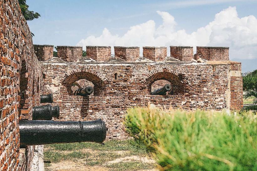
The remaining structures in Port Royal are primarily low-rise buildings constructed from concrete and corrugated metal. The area is characterized by its waterfront location, with views of Kingston Harbour. Archaeological sites reveal foundations and remnants of earlier brick and stone fortifications.
Location & Access Logistics
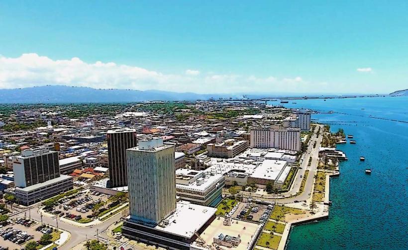
Port Royal is situated at the end of the Palisadoes, a long sand spit. Access is via Palisadoes Road from Kingston. The distance from central Kingston is approximately 18 kilometers. Parking is available in designated areas near the main settlement. Public transport options include route taxis and buses that travel along Palisadoes Road.
Historical & Ecological Origin
Port Royal was established by the English in 1655. It served as a naval base and a center for privateering operations. The settlement was largely destroyed by an earthquake in 1692, followed by subsequent fires and hurricanes. Ecologically, it is situated on a dynamic sand spit influenced by coastal erosion and deposition.
Key Highlights & Activities
Visitors can explore Fort Charles, a surviving fortification that dates back to the 17th century. The Port Royal Archaeological Museum displays artifacts recovered from the submerged sections of the old city. Walking tours of the remaining historical sites are available. Boat tours offer views of the submerged ruins and the surrounding harbor.
Infrastructure & Amenities
Restrooms are available at the museum and some local establishments. Limited shade is provided by existing structures and trees. Cell phone signal (4G) is generally available. Local food vendors and small restaurants are present within the community.
Best Time to Visit
The best time of day for photography is generally in the morning or late afternoon when the sun angle is lower, providing softer light. The dry season, from December to April, offers the most favorable weather conditions with less rainfall. There are no specific tide requirements for visiting the accessible land-based sites.
Facts & Legends
A notable historical event is the devastating earthquake of June 7, 1692, which caused a significant portion of the city to sink into the harbor. Local legends often speak of the "Devil's Sea" and the curse placed upon the city due to its history of piracy and debauchery.
Nearby Landmarks
- Norman Manley International Airport (0.8km West)
- Fort Rocky (1.2km West)
- Plum Point (2.5km Southwest)
- Kingston (18km Northwest)