Information
Landmark: Putrajaya LakeCity: Putrajaya
Country: Malaysia
Continent: Asia
Putrajaya Lake, Putrajaya, Malaysia, Asia
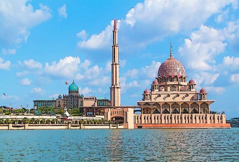
Putrajaya Lake is a man-made reservoir situated in the administrative capital of Putrajaya, Malaysia. It functions as a central feature of the city's urban planning and environmental management system.
Visual Characteristics
The lake covers an area of approximately 400 hectares. Its water color varies depending on atmospheric conditions and algae presence, typically appearing greenish-brown. The shoreline is extensively landscaped with concrete embankments, pedestrian walkways, and planted vegetation. Several bridges, including the Seri Wawasan Bridge and the Putra Bridge, span sections of the lake.
Location & Access Logistics
Putrajaya Lake is located in the center of Putrajaya, approximately 25 kilometers south of Kuala Lumpur. Access is via the North-South Expressway (E2) or the Maju Expressway (E20), exiting at Putrajaya. Parking is available at various points around the lake, including the Putrajaya Convention Centre and the IOI City Mall. Public transport options include the Nadi Putra bus service, with several routes circulating the city and stopping near the lakefront.
Historical & Ecological Origin
The lake was created in 1995 as part of the development of Putrajaya as Malaysia's federal administrative center. It was formed by damming the Sungai Chu and Sungai Melaka rivers. The primary purpose was to create a central water feature for aesthetic appeal, climate moderation, and to serve as a natural drainage system for the city.
Key Highlights & Activities
Boating activities are available, including rental of paddle boats and cruises on larger vessels like the Putrajaya Lake Cruise. Fishing is permitted in designated areas. The surrounding parks and walkways are suitable for walking and cycling. The Putrajaya International Convention Centre (PICC) is situated on the lake's northern shore.
Infrastructure & Amenities
Restrooms are available at various points along the lakefront, particularly near public parks and jetties. Shade is provided by trees and some covered seating areas. Cell phone signal (4G/5G) is generally strong throughout the area. Food vendors and cafes are located in the vicinity of major attractions and shopping centers.
Best Time to Visit
The best time for photography is during the early morning or late afternoon when the sun angle provides softer light. The weather in Putrajaya is tropical, with high humidity and rainfall year-round. The driest months are typically June to August. There are no specific tide requirements as it is a man-made lake.
Facts & Legends
A unique aspect of Putrajaya Lake is its role in flood control for the surrounding urban area. It acts as a large retention basin, mitigating the impact of heavy rainfall. Local folklore does not prominently feature specific legends tied to the lake itself, but the city's development is often discussed in terms of its ambitious urban planning.
Nearby Landmarks
- Putrajaya Convention Centre (PICC) - 0.2km North
- Seri Wawasan Bridge - 0.8km West
- Dataran Putra (Putrajaya Square) - 1.5km Northwest
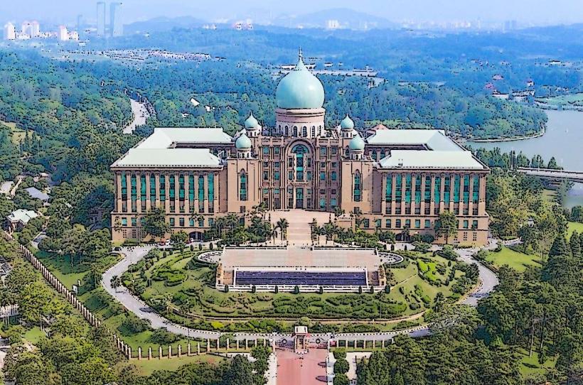
- Prime Minister's Office Complex - 1.8km Northwest
- IOI City Mall - 3.5km Southwest