Information
Landmark: Rotuma IslandCity: Rotuma
Country: Fiji
Continent: Australia
Rotuma Island, Rotuma, Fiji, Australia
Rotuma is a volcanic island dependency of Fiji located at 12°30'S and 177°05'E, approximately 465 kilometers north of the main Fiji group. It consists of a main island and several small offshore islets, totaling approximately 43 square kilometers of land area.
Visual Characteristics
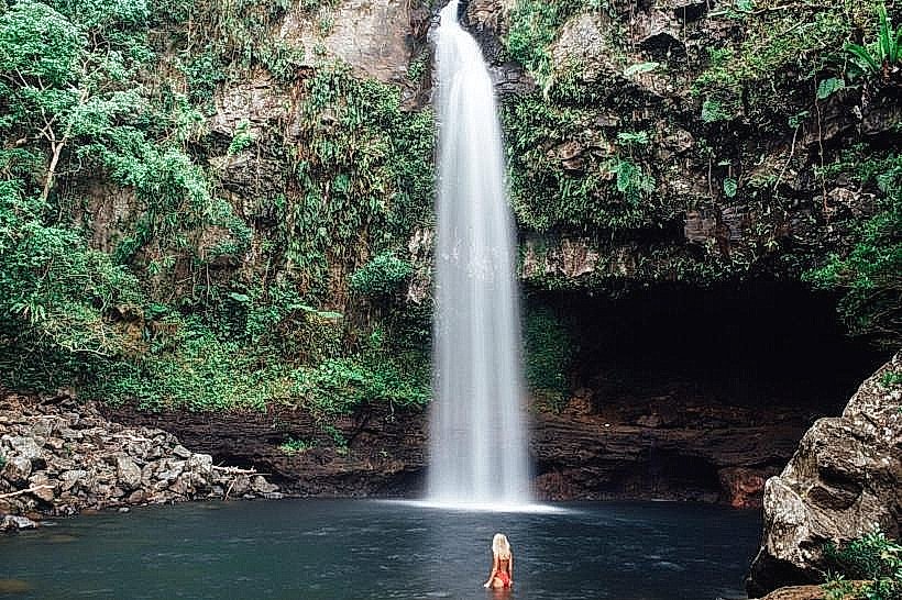
The main island is 13 kilometers long and nearly 5 kilometers wide at its broadest point, comprised of at least 21 small volcanic peaks and craters. The terrain features a central ridge of hills reaching a maximum elevation of 256 meters, with an isthmus of white sand only 100 yards wide connecting the two main parts of the island. Dense vegetation includes coconut palm plantations and pockets of indigenous lowland rainforest, while the coastline is defined by basaltic volcanic rock, fringing coral reefs, and turquoise lagoons.
Location & Access Logistics
Rotuma is situated in relative isolation at the intersection of Melanesia, Micronesia, and Polynesia. Access is primarily via Fiji Link flights from Nadi International Airport to Rotuma Airport (RTC) or by monthly government-franchised supply ships from Suva that dock at the Oinafa Wharf. Travel on the island is facilitated by a single main coastal road that circles the perimeter, though paved sections are limited and many interior tracks remain unsealed.
Historical & Ecological Origin
The island is of volcanic origin, formed by a series of shield eruptions that created basaltic flows and cinder cones, now largely extinct. It was first sighted by Europeans in 1791 aboard the HMS Pandora and was later ceded to Great Britain in 1881. Ecologically, the island lacks permanent rivers or lakes due to the porous nature of the volcanic soil, which absorbs the average annual rainfall of 3,350mm.
Key Highlights & Activities
Snorkeling and diving are primary activities due to the presence of healthy fringing reefs and clear visibility. Visitors can hike to the summits of the volcanic peaks for vantage points of the archipelago or visit the "split island" of Hafliua. Traditional cultural engagement includes observing local ceremonies in the seven districts and visiting the Ahau government station.
Infrastructure & Amenities
Infrastructure is minimal; electricity is provided by a centralized power plant in Ahau and local community generators, with power usually restricted to specific windows (06:00–16:00 and 18:30–22:00). Digital connectivity is limited to 3G/4G mobile network coverage in certain coastal areas, and there is no public Wi-Fi. Public restrooms are unavailable outside of private residences or guest houses, and food must be purchased from small village canteens or local markets.
Best Time to Visit
The dry season from May to October is the optimal period for visitation, offering lower humidity and stable weather conditions. August provides the highest probability of clear skies (43% on average) for photography and outdoor activities. High-speed winds and heavy rain during the cyclone season (November to April) can frequently lead to the cancellation of flights and shipping services.
Facts & Legends
Local mythology attributes the founding of the island to Raho, a chief from Samoa who reportedly formed the island by pouring a basket of sand into the ocean. A prominent physical legend involves the "magic square" stone carvings and "tupu'a"-petrified stones believed to be ancestral figures or spirits that protect specific family lands and districts.
Nearby Landmarks
Hatana Islet - 4.2km West
Uea Island - 4.8km Northwest
Oinafa Wharf - 3.5km East (from Ahau)
Hafliua (Split Island) - 4.5km West