Information
City: AmbalavaoCountry: Madagascar
Continent: Africa
Ambalavao, Madagascar, Africa
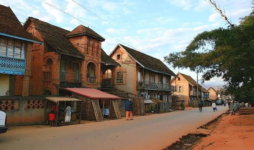
Ambalavao is a town in the Haute Matsiatra region of the southern highlands, located approximately 56 km south of Fianarantsoa on the RN7. Known as the "Gateway to the South," it marks the transition from the high-altitude rice terraces of the Betsileo to the arid plains of the Bara people.
Historical Timeline
In the 19th century, Ambalavao was a site of frequent conflict between the Bara and Betsileo tribes, and later a stronghold for the Merina during their southern expansion. Under French colonial rule, it was developed into a center for trade and specialized agriculture, notably tea, silk, and vineyards.
Demographics & Population
The population is approximately 35,000. It is primarily inhabited by the Betsileo, though its role as the country’s largest livestock hub draws a significant semi-nomadic Bara population from the south.
Urban Layout & Key Districts
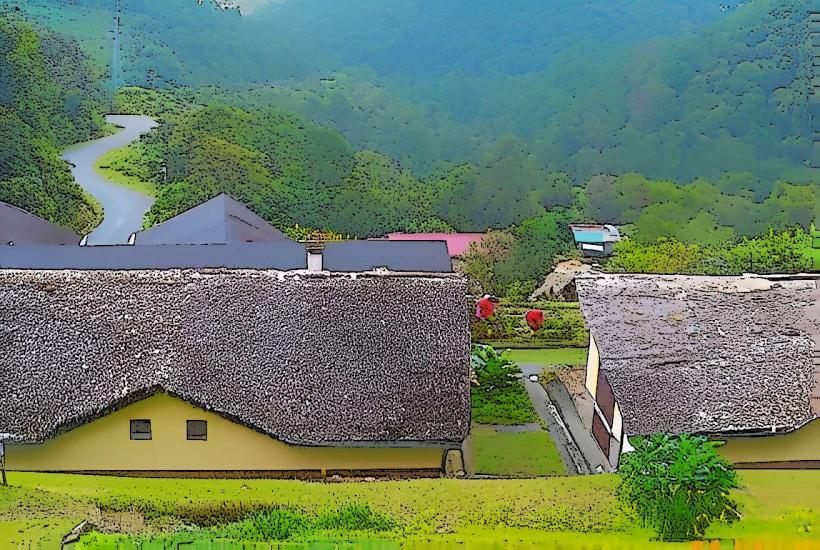
The town is characterized by its well-preserved Betsileo architecture, featuring pastel-colored houses with carved wooden balconies and tiled roofs.
Town Center: Home to the Antemoro paper workshops and the silk weaving centers.
Cattle Market Hill: Located on the southern outskirts, this 2-hectare site hosts the massive zebu market.
The High Street: A central hub for trade, markets, and transit along the RN7.
Top Landmarks
Zebu Market: Held every Wednesday (and sometimes Thursday), this is the largest livestock market in Madagascar. Thousands of cattle are traded in a highly organized, high-energy spectacle.
Antemoro Paper Factory: A family-run workshop producing traditional handmade paper from the bark of the Avoha tree, a craft introduced by early Arab migrants.
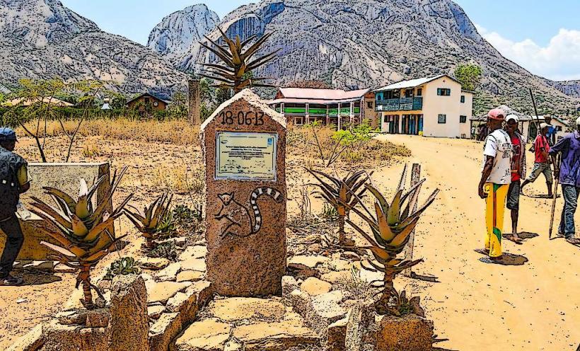
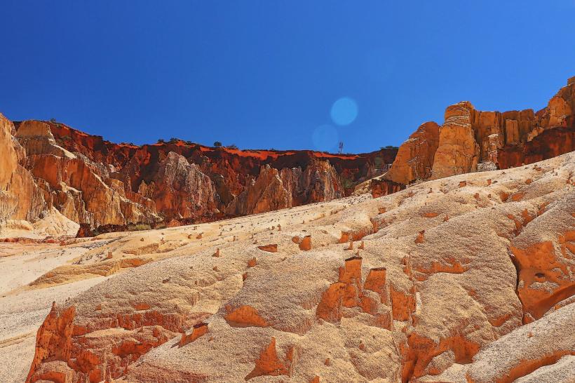
Anja Community Reserve: Located 13 km south, this locally-managed sanctuary is famous for its high density of ring-tailed lemurs and dramatic granite boulders.
Soavita Vineyard: One of the region's primary wine-producing estates, offering tours and tastings of local Malagasy wine.
Landy Silk Workshops: Facilities where wild silk (landibe) is harvested from endemic moths feeding on tapia trees and woven into traditional fabrics.
Transportation Network
Roads: Situated directly on the RN7. The drive from Fianarantsoa takes roughly 1 to 1.5 hours.
Public Transit: Taxi-brousses are the primary link to Fianarantsoa (North) and Ihosy/Toliara (South).
Local: The town is compact and best explored on foot. Private taxis are available for transit to Anja or the zebu market.
Safety & "Red Zones"
Livestock Market: Use caution around stampeding zebu; the terrain is chaotic and animals frequently break loose.
Highway Safety: The stretch of the RN7 south of Ambalavao toward Ihosy is a known high-risk zone for dahalo (bandit) activity. Night travel is strictly prohibited by most reputable operators.
Environmental: The granite peaks of the nearby Andringitra Massif are prone to sudden weather shifts and extreme cold.
Digital & Financial Infrastructure
4G signal is reliable in the town center but drops quickly in the surrounding mountains. There are limited banking facilities; ensure you have sufficient cash (Ariary) before arriving, as the zebu market and local workshops rarely accept cards.
Climate & Air Quality
Climate: Savannah climate with dry, cool winters. Temperatures typically range from 12°C to 27°C. It is notably warmer than Fianarantsoa but can be very cold at night during the winter (June–August).
Air Quality: Excellent, though the town center can be dusty during the dry season.
Culture & Social Norms
Zebu Rodeos: Occasionally held during the market, where young men prove their courage by attempting to ride bulls.
Healing Market: A specialized section of the weekly market selling diverse medicinal herbs and traditional remedies.
Dress: Modest dress is standard, particularly when visiting the sacred sites and royal tombs located in the surrounding hills.
Local Cost Index
1 Espresso: ~4,500 MGA ($1.00)
1 Simple Meal: ~10,000 MGA ($2.25)
1 Entry to Anja Reserve: ~30,000 MGA ($6.70)
Nearby Day Trips
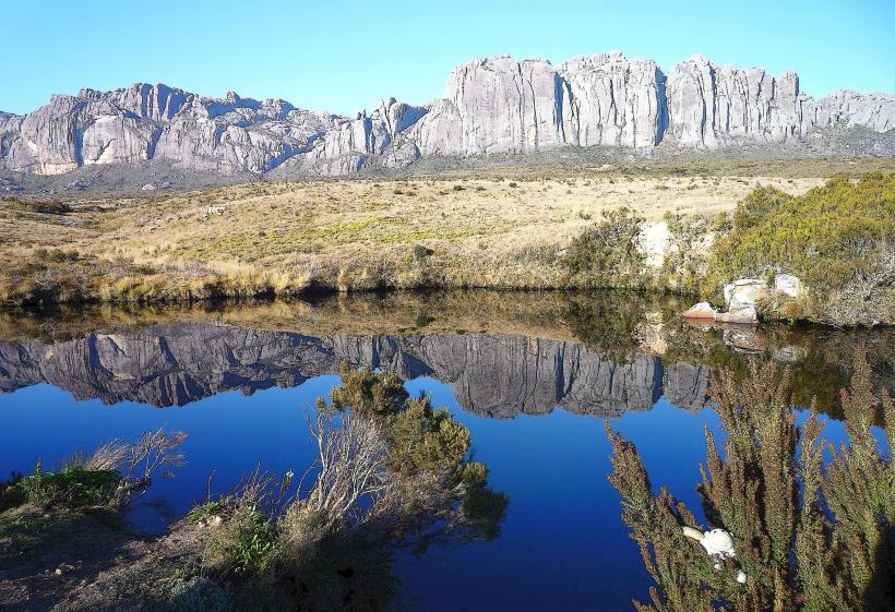
Andringitra National Park: Home to Pic Boby (2,658m), the second-highest peak in Madagascar. The park entrance is approx. 40 km south of town.
Tsaranoro Valley: A premier destination for rock climbing and trekking, known for its massive sheer granite walls.
Facts & Legends
A verified historical oddity is that the Antemoro paper produced here is still made using the exact 16th-century techniques brought by Arab settlers to the East Coast. Local legend identifies the nearby Ambondrombe Massif as the "Valley of the Dead," where the spirits of all Malagasy ancestors are said to reside after death.