Information
Landmark: Andringitra National ParkCity: Ambalavao
Country: Madagascar
Continent: Africa
Andringitra National Park, Ambalavao, Madagascar, Africa
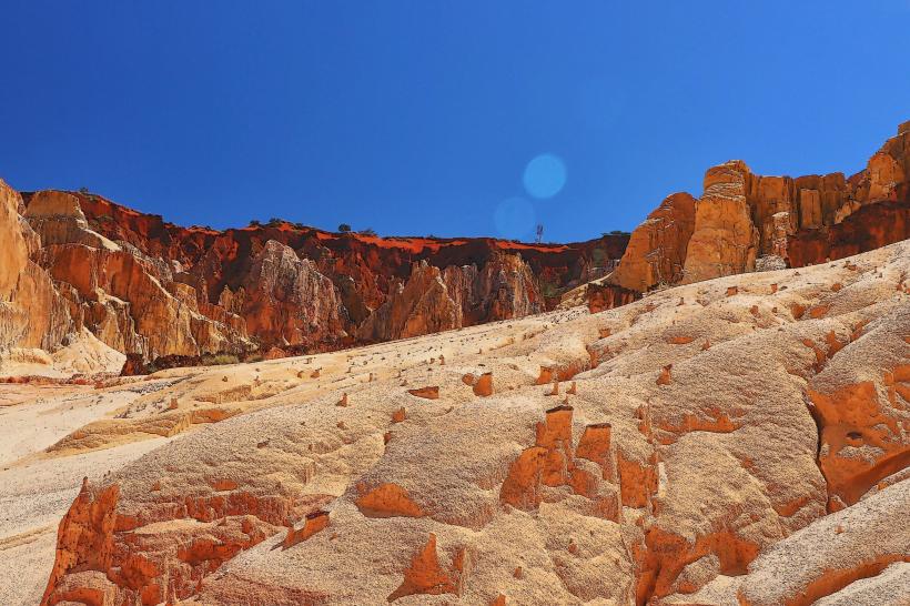
Visual Characteristics
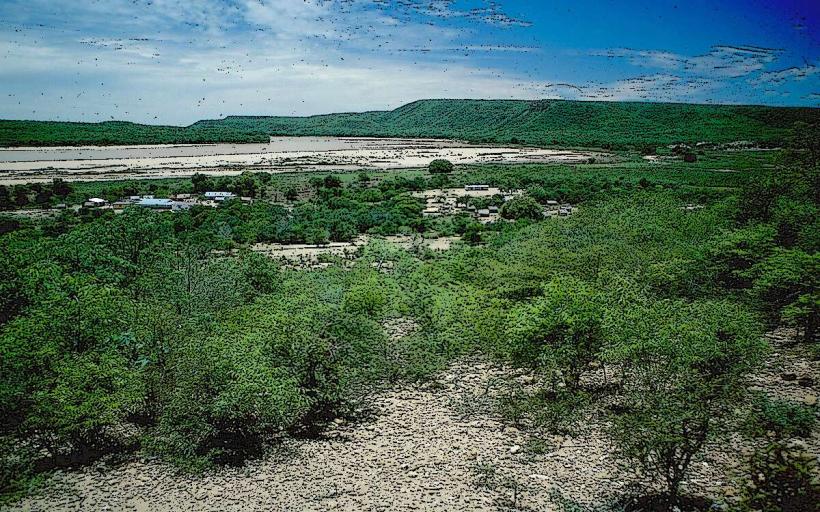
The park is characterized by a granitic massif with prominent peaks, deep valleys, and high plateaus. Elevations range from 500 meters to 2,658 meters at Imarivolanitra (Pic Boby). Vegetation varies significantly with altitude, including dense humid forest in the east, high-altitude grasslands, and xerophytic vegetation on western slopes. Exposed granite rock faces are common, displaying a range of grey and reddish hues.
Location & Access Logistics
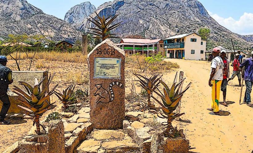
Access to Andringitra National Park is primarily from Ambalavao. From Ambalavao, visitors travel south on National Route 7 (RN 7) for a short distance before turning onto local tracks. The main access points are near villages such as Namoly (eastern side) or through the Tsaranoro Valley (western side). These tracks require a 4x4 vehicle, especially during the wet season. The distance from Ambalavao to the park's eastern entrance near Namoly is approximately 47 kilometers. Parking is available in designated areas near the access villages. Public transport options include bush taxis (taxi-brousse) to Ambalavao; onward travel to the park requires private vehicle hire or arrangement with local guides.
Historical & Ecological Origin
Andringitra National Park is part of the Precambrian basement of Madagascar, primarily composed of granitic and gneissic rock formations. Ecologically, it is a critical biodiversity hotspot, encompassing montane rainforest, high-altitude grassland, and xerophytic forest ecosystems. The park was officially established in 1999, building upon its previous status as a Strict Nature Reserve since 1927, to protect its unique flora and fauna, including numerous endemic species of lemurs, birds, and plants.
Key Highlights & Activities
- Trekking and hiking, including the multi-day ascent of Imarivolanitra (Pic Boby), the second highest peak in Madagascar.
- Rock climbing on the granite cliffs of the Tsaranoro Massif, located adjacent to the park's western boundary.
- Bird watching, with opportunities to observe endemic species such as the Yellow-browed Oxylabes.
- Exploring waterfalls, including Riandahy and Riampesona, accessible via marked trails.
- Camping at designated sites within the park, offering immersion in the natural environment.
Infrastructure & Amenities
Basic infrastructure is present within Andringitra National Park. Designated campsites offer rudimentary facilities, including pit latrines. Shade availability varies significantly depending on the specific trail and altitude, ranging from dense forest cover to exposed high-altitude plateaus. Cell phone signal (4G/5G) is generally limited to non-existent within the park's interior. There are no permanent food vendors or shops inside the park; visitors must bring all necessary supplies. Local guides and porters, often hired from nearby villages, can assist with cooking and carrying provisions.
Best Time to Visit
The best time to visit Andringitra National Park is during the dry season, from May to October. This period offers more stable weather conditions, lower rainfall, and clearer skies, which are ideal for trekking and rock climbing. For photography, early morning and late afternoon light provide optimal conditions for capturing the granitic peaks and diverse landscapes.
Facts & Legends
The peak of Imarivolanitra, known locally as Pic Boby, is considered sacred by the local Bara and Betsileo communities, who believe it is a dwelling place for ancestral spirits. A verified historical fact is that the park harbors over 100 species of birds, 13 species of lemurs, and numerous endemic plant species, highlighting its ecological significance. A specific tip for visitors is that hiring a local guide is mandatory for entry and trekking within the park, ensuring safety and supporting local communities.
Nearby Landmarks
- Namoly Village: 0km, serving as a primary eastern access point to the park.
- Riandahy Waterfall: Approximately 3km West from the Namoly access point, within the park.
- Riampesona Waterfall: Approximately 3.5km West from the Namoly access point, within the park.
- Pic Boby (Imarivolanitra) Trailhead: Approximately 1km West from Namoly Village, marking the start of the ascent.
- Tsaranoro Valley: Adjacent to the park's western boundary, approximately 5km West of the park's western edge, known for its climbing routes.