Information
City: AntsirananaCountry: Madagascar
Continent: Africa
Antsiranana, Madagascar, Africa
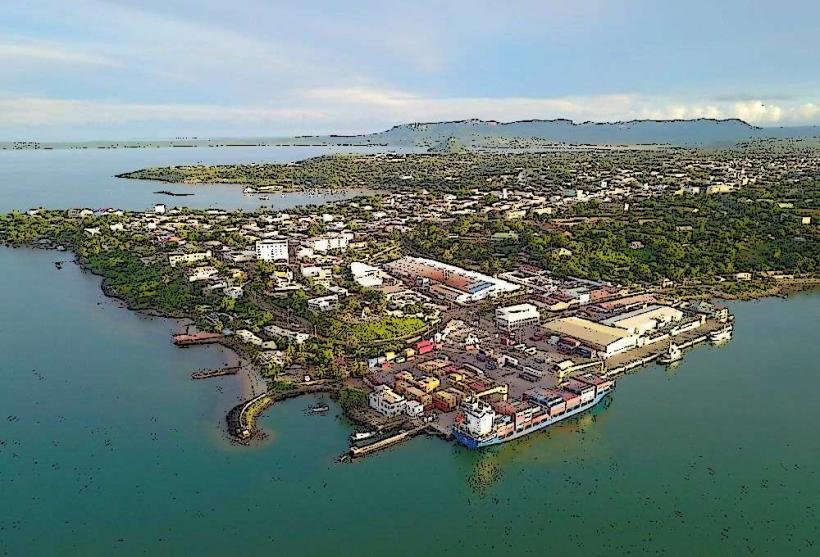
Antsiranana, still widely known by its colonial name Diego-Suarez, is the capital of the Diana Region in the far north of Madagascar. It sits on the world’s second-largest natural bay and serves as a major strategic naval base and commercial port.
Historical Timeline
The bay was sighted by Portuguese explorers Diego Dias and Fernando Suarez in the early 1500s. In the late 17th century, it was rumored to be the site of Libertatia, a legendary anarchist pirate colony. The French officially established a protectorate here in 1885 due to the bay's strategic value, and it served as a critical theater during Operation Ironclad in 1942, when British forces seized the port from Vichy France to prevent Japanese naval use.
Demographics & Population
The population is approximately 130,000. The demographic is dominated by the Antankarana ("The people of the cliffs"), though the city is highly cosmopolitan. There are significant populations of Yemenis, Somalis, Comorians, Indians, and French expatriates, reflecting its history as a global crossroads.
Urban Layout & Key Districts
The city is built on a promontory overlooking the bay.
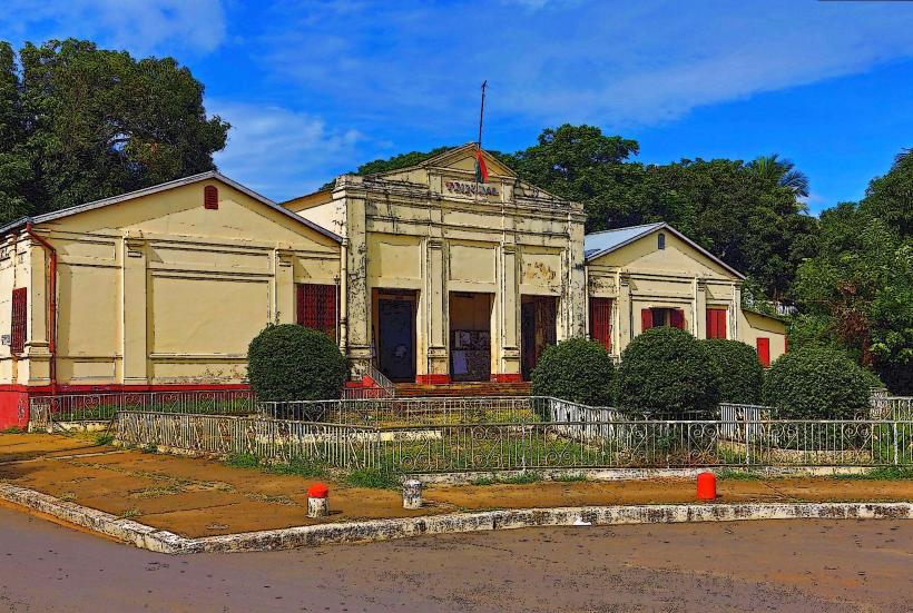
The Old Town (Colonial Quarter): Located near the port, featuring crumbling 19th-century French architecture, wide colonnaded streets, and the historic military barracks.
Rue Colbert: The city's main artery, lined with restaurants, boutiques, and nightlife.
The Port: A deep-water facility on the northern edge of the city.
Quartier de la Marine: The naval district, maintaining a strong French and Malagasy military presence.
Top Landmarks
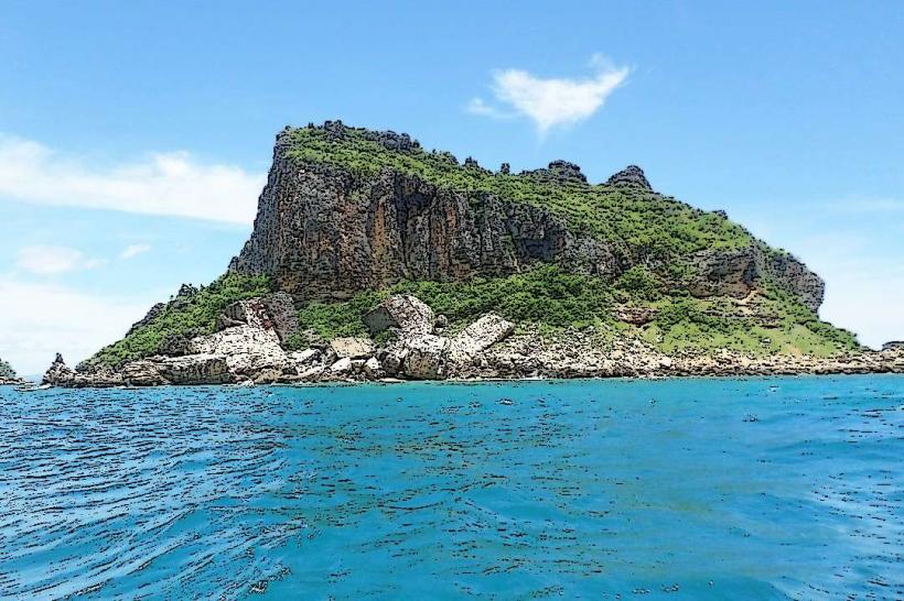
Pain de Sucre (Sugar Loaf): A perfectly conical volcanic islet in the center of the bay; it is a sacred site where locals perform fomba (ancestral rituals).
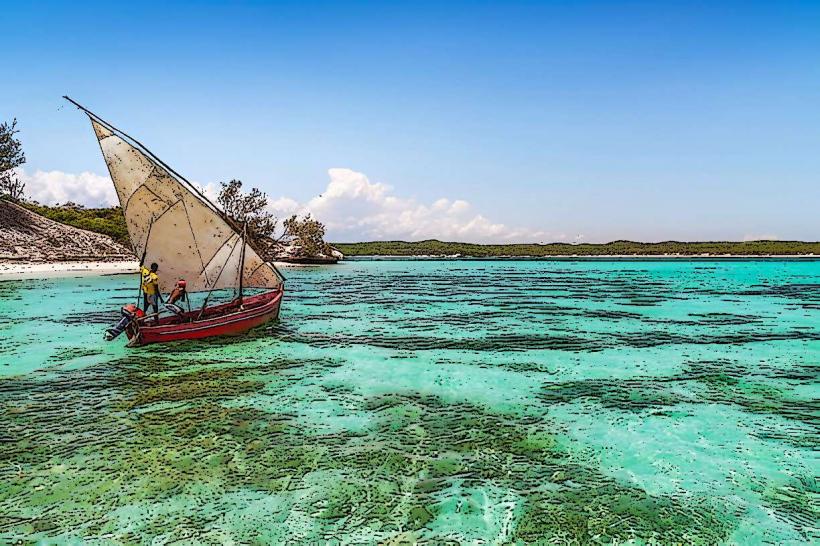
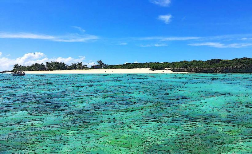
The Three Bays (Les Trois Baies): A series of turquoise inlets (Baie des Dunes, Baie des Pigeons, Baie Sakalava) reachable via a rugged coastal track.
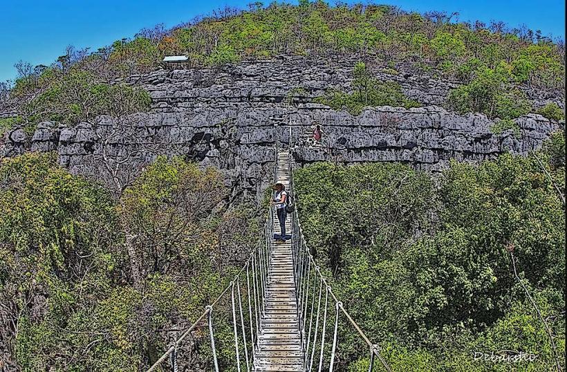
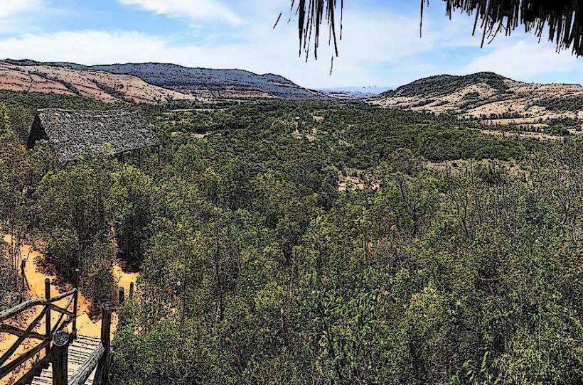
Montagne d’Ambre National Park: Located 40 km south, this high-altitude rainforest is a "water tower" for the region, home to waterfalls and crater lakes.
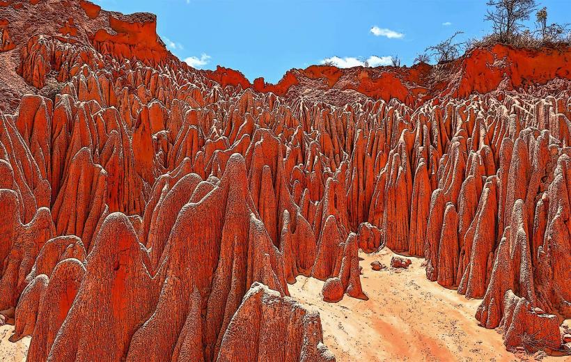
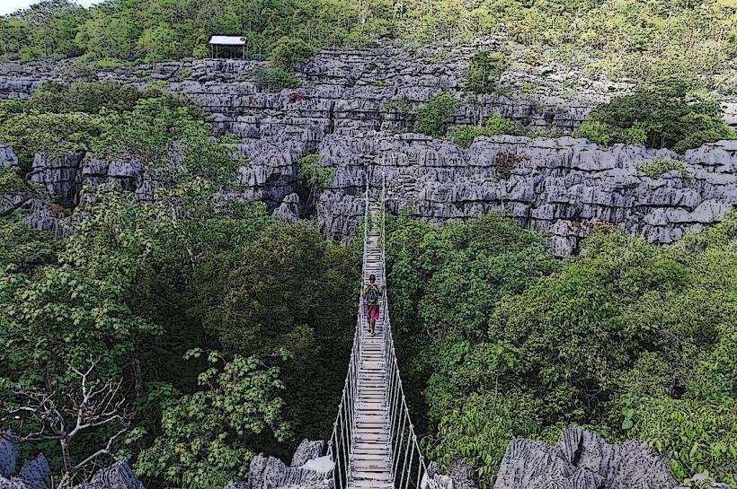
The Red Tsingy: Unique geological formations of eroded red laterite and sandstone, distinct from the limestone Tsingy found elsewhere.
Ramena Beach: A popular white-sand beach located 18 km from the city, serving as the social hub for weekends.
Transportation Network
Air: Arrachart Airport (DIE) connects to Antananarivo and Nosy Be. It is small but handles high tourist volume.
Roads: Located at the northern end of the RN6. The road from Ambanja is frequently in poor condition due to rain and heavy truck traffic.
Local Transit: Tuk-tuks are the primary mode of transport. The yellow "Renault 4" taxis are a city icon.
Sea: Small boats connect the city to remote parts of the bay and Emerald Sea (Mer d’Emeraude).
Safety & "Red Zones"
The city has a relaxed "north coast" vibe but requires vigilance.
Risks: The strong "Varatraza" wind (May–October) creates hazardous sea conditions for small boats.
Night Safety: Rue Colbert is safe for walking in groups, but unlit side streets should be avoided.
Environmental Safety: The waters around the Three Bays can have strong currents; sharks are occasionally reported near the deep-water port entrance.
Digital & Financial Infrastructure
4G coverage is robust. Fiber-optic internet is available in upscale hotels. Several banks (BNI, BMOI, Société Générale) provide ATMs on Rue Colbert. The currency is the Malagasy Ariary (MGA).
Climate & Air Quality
Climate: Tropical savanna with a fierce windy season. The Varatraza wind blows consistently from the east, keeping the heat manageable but making boat travel difficult.
Air Quality: Excellent, as the constant wind prevents the accumulation of pollutants.
Culture & Social Norms
The city is famous for its Salegy music and high energy.
Khat: Antsiranana is the center of Madagascar’s khat culture; many locals chew the stimulant leaves in the afternoons.
Etiquette: The Antankarana are traditional; always ask for permission before photographing sacred sites like the Pain de Sucre.
Local Cost Index
1 Espresso: ~5,000 MGA ($1.10)
1 Tuk-tuk Ride (City): ~2,000 MGA ($0.45)
1 Guided Day Trip to Emerald Sea: ~160,000 MGA ($35.75)
Facts & Legends
A verified historical oddity is that the city’s military cemetery contains graves of French, British, and Malagasy soldiers from WWII, a rarity in the Indian Ocean. Local legend says that the Libertatia pirates hid a massive treasure in the limestone caves of the nearby Ankarana Reserve, protected by the ghosts of the "Pirate Republic."