Information
City: ArequipaCountry: Peru
Continent: South America
Arequipa, Peru, South America
Arequipa is the second-largest city in Peru and the capital of the Arequipa Region. Known as the Ciudad Blanca (White City), its historic center is a UNESCO World Heritage site constructed almost entirely from sillar, a white volcanic pearly stone. It sits at an elevation of $2,335$ m, framed by three massive volcanoes.
Historical Timeline
Founded in 1540 by Garcí Manuel de Carbajal, it became a crucial bridge between the coastal ports and the silver mines of the Andes. Arequipa maintained a distinct, fiercely independent political identity for centuries, often acting as a rival to Lima. In the 19th and 20th centuries, it became the epicenter of Peru’s wool trade, particularly alpaca and vicuña.
Demographics & Population
The metropolitan population is approximately 1.1 million. The city is the commercial and industrial heart of southern Peru. Its inhabitants, known as Arequipeños, are noted for their strong regionalism and distinct Spanish-influenced dialect.
Urban Layout & Key Districts
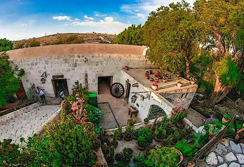
Historic Centre: The core area housing the Plaza de Armas and the massive Santa Catalina Monastery.
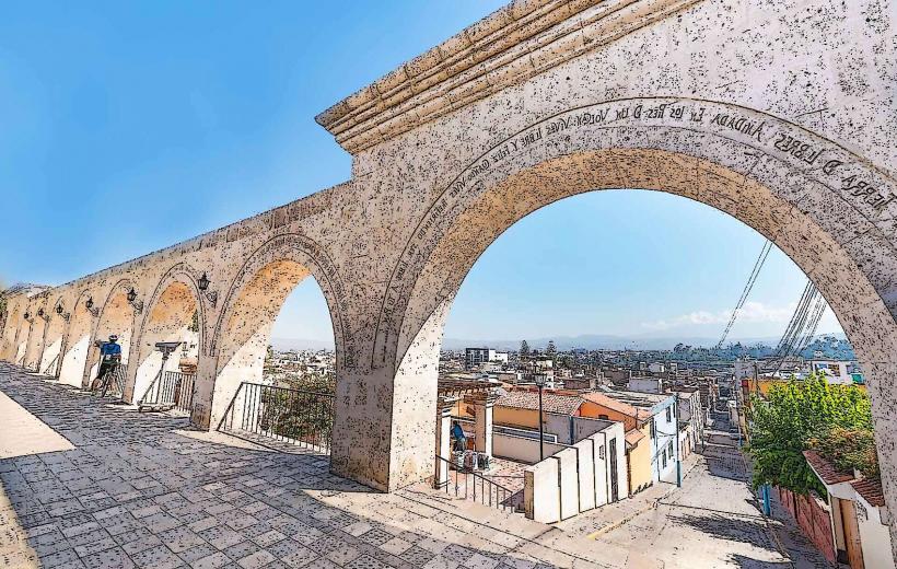
Yanahuara: Famous for its colonial-style plazas and arches made of sillar, offering panoramic views of the volcanoes.
Cayma: An upscale residential and commercial district, often called the "Balcony of Arequipa."
Selva Alegre: A large park district with a mix of colonial and modern architecture.
Top Landmarks
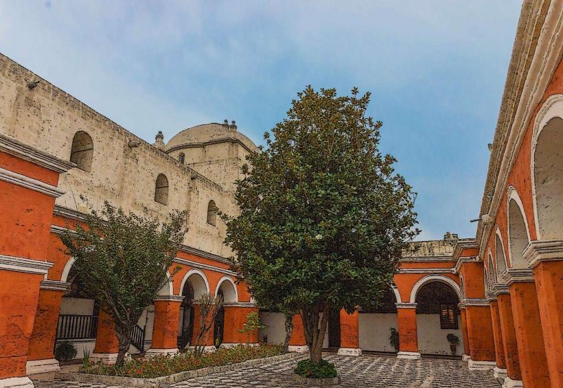
Santa Catalina Monastery: A "city within a city," this $20,000$ square-meter cloistered convent features vibrant blue and red walls and narrow streets.
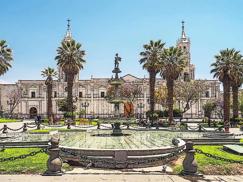
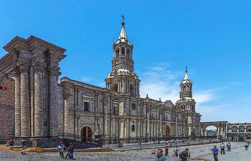
Basilica Cathedral of Arequipa: One of the few cathedrals in the world that stretches across the entire side of a plaza.
Yanahuara Viewpoint: A series of 19th-century arches inscribed with poetry, framing the Misti Volcano.
Museo Santuarios Andinos: Home to Juanita the Ice Maiden, the exceptionally well-preserved mummy of an Inca girl sacrificed on Mount Ampato.
Plaza de Armas: Widely considered the most beautiful main square in Peru.
Transportation Network
Air: Rodríguez Ballón International Airport (AQP) connects to Lima, Cusco, and Santiago de Chile.
Road: A major hub on the Pan-American Highway. Long-distance buses depart from the Terminal Terrestre.
Local: Relies on a network of small buses (combis) and taxis. Unlike Lima, it does not have a mass transit rail system.
Safety & Seismic Risk
Earthquakes: Arequipa is located in a highly active subduction zone. The city has survived multiple major earthquakes; sillar is favored because it is relatively lightweight and flexible for masonry.
Volcanic Activity: The city is flanked by Misti (active), Chachani, and Pichu Pichu. While Misti is dormant, it is monitored constantly by the Geophysical Institute of Peru.
Sun Exposure: High-altitude UV levels are extreme; sun protection is required year-round.
Digital & Financial Infrastructure
5G is available in the Historic Centre and Cayma. The currency is the Peruvian Sol (PEN). ATMs are abundant around the Plaza de Armas and in malls like Real Plaza. Contactless payment is standard in mid-to-high-end establishments.
Climate & Air Quality
Highland desert climate. Arequipa averages over 300 days of sunshine per year. Humidity is very low. Air quality is moderate, though the city’s bowl-like geography can trap vehicle emissions during the dry season.
Culture & Social Norms
Picanterías: Traditional lunchtime restaurants that are the soul of Arequipeño culture. They serve spicy dishes and corn beer (chicha de jora).
Distinct Identity: It is common to see the Arequipa regional flag flown alongside or instead of the Peruvian flag.
Cuisine: Arequipa is the culinary rival to Lima. Signature dishes include Rocoto Relleno (stuffed spicy pepper), Chupe de Camarones (shrimp chowder), and Queso Helado (traditional iced dessert).
Local Cost Index (PEN)
1 Lunch at a Picantería: S/ 25.00–S/ 45.00
1 Entry to Santa Catalina Monastery: S/ 40.00
1 Taxi (City Center): S/ 7.00–S/ 12.00
Nearby Day Trips
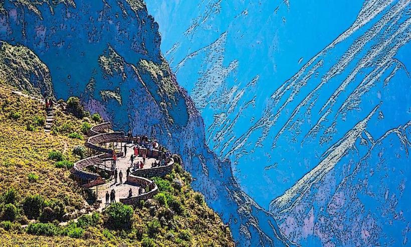
Colca Canyon: One of the world's deepest canyons ($3,270$ m), home to the Andean Condor. Located 3 hours away.
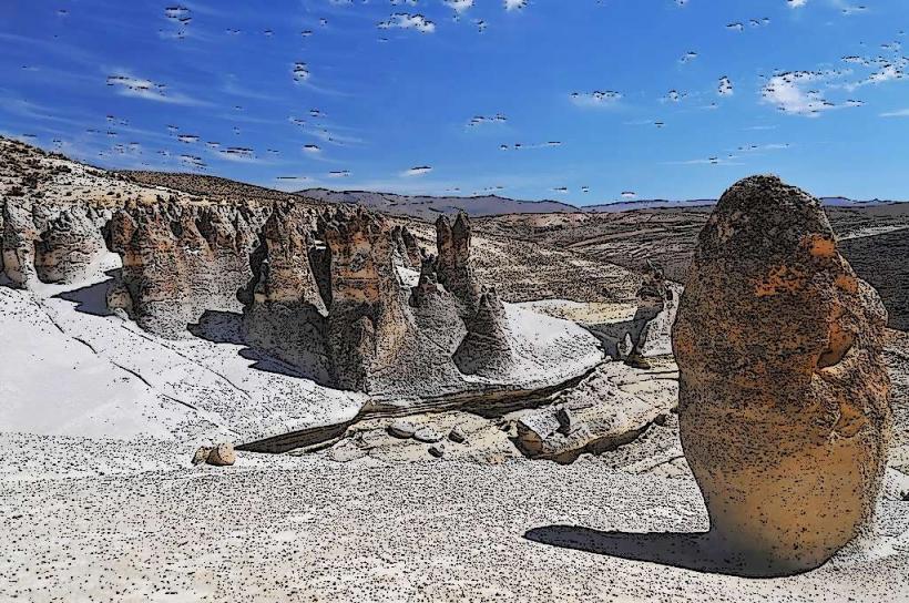
Ruta del Sillar: A tour of the quarries where the white volcanic stone is still hand-cut by artisans.
Facts & Legends
Legend says the name comes from the Quechua phrase Ari Qhipay, meaning "Yes, stay here," allegedly spoken by an Inca ruler impressed by the valley. A geographic fact: The Cathedral of Arequipa is one of the few in the world allowed to fly the Vatican flag because of its special relationship with the Holy See. Historically, the city provided so many of Peru's presidents and intellectuals that it earned the title "The Legal Capital of Peru."