Information
City: BauchiCountry: Nigeria
Continent: Africa
Bauchi, Nigeria, Africa
Bauchi serves as the administrative capital of Bauchi State and a critical gateway to the Yankari Game Reserve. It is situated in the transitional zone between the Sudan savanna and the Sahel, positioned in the northeastern geopolitical zone of Nigeria.
Historical Timeline
Bauchi was founded in the early 19th century by Yakubu dan Dadi, the only non-Fulani flag-bearer of the Sokoto Jihad. It transitioned from a pre-colonial emirate to a provincial headquarters under British rule in 1904. The most significant political reconstruction followed the 1976 creation of Bauchi State, which established the city as a modern administrative center. The primary event shaping its urban form was the colonial-era railway expansion, though the city remains deeply anchored to its traditional walls and the central Emir's Palace.
Demographics & Population
The metropolitan population is approximately 680,000 as of 2026. The demographic is highly diverse, comprising the Hausa, Fulani, Gerawa, and Jarawa ethnic groups. The median age is 18.2 years.
Urban Layout & Key Districts
The city is organized into the historic Old City (Birni), characterized by traditional mud-brick architecture and the ancient wall perimeter, and the modern expansions. Key districts include the GRA (South), housing government secretariats and high-end residences; Wunti (Central), the primary commercial and transport node; and Yelwa (East), which serves as the academic hub surrounding the university.
Top City Landmarks
The Emir of Bauchi’s Palace
Tomb of Sir Abubakar Tafawa Balewa (Nigeria's first Prime Minister)
Bauchi Central Mosque
Gidan Madaki (Historic mud-brick architecture)
Yankari Game Reserve (110 km from city center)
Transportation Network
Internal movement relies on a radial road network centered on the Post Office roundabout. Transit is dominated by "Keke" (tricycles) and local minibuses; commercial motorcycles are heavily restricted in the city center. There is no metro system. Ride-sharing is limited. Official taxis are typically painted yellow with black stripes. Traffic density is moderate, peaking at the Wunti Market axis.
Safety & "Red Zones"
The general safety level within the city is stable. However, caution is advised in the border areas with Yobe and Gombe states due to regional security volatility. Travelers should avoid the forest-dense outskirts of the Alkaleri LGA at night. Movement within the city after midnight is discouraged for non-residents.
Digital & Financial Infrastructure
Average internet speeds are 25–40 Mbps on 4G networks. Main carriers are MTN, Airtel, and Glo. Card acceptance is standard in GRA hotels and modern retail outlets, but cash is mandatory for all transactions in the Wunti and Muda Lawal markets. ATMs are concentrated along the Ahmadu Bello Way and Bank Road.
Climate & Air Quality
Temperatures range from 12°C in January to 40°C in April. Bauchi experiences a tropical savanna climate with a rainy season from May to September. Air quality is severely impacted by the Harmattan (December–February), which brings thick Saharan dust and significantly reduced visibility.
Culture & Social Norms
Tipping is voluntary (5–10%). Conservative Islamic social norms are prevalent; modest dress is mandatory for all genders, particularly when visiting the Old City or religious sites. Handshakes are the standard greeting among men. Alcohol is restricted and only available in designated military "Mami" markets or specific private hotels.
Accommodation Zones
Bauchi GRA: Recommended for high security, quiet environment, and proximity to government offices.
Yankari (Wikki Camp): Recommended for tourism-focused stays (located 1.5 hours from the city).
Local Cost Index
1 Espresso: ₦2,800 ($1.85)
1 Standard Lunch: ₦8,000 ($5.30)
1 Metro/Bus Ticket: ₦500 ($0.33) - Local Keke rate.
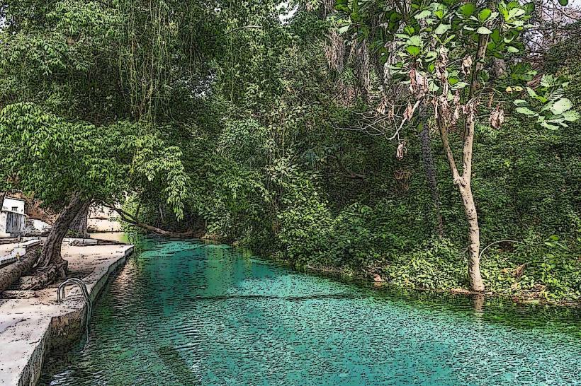
Nearby Day Trips
Wikki Warm Springs (Yankari): 110 km (90 minutes)
Marshall Caves: 115 km (100 minutes)
Gubi Dam: 15 km (25 minutes)
Sumu Wildlife Park: 60 km (70 minutes)
Facts & Legends
Bauchi is nicknamed "The Pearl of Tourism." A local legend surrounds the name "Bauchi," which is said to be derived from a hunter named Baushe, who advised Yakubu dan Dadi to build the city in its current location because the hills provided spiritual protection. It is a verified historical fact that the tomb of Abubakar Tafawa Balewa is a National Monument, designed as a sunken structure to symbolize the humility of the late leader.