Information
City: Bikini AtollCountry: Marshall Islands
Continent: Australia
Bikini Atoll, Marshall Islands, Australia
Bikini Atoll is a coral atoll of 23 islands in the Ralik Chain of the Marshall Islands. It is globally recognized as a UNESCO World Heritage site and the primary "Pacific Proving Ground" for United States nuclear testing. In 2026, it remains uninhabited by its indigenous population, serving instead as a "living laboratory" for radiation recovery and a premier destination for technical wreck diving.
Historical Timeline
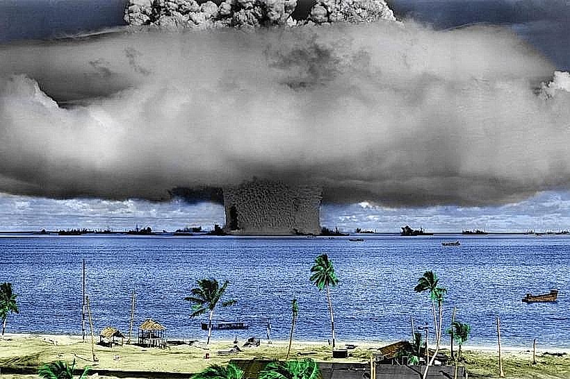
Inhabited by the Bikinian people for centuries as a secluded fishing community. A critical historical event occurred in March 1946 when the 167 residents were relocated to Rongerik Atoll-and later Kili Island-on the understanding that their land was needed for "the good of mankind." Between 1946 and 1958, the U.S. conducted 23 nuclear detonations at Bikini. The most significant was the 1954 Castle Bravo test, the largest U.S. nuclear explosion, which yielded 15 megatons-1,000 times the power of the Hiroshima bomb-and caused catastrophic radioactive fallout. In 2010, it was inscribed as a UNESCO site to memorialize the dawn of the nuclear age.
Demographics & Status
The 2026 population is zero (permanent residents). While background gamma radiation is now within safe limits for short-term stays, the soil remains contaminated with Cesium-137. This radionuclide is absorbed by food crops (coconuts, breadfruit), making the local diet lethal over long-term consumption. The Bikinian people, now numbering over 7,000, primarily reside on Kili, Ejit, and in Springdale, Arkansas, U.S.
Urban Layout & Landmarks
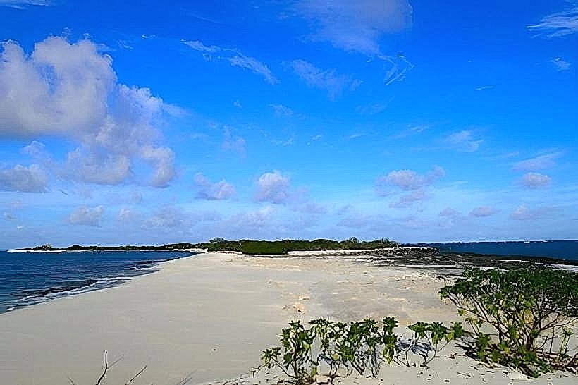
The atoll consists of a 594-square-kilometer lagoon surrounded by a reef.
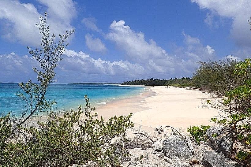
Bikini Island: The largest landmass; features abandoned 1970s resettlement houses, overgrown coconut plantations, and concrete bunkers.
Bravo Crater: A massive 2-km wide, 80-meter deep scar on the reef's northwest corner, created by the 1954 thermonuclear blast.
Eneu Island: Home to a functional airstrip and the remnants of the main monitoring bunkers used during the tests.
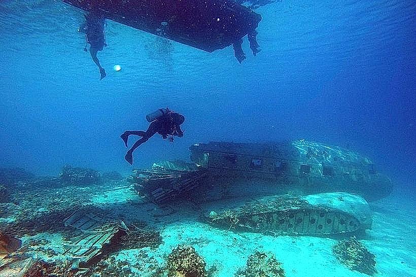
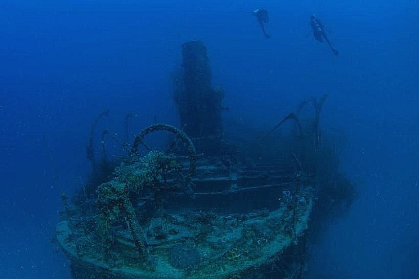
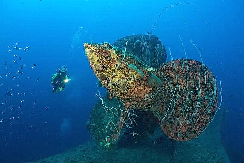
The Ghost Fleet: A cluster of sunken warships at the bottom of the lagoon, including the USS Saratoga (aircraft carrier), the HIJMS Nagato (Japanese battleship), and the USS Arkansas.
Transportation Network
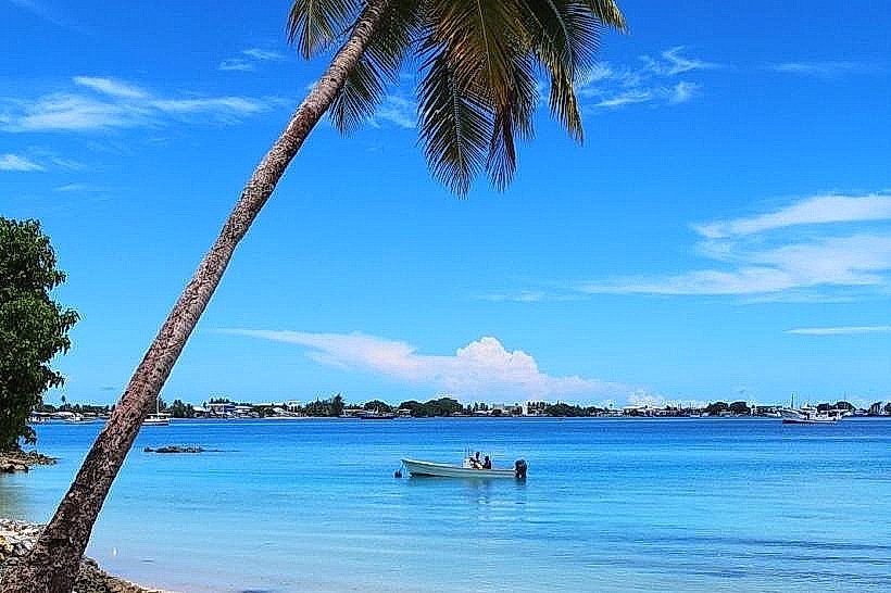
Access is strictly controlled and difficult. In 2026, travel is primarily via chartered liveaboard dive vessels departing from Kwajalein or Majuro. Eneu Airfield is used for occasional supply flights but lacks scheduled commercial service. There are no paved roads; movement on the islands is limited to foot traffic and rough trails.
Safety & Radiation Protocol
Safety is managed through strict consumption bans. Do not eat locally grown food (coconuts, land crabs, or fruit). Potable water and all food must be imported. Technical diving is the primary activity; most wrecks lie between 40 and 60 meters, requiring advanced decompression and trimix certifications. Environmental hazards include oil seepage from the sunken fleet and high concentrations of sharks (Gray Reef and Silvertip) which have flourished in the absence of commercial fishing.
Digital & Financial Infrastructure
Connectivity is negligible. There is no cellular service or public 5G; communications are limited to satellite links (Starlink or Iridium) on visiting vessels. The economy is non-existent on-site; all fees for visiting the atoll are paid in U.S. Dollars (USD) to the Bikini Atoll Local Government based in Majuro.
Climate & Ecology
Tropical marine climate. Despite the nuclear history, the marine ecosystem has undergone a "remarkable recovery." The lagoon is a sanctuary for massive coral structures and high-density fish populations. In 2026, the atoll is a critical site for studying ecosystem resilience in the face of both radiological and climate-change-driven stressors.
Local Cost Index (Expedition Scale)
10-Day Dive Expedition: $5,000–$8,000 USD.
Bikini Entry/Scuba Fee: $500 USD (standard municipal permit).
Facts & Legends
The "Bikini" swimsuit was named by Louis Réard in 1946, specifically to capitalize on the "explosive" news of the nuclear tests. Historically, the HIJMS Nagato was the flagship from which Admiral Yamamoto ordered the attack on Pearl Harbor; it now lies upside down on the lagoon floor. A local legend involves the displacement of the spirits, as many Bikinians believe the traditional protectors of the land were driven away by the "poison" (radiation), leaving the atoll a beautiful but hollow shell. Another fact: the coconuts on Bikini are reportedly so radioactive that they can cause a faint glow in specialized detection equipment, though they do not glow to the naked eye.